Bilsdean

Last updated
Bilsdean
Bilsdean - geograph.org.uk - 1366546.jpg
Approaching Bilsdean along the old A1 road
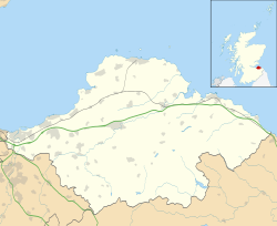
East Lothian UK location map.svg
Red pog.svg
Bilsdean
Scotland location map.svg
Red pog.svg
Bilsdean
Bilsdean shown within Scotland
OS grid reference NT761725
Civil parish
Council area
Lieutenancy area
Country Scotland
Sovereign state United Kingdom
Post town COCKBURNSPATH
Postcode district TD13
Dialling code 01368
Police Scottish
Fire Scottish
Ambulance Scottish
EU Parliament Scotland
UK Parliament
Scottish Parliament
List of places
UK
Scotland
55°56′46″N2°22′52″W / 55.946°N 2.381°W / 55.946; -2.381 Coordinates: 55°56′46″N2°22′52″W / 55.946°N 2.381°W / 55.946; -2.381

Bilsdean is a village between Thorntonloch and Cockburnspath on the East Lothian coast of Scotland.

Cockburnspath village in United Kingdom

Cockburnspath is a village in the Scottish Borders area of Scotland. It lies near the North Sea coast between Berwick-upon-Tweed and Edinburgh. It is at the eastern extremity of the Southern Upland Way a long-distance footpath from the west to east coast of Scotland. It is also the termini of the Sir Walter Scott Way and the Berwickshire Coastal Path. At the nearby village of Cove, there is a small fishing harbour.

East Lothian Council area of Scotland

East Lothian, is one of the 32 council areas of Scotland, a historic county, and lieutenancy area.

Scotland Country in Europe, part of the United Kingdom

Scotland is a country that is part of the United Kingdom. Sharing a border with England to the southeast, Scotland is otherwise surrounded by the Atlantic Ocean to the north and west, by the North Sea to the northeast and by the Irish Sea to the south. In addition to the mainland, situated on the northern third of the island of Great Britain, Scotland has over 790 islands, including the Northern Isles and the Hebrides.

Contents

The place-name derives from Biel, East Lothian, also Biel House, Biel Water, Belhaven, and Belhaven Bay.

Biel, East Lothian village in United Kingdom

Biel is a village in East Lothian, Scotland, UK, to the south of Dunbar, off the B6370 road. It is situated on the Biel Estate, close to Biel House.

Biel House is a historic house on the Biel Estate near Stenton, East Lothian, Scotland. It is a Category A listed building.

Biel Water river in Biel, East Lothian, Scotland

The Biel Water is a river running through the Biel Estate in Biel, East Lothian. It runs for 4.5 kilometres from the Luggate Burn and the Whittinghame Water, via Stenton, Biel House, West Barns, and finally to Belhaven Bay with its rather unusual bridge, whose ends are submerged at high tide.

Bilsdean Glen Bilsdean Glen - geograph.org.uk - 138158.jpg
Bilsdean Glen

See also

Related Research Articles

Firth of Forth estuary or firth of Scotlands River Forth

The Firth of Forth is the estuary (firth) of several Scottish rivers including the River Forth. It meets the North Sea with Fife on the north coast and Lothian on the south. It was known as Bodotria in Roman times. In the Norse sagas it was known as the Myrkvifiörd. An early Welsh name is Merin Iodeo, or the "Sea of Iudeu".

River Tyne, Scotland river in south-east Scotland

The River Tyne is a river in Scotland. It rises in the Moorfoot Hills in Midlothian near Tynehead to the south of Edinburgh, at the junction of the B6458 and the B6367. It continues for approx. 30 miles in a north-eastern direction and empties into the North Sea near Belhaven.

Dunbar town in East Lothian, Scotland

Dunbar is a town on the North Sea coast in East Lothian in the south-east of Scotland, approximately 30 miles (48 km) east of Edinburgh and 30 miles (48 km) from the English border north of Berwick-upon-Tweed.

Haddington, East Lothian town in East Lothian, Scotland

The Royal Burgh of Haddington is a town in East Lothian, Scotland. It is the main administrative, cultural and geographical centre for East Lothian, which as a result of late-nineteenth century Scottish local government reforms took the form of the county of Haddingtonshire for the period from 1889-1921. It lies about 17 miles (27 km) east of Edinburgh. The name Haddington is Anglo-Saxon, dating from the sixth or seventh century AD when the area was incorporated into the kingdom of Bernicia. The town, like the rest of the Lothian region, was ceded by King Edgar of England and became part of Scotland in the tenth century. Haddington received burghal status, one of the earliest to do so, during the reign of David I (1124–1153), giving it trading rights which encouraged its growth into a market town.

Belhaven, Scotland village in United Kingdom

Belhaven is a village in East Lothian, Scotland, and was originally the ancient port of Dunbar of which town the village has always been a part. Belhaven takes its name from its situation at the mouth of the Biel Water.

West Barns village in the United Kingdom

West Barns is a small village in East Lothian, Scotland. It lies 2 miles west of Dunbar and approximately 28 miles east of Edinburgh. It is close to John Muir Country Park and Belhaven Bay. For many years, it was home to the West Barns Inn and is still home to a John Deere manufacturer. There is also a local amateur football team, West Barns Star. Children of primary-school age attend West Barns Primary, after which they will go to Dunbar Grammar School.

Archerfield and Archerfield Links are a country house and pair of golf courses in the parish of Dirleton, East Lothian, Scotland. An older golf course, also called Archerfield Links, occupied the area before falling into disuse after World War II.

Whiteadder Water river in south-east Scotland

Whiteadder Water is a river in East Lothian and Berwickshire, Scotland. It also flows for a very short distance through Northumberland before joining the River Tweed. In common with the adwaters of the Biel Water it rises on the low hillside of Clints Dod in the Lammermuir Hills, just ESE of Whitecastle Hillfort and 3 km (1.9 mi) south-east of the village of Garvald.

Stenton village in the United Kingdom

Stenton is a parish and village in East Lothian, Scotland. It is bounded on the north by parts of the parishes of Prestonkirk and Dunbar, on the east by Spott and on the west by Whittingehame. The name is said to be of Saxon derivation. The village has a number of houses, a school, and a church.

George IV Bridge road bridge in Edinburgh, United Kingdom

George IV Bridge is an elevated street in Edinburgh, Scotland, and is home to a number of the city's important public buildings. Measuring 300 metres in length, the bridge was constructed between 1829 and 1832 as part of the Improvement Act of 1827. Named after King George IV, it was designed by architect Thomas Hamilton to connect the South Side district of Edinburgh to the New Town. Two of Edinburgh Old Town's traditional streets, Old Bank Close and Liberton's Wynd, had to be demolished for the construction of the bridge.

William Hamilton Nisbet British politician

William Hamilton Nisbet was a British politician.

National Cycle Route 76

National Cycle Network (NCN) Route 76 is a Sustrans National Route that runs from Berwick-upon-Tweed to Kirkcaldy. The route is 168 miles (270 km) in length and is fully open and signed in both directions. Between Dunbar and Kirkcaldy the route is known as the Round the Forth.

Belhaven Hospital Hospital in East Lothian, Scotland

Belhaven Hospital is a community hospital located in Beveridge Row, Dunbar, East Lothian. The hospital is managed by NHS Lothian.

References

    Commons-logo.svg Media related to Bilsdean at Wikimedia Commons