Jamui is a town and a municipality in Jamui district in the Indian state of Bihar. It is the district headquarter of Jamui district. Jamui was formed as a district on 21 February 1991 as a result of its separation from Munger. It is part of Munger Division. The town is situated about 60km South-West of Munger.
Khagaria is a town in Indian state of Bihar and the administrative headquarters of Khagaria district. Khagaria is a part of Munger division. It is located at 25.5°N 86.48°E and has an average elevation of 36 metres (118 feet). The Khagaria Junction railway station serves the town.It is situated about 25 km north of Munger.

Munger, formerly spelt as Monghyr, is a twin city and a Municipal Corporation situated in the Indian state of Bihar. It is the administrative headquarters of Munger district and Munger Division. Munger was one of the major cities in Eastern India and undivided Bengal during Mughal period and British Raj. It is one of the major political, cultural, educational and commercial center of Bihar and Eastern India. Munger is situated about 180km from east of capital city Patna, about 480km west of Eastern India's largest city Kolkata and 1200km from country's capital New Delhi.

Patna district is one of the thirty-eight districts of Bihar state in eastern India. Patna, the capital of Bihar, is the district headquarters. The Patna district is a part of Patna division. The Patna district is divided into 6 Sub-divisions (Tehsils) i.e. Patna Sadar, Patna City, Barh, Masaurhi, Danapur and Paliganj.

Khagaria district is an administrative district in the state of Bihar in India. The district headquarters are located at Khagaria. Earlier it was a part of Munger District as a sub-division that was created in 1943–44. It was upgraded to the status of a district on 10 May 1981. Khagaria district is a part of Munger Division.

Sheikhpura district is one of the thirty-eight districts of the Indian state of Bihar. Sheikhpura is the administrative headquarter of this district. Sheikhpura district is a part of the Munger division. Sheikhpura was split from the Munger district into a separate district with headquarters in Sheikhpura on 31 July 1994 by Rajo Singh. As of 2011 it was the least populous district of Bihar.

Begusarai District is one of the thirty-eight districts of the Indian state of Bihar. The city of Begusarai is its administrative headquarters and is part of the Munger division.

Munger district is one of the thirty-eight districts of Bihar state in eastern India. The city of Munger is the administrative headquarters of this district. The district is a part of Munger Division. Its literacy rate of 73.3% is higher than the state literacy rate of 63.8%, but lower than national rate of 74.04%.
At the 2011 Census, Bihar was the third most populous state of India with total population of 104,099,452, nearly 89% of it rural. It was also India's most densely populated state, with 1,106 persons per square kilometre. The sex ratio was 918 females per 1000 males. Almost 58% of Bihar's population was below 25 years age, which is the highest in India. At 11.3%, Bihar has the second-lowest urbanisation rate in India after Himachal Pradesh.
Lohara is a village in Munger District, in the state of Bihar, India. Administratively it is under Bangama gram panchayat, Tetia Bambar Tehsil of Munger District. Lohara is located 9.5 km by road southeast of Kharagpur and 47 km by road south of Munger.
Udhwa is a community development block that forms an administrative division in the Rajmahal subdivision of the Sahibganj district, Jharkhand state, India.

Nauhatta is a village and corresponding community development block in Rohtas district of Bihar, India. As of 2011, the village of Nauhatta had a population of 5,103, in 909 households, while Nauhatta block had a population of 94,065, in 16,387 households. The nearest city is Dehri.

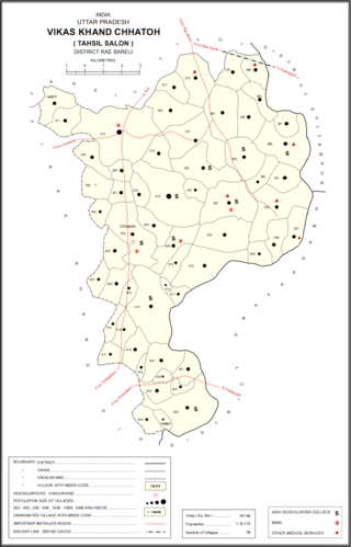
Basupur is a village in Chhatoh block of Rae Bareli district, Uttar Pradesh, India. It is located 32 km from Raebareli, the district headquarters. As of 2011, Basupur has a population of 902 people, in 184 households. It has one primary school and no healthcare facilities, and it does not host a permanent market or a weekly haat. It belongs to the nyaya panchayat of Chhatoh.
Rahmatpur is a large village located in Asarganj block of Munger district in the Indian state of Bihar.
Khawaspur Diara urf Topra is a large village in Bihar, India, near the northern edge of Bhagalpur District. The village is located approximately 40 kilometres northeast of the district seat Bhagalpur, and is surrounded by the settlements of Nandi Gobind urf Chulia, Khawaspur Milik and Sangalbahita. In the 2011 census, it had a population of 35,545.
Nauagarhi is a village in Munger District, Bihar, India. It is situated on the northern portion of Munger District. The village had a population of 34,356 as of the 2011 census.
Pundarakh is a city under the administration of the Indian state Bihar. It is located within Patna district, about 68 kilometres east of the state capital Patna. As of 2011, the village had a population of 32,627.
Chamtha is a village in the state of Bihar, India. It is located in Bachhwara Block of Begusarai District, about 38 kilometres northwest of the district seat Begusarai. The village's population was 32,434 as of 2011.
Bara Haldibari is a village in the state of West Bengal, India. It is located near Bangladesh–India border, about 67 kilometres west of the district capital Koch Bihar. According to the 2011 census, the village had a population of 32,340.


