
Bihar is a state in eastern India. It is the third largest state by population, the 12th largest by area, and the 14th largest by GDP in 2021. Bihar borders Uttar Pradesh to its west, Nepal to the north, the northern part of West Bengal to the east, and with Jharkhand to the south. The Bihar plain is split by the river Ganges, which flows from west to east.

Sitamarhi is an Indian city and the district headquarters of the Sitamarhi district in the Mithila region of Bihar and is a part of the Tirhut Division. The name of the city had kept as honours the birthplace of the goddess, Sita. The Bihar government declared Sitamarhi a municipal council.

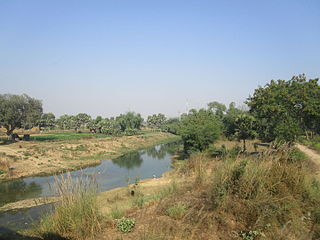
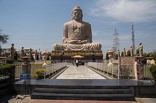
Gaya is a city, municipal corporation and the administrative headquarters of Gaya district and Magadh division of the Indian state of Bihar. Gaya is 116 kilometres (72 mi) south of Patna and is the state's second-largest city, with a population of 470,839. The city is surrounded on three sides by small, rocky hills, with the Phalgu River on its eastern side.

Vaishali district is a district in the Indian state of Bihar. It is a part of Tirhut division. Vaishali is known for being the birthplace of Mahavira of the Jain religion. Hajipur, its largest city and district headquarters, is known for its banana forest. The district is connected via the NH-77 and NH-322 highways, which connect the state capital Patna, the division headquarters Muzaffarpur, and the eastward district Samastipur.

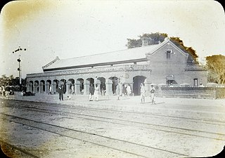
Munger, formerly spelt as Monghyr, is a twin city and a Municipal Corporation situated in the Indian state of Bihar. It is the administrative headquarters of Munger district and Munger Division. Munger was one of the major cities in Eastern India and undivided Bengal during Mughal period and British Raj. It is one of the major political, cultural, educational and commercial center of Bihar and Eastern India. Munger is situated about 180km from east of capital city Patna, about 480km west of Eastern India's largest city kolkata and 1200km from country's capital New Delhi.

Muzaffarpur is a city located in Muzaffarpur district in the Tirhut region of the Indian state of Bihar. It serves as the headquarters of the Tirhut division, the Muzaffarpur district and the Muzaffarpur Railway District. It is the fourth most populous city in Bihar.
East Champaran is an administrative district in the state of Bihar in India.The district headquarters are located at Motihari. Prior to 1st Dec 1977, there was a single district called "Champaran". On 1 December 1977, the district was divided into 2 parts East Champaran and West Champaran. In early days the land of East Chamapran was ruled by different kingdoms as Videha, Sunga, Kanvas. It is also believed that Champaran used to be a major part of King Janak's empire. Mahatma Gandhi Started his famous Satyagraha movement from here. Proper district Entry Point Mangrahi, Bakhari in Mehsi Champaran

Araria district is one of the thirty-eight districts of Bihar state, India. Araria district is a part of Purnia division. The district occupies an area of 2,830 km2 (1,090 sq mi). Araria town is the administrative headquarters of this district. Distance from Nepal border is only about 8 km from Forbesganj head quarter.

Darbhanga district is one of the thirty-eight districts of Bihar state in eastern India, and Darbhanga city is the administrative headquarters of this district and 5th largest city of Bihar as well. Darbhanga district is a part of Darbhanga Division. The district is bounded on the north by Madhubani district, on the south by Samastipur district, on the east by Saharsa district and on the west by Sitamarhi and Muzaffarpur districts. The district covers an area of 2,279 km2 (880 sq mi).
Aurangabad district is one of the thirty-eight districts of Bihar state, India. It is currently a part of the Red Corridor.
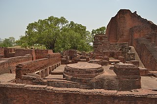
Nalanda district is one of the thirty-eight districts of the state of Bihar in India. Bihar Sharif is the administrative headquarters of this district. The districts contain the ancient Nalanda Mahavihara a UNESCO World Heritage site. Nalanda is located in the Magadh region of southern Bihar.

Kishanganj district is one of the thirty-eight districts of Bihar state, India, and Kishanganj town is the administrative headquarters of this district. Kishanganj district is a part of Purnia division (Seemanchal).

Muzaffarpur District is one of the thirty-eight districts of Bihar state, India. Muzaffarpur district is part of and also the headquarters of Tirhut Division Tirhut is the ancient name of all of northern Bihar.
Rohtas District is one of the thirty-eight districts of Bihar state, India. It came into existence when Shahabad District was bifurcated into Bhojpur & Rohtas in 1972. Administrative headquarter of the district is Sasaram. Rohtas district has the highest literacy in Bihar. The literacy rate of Rohtas district which is 73.37% as per 2011 census is highest among all 38 districts of Bihar.

Bhojpur district is one of the thirty-eight districts of the Indian state of Bihar. Arrah town is the administrative headquarters of this district. Bhojpur district came into existence in 1972. Earlier it was the part of Shahabad district. This district is named "Bhojpur" after great Parmara King Bhoja as most early settlers were Rajput rulers of Parmara dynasty then called as Ujjainiya.

The Government of Bihar, known locally as the State Government, is the supreme governing authority of the Indian state of Bihar and its 9 divisions which consist of 38 districts. It consists of an executive, led by the Governor of Bihar, a judiciary and legislative branches.
The economy of Bihar is one of the fastest-growing in India. It is largely service-based, with a significant share of agricultural and industrial sectors. The GDP of the state was ₹7,45,310 crores at the current market price (2022–23).

The first COVID-19 case in the Indian state of Bihar was reported in Munger on 22 March 2020, a 38-year-old tested positive for COVID-19, he was also the first victim. He had travel history to Qatar. The Ministry of Health and Family Welfare has confirmed a total of 62,031 cases as of 4 August 2020, including 20,922 active cases, 349 deaths and 40,760 recoveries. The virus has spread in 38 districts of the state, of which Patna district has the highest number of cases.

