Saharsa is a city and municipal corporation in the Saharsa District in the eastern part of the state of Bihar, India. It is situated near the eastern banks of the Kosi River. It serves as the administrative headquarters for Saharsa District and is also the Divisional Headquarter of the Kosi Division.

Saharsa is one of the thirty-eight districts of Bihar, India. Saharsa city is the administrative headquarters of this district. Saharsa district is a part of the Kosi Division and it became a district on 1 April 1954 and has subsequently become smaller with other districts being carved from it, most notably Madhepura in 1981.
Adavad, also spelled Adawad or Adwad, is a village in the Chopda Tehsil of Jalgaon District, Maharashtra, India. It is situated at the southern base of the Satpura Hills, about 30 kilometres northwest of the district seat Jalgaon, and 13 kilometres east of the subdistrict seat Chopda. As of the year 2011, it has a total population of 24,357.

Wandoor is a town in Nilambur Taluk, Malappuram District, Kerala, India. It is located on the southeast of Chaliyar River, about 24 kilometres northeast of the district seat Malappuram, and 8 km south of the taluk seat Nilambur. In the year 2011, the town has a population of 50,973.
Hadubangi, also romanized as Hadobhangi or Haddubangi, is a village in Kashinagara Tehsil, Gajapati District, Odisha, India. It is located near the Odia-Andhra Pradesh border, about 13 kilometres west of the district capital Paralakhemundi, and 11 kilometres southeast of the tehsil capital Kashinagara. As of the year 2011, It has a total population of 1,124.
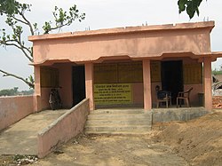
Sihaul is a village with population of about 11,000 in the sub-district of Satar Kataiya, where it ranks as the third most populous village. The sub-district forms a part of Saharsa district in the state Bihar, India. The geographical area of the village is 9 km2 (3.5 sq mi) and it is the third biggest village by area in the sub-district. Population density of the village is 1287 persons per km2.
Mohare is a village in Bailhongal Taluk, Belagavi District of Karnataka, India. It is located near the state border with Maharashtra, about 26 kilometres east of the district seat Belgaum, and 16 kilometres northwest of the taluk seat Bailhongal. As of 2011, it has a total population of 2,365.
Gania is a village in Gania Tehsil, Nayagarh District, Odisha, India. As of the year 2011, the village has a total population of 2,213.
Raj Khand is a village in Aurai Block, Muzaffarpur District, Bihar, India. It is located on Northern Bihar, about 45 kilometres northeast of the district capital Muzaffarpur, and 14 kilometres southeast of the block capital Aurai. As of the year 2011, it is home to 19,296 inhabitants.
Aurai is a block of Muzaffarpur District, Bihar, India. Its administrative center is the village of Aurai. As of 2011, the block has a total population of 290,545.
Dhamdaha is a village and the administrative division of Dhamdaha Block, Purnia District, Bihar, India. It is situated in the Eastern part of Bihar, about 26 kilometres southwest of the block capital Purnia. In the year 2011, the village has a total population of 37,987.
Dhamdaha is a block of Purnia District, Bihar, India. Its seat of government is located in the village of Dhamdaha. In 2011, the block has a total population of 288,084.
Itawa is a town in Pipalda Tehsil, Kota District, Rajasthan, India. It is located near the state boundary with Madhya Pradesh, about 79 kilometres northeast of the district seat Kota, and 5 kilometres southwest of the tehsil seat Pipalda. As of 2011, the town has a population of 26,741.
Pipalda is a tehsil of Kota District, Rajasthan, India. Its administrative center is the town of Pipalda. As of 2011, it has a total population of 179,800.
Masuri is a Village in Ghaziabad Tehsil, Ghaziabad District, Uttar Pradesh, India. It is situated on the western bank of Upper Ganga Canal, approximately 16 kilometres northeast of the district and tehsil seat Ghaziabad. In the year 2011, the Village has a total population of 22,934.
Nigohi is a town in Tilhar Tehsil, Shahjahanpur District, Uttar Pradesh, India. It is situated on the northern part of Shahjahanpur District, about 25 kilometres north of the district capital Shahjahanpur, and 20 kilometres northeast of the tehsil capital Tilhar. In the year 2011, the town has a population of 18,523.
Rajaudha, also spelled as Rajodha, is a village in Porsa Tehsil, Morena District, Madhya Pradesh, India. It is located near the state border with Uttar Pradesh, about 49 kilometres northeast of the district capital Morena, and 6 kilometres northeast of the tehsil capital Porsa. As of the year 2011, it has a population of 16,524.
Bariarpur Urf Bazidpur is a village in Baruraj (Motipur) Block, Muzaffarpur District, Bihar, India. It is located on the northern edge of the district, about 29 kilometres northwest of the district seat Muzaffarpur, and 7 kilometres northeast of the block seat Baruraj. In 2011, there are a total of 42,775 inhabitants within the village.