
Garreg Lwyd, also known as Moel Gornach, is a peak in the Black Mountain of the Brecon Beacons, South Wales. It is a subsidiary summit of Fan Brycheiniog.

Cadair Berwyn, Cader Berwyn or Craig Uchaf is a mountain summit in north-east Wales with a height of 832 metres (2,730 ft) above sea level. It is the highest point in the Berwyn range, the highest in North East Wales and the highest significant summit in Wales outside the National Parks. Cadair Berwyn and Foel Cedig to the west are the two Marilyns that form the Berwyn range. The undulating plateau of the range also includes a large number of other summits above 2,000 feet (610 m), including satellite summits of Cadair Berwyn and many which are classed as Nuttalls.

The Black Mountain, is a mountain in the Black Mountains. It is the only Marilyn to fall exactly on the Welsh–English border, Powys and Herefordshire. Its parent peak, Waun Fach, lies to the west.

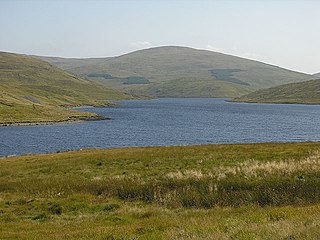
Waun Fach is, with a summit height of 811 metres (2,661 ft), the highest mountain in the Black Mountains in south-eastern Wales. It is one of the three Marilyns over 600 m that make up the range, the others being Black Mountain and Mynydd Troed. To the north Rhos Fawr and the Radnor Forest can be seen. It is the third highest mountain in Britain south of Snowdonia. It is situated at the head of the Grwyne Fechan valley, above and to the west of the Grwyne Fawr reservoir. It has an undistinguished rounded summit. The nearby tops on the ridge, Pen Trumau and Pen y Gadair Fawr, although lower, are very much more recognisable.

Radnor Forest is a rock dome composed of Silurian shales, mudstones and limestone in the historic county of Radnorshire, Powys, Mid Wales. It is a forest in the medieval sense of the word. It lies within the Welsh Marches region since Offa's Dyke lies nearby to the east.

Mynydd Tarw is a subsidiary summit of Cadair Berwyn in north east Wales. It used to have a top: Rhos which has now been deleted as a Nuttall.

Clermont Carn, also known as Black Mountain, is a mountain that rises to 510 metres (1,670 ft) in the Cooley Mountains of County Louth, Ireland. It is at the border with Northern Ireland, and is also the location of the Clermont Carn transmission site. The mountain's name refers to an ancient burial cairn on its summit, and to Lord Clermont of Ravensdale.
Y Garn is a subsidiary summit of Pen Pumlumon Fawr and the fourth highest peak on the Plynlimon massif, a part of the Cambrian Mountains in the county of Ceredigion, Wales.
Pen Pumlumon Arwystli is the second highest summit on the Plynlimon massif, a part of the Cambrian Mountains in the county of Ceredigion, Wales.

Corn Du is a summit of the twin topped Pen y Fan and the second highest peak in South Wales at 871.5 m (2,864 ft), situated in the Brecon Beacons National Park. The summit itself is marked by a well structured Bronze Age cairn with a central burial cist like that on nearby Pen y Fan. The two summits are visible from great distances owing to their height above the surrounding moorland, and are famous landmarks. The views from the peaks are also panoramic and very extensive, the Black Mountain and Fforest Fawr being especially obvious to the west. Mynydd Epynt is visible to the north behind the county town of Brecon, and other parts of the escarpment to the east.

Gorllwyn is a subsidiary summit of Drygarn Fawr, located on a remote moorland plateau of the Cambrian Mountains. The summit is grassy and is surrounded by peat bog. There is a shelter cairn and a trig point.

Bache Hill is a subsidiary summit of Rhos Fawr or Great Rhos, in the Radnor Forest in Wales. It is located to the east of Black Mixen. The summit is marked by a trig point built on an ancient burial mound, probably of Bronze Age date, like most of the summit cairns and round barrows in Wales.

Arenig Fach is a mountain in southern Snowdonia, north Wales. It is a peak in the Arenig range and lies to the north of its parent peak Arenig Fawr.

Pen y Boncyn Trefeilw is a subsidiary summit of Cyrniau Nod in north east Wales. It forms a part of the Berwyn range called the Hirnantau. It has two tops: Stac Rhos and Pen y Cerrig Duon. Pen y Cerrig Duon is now listed as a deleted Nuttall due to re-surveying.

Moel y Cerrig Duon is a subsidiary summit of Esgeiriau Gwynion in Gwynedd in north Wales.
Rhos Fawr is a mountain summit in the Radnor Forest, a rather isolated dome of hills to the north of the village of New Radnor. The local rocks are sedimentary shales and mudstones with some Silurian limestone. With a height of 660 metres (2,170 ft), it is the highest point in the Radnor Forest and the historic county top of Radnorshire.

Stac Rhos is a top of Pen y Boncyn Trefeilw in north east Wales. It forms a part of the Berwyn range called the Hirnantau.

Pen Allt-mawr is a 719 metres (2,359 ft) high subsidiary summit of Waun Fach and the third highest peak in the Black Mountains in south-eastern Wales. A very recognisable and prominent peak of the Black Mountains, it lies near the end of the more westerly of Waun Fach's two broad southern ridges. Its top Pen Twyn Glas is to the north, while its close neighbour Pen Cerrig-calch is to the south. A prominent spur 1 km to the SSW of the summit is known as Pen Gloch-y-pibwr. The stepped Bryniog ridge curves southward from this point.

Chwarel y Fan is a peak in the Black Mountains in south-eastern Wales. It is the highest rise on the long ridge which extends southeastwards from Rhos Dirion. The ridge continues southeastwards to the lesser summit of Bal-Mawr whose top is adorned by a trig point at 607 metres (1,991 ft) above sea level. About one km (0.62 mi) southeast along the ridge is the lesser top of Bal-Bach at a height of just over 520 metres (1,710 ft). Chwarel y Fan is the county top of the historic county of Monmouthshire, and is also the highest point in the current local government area of Monmouthshire.

Truskmore is a mountain with a height of 647 metres (2,123 ft) on the border of County Sligo and County Leitrim in Ireland. It is the highest summit in the Dartry Mountains and the highest in Sligo. It is in the middle of a plateau whose edges are marked by high cliffs, including Benbulbin (526m), Benwiskin (514m), Slievemore (597m) and Kings Mountain (462m). The top of Truskmore lies in County Sligo, a short distance from the border with County Leitrim; however, the mountain itself is in both counties.
