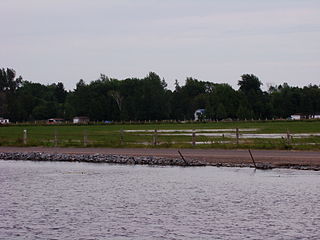
The Scugog River is a river in the city of Kawartha Lakes in Central Ontario, Canada. It is in the Kawartha Lakes region, is part of the Great Lakes Basin, and is a branch of the Trent-Severn Waterway.
The Head River is a river in the township of Ramara, Simcoe County and the city of Kawartha Lakes in Southern Ontario, Canada. It is in the Great Lakes Basin, and flows from Head Lake west to the Black River, east of Lake Couchiching. The Black River flows via the Severn River to Georgian Bay on Lake Huron.
Black Lake is a lake in the municipality of Minden Hills, Haliburton County in Central Ontario, Canada. It is part of the Great Lakes Basin and lies within geographic Lutterworth Township.
Rosedale is a Dispersed Rural Community and unincorporated place located in the city of Kawartha Lakes, Ontario, Canada, 29 kilometres (18 mi) north-west of Lindsay. It is partly in geographic Fenelon Township and partly in Somerville Township, and is on the Rosedale River, part of the Trent–Severn Waterway, where that river drains Balsam Lake on its way to Cameron Lake.
Redstone Lake is a lake located in geographic Guilford Township in the Municipality of Dysart et al, Haliburton County in Central Ontario, Canada. It is in the Great Lakes Basin and is part of the Gull River system. At its longest, it is approximately 6.5km.
Riley Lake is a lake in geographic Ryde Township in the town of Gravenhurst, District Municipality of Muskoka in Central Ontario, Canada. It is part of the Great Lakes Basin.

Mitchell Lake is a small, artificial lake in the Great Lakes Basin and located in the city of Kawartha Lakes in Central Ontario, Canada. The lake was formed sometime in the first decade of the twentieth century alongside the construction of the Kirkfield Lift Lock, which was completed and operational by the end of 1907. It is part of the summit of the Trent–Severn Waterway, the middle of a connection via canals of Balsam Lake on the Gull River system, which flows eventually to Lake Ontario, and the Kirkfield Lift Lock and Canal Lake on the Talbot River system, which flows to Lake Simcoe and eventually to Lake Huron.
Bull Lake is a lake in geographic Devonshire Township in the municipality of Sioux Narrows-Nestor Falls, Kenora District, Ontario, Canada. It is about 570 metres (1,870 ft) long and 260 metres (853 ft) wide, and lies at an elevation of 358 metres (1,175 ft) about 15 kilometres (9.3 mi) northeast of the community of Sioux Narrows. The primary outflow is an unnamed creek to Mac Lake, whose waters flow via the Black River into Lake of the Woods.
North River may refer to one of five rivers in Ontario, Canada:

The Black River is a river in Hastings County in Central Ontario, Canada. It is part of the Great Lakes Basin, and is a left tributary of the Moira River.

The Black River is a river in the Regional Municipality of York and the Regional Municipality of Durham in Central Ontario, Canada. It is part of the Great Lakes Basin, and is a tributary of Lake Simcoe; the entire watershed is under the auspices of the Lake Simcoe Region Conservation Authority.
The Black River is a river in the municipality of Sioux Narrows-Nestor Falls, Kenora District in Northwestern Ontario, Canada. It is part of the Hudson Bay drainage basin, and is a tributary of the Lake of the Woods.
Black Lake is a lake in the municipality of Dysart et al, Haliburton County in Central Ontario, Canada. It is part of the Great Lakes Basin and lies within geographic Dysart Township.
Black Lake is a lake in geographic Barager Township in the Unorganized North Part of Algoma District in Northeastern Ontario, Canada. It is part of the Great Lakes Basin, lies entirely within Lake Superior Provincial Park, and is the source of the Coldwater River, which is its primary outflow at the east. The Coldwater River flows to Lake Superior.
Black Lake is a lake in geographic LeCaron Township in the Unorganized North Part of Algoma District in Northeastern Ontario, Canada. It is part of the Great Lakes Basin.
The Little White River is a river in the Unorganized North Part of Algoma District in Northeastern Ontario, Canada. It is in the Great Lakes Basin and is a left tributary of the Mississagi River.

The Black River is a river in Cochrane District and Timiskaming District in Northeastern Ontario, Canada. It is part of the James Bay drainage basin, and is a right tributary of the Abitibi River. The municipality of Black River-Matheson is named after the river.
The Black River is a river in Simcoe County, the District Municipality of Muskoka, the City of Kawartha Lakes, and Haliburton County in Central Ontario, Canada. It is part of the Great Lakes Basin, and is a right tributary of the Severn River.
Riley Creek is a stream in the Great Lakes Basin in Central Ontario, Canada. It flows south from its source at Riley Lake in geographic Ryde Township in the municipality of Gravenhurst, District Municipality of Muskoka, to its mouth as a right tributary of the Black River in geographic Dalton Township in the city of Kawartha Lakes. The Black River flows via the Severn River to Georgian Bay on Lake Huron.
The Rosedale River is a river in the City of Kawartha Lakes in Central Ontario, Canada. It is in the Great Lakes Basin and is part of the Trent–Severn Waterway. The river is named after Rosa Dale, the wife of settler John Cameron, who first settled the area of nearby Fenelon Falls.


