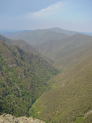
The Blue Mountains National Park is a protected national park that is located in the Blue Mountains region of New South Wales, in eastern Australia. The 267,954-hectare (662,130-acre) national park is situated approximately 80 kilometres (50 mi) west of the Sydney CBD, and the park boundary is quite irregular as it is broken up by roads, urban areas and areas of private property. Despite the name mountains, the area is an uplifted plateau, dissected by a number of larger rivers. The highest point in the park is Mount Werong at 1,215 metres (3,986 ft) above sea level; while the low point is on the Nepean River at 20 metres (66 ft) above sea level as it leaves the park.

The Gardens of Stone National Park is a protected national park that is located in the Central Tablelands region of New South Wales in eastern Australia. The 15,080-hectare (37,300-acre) national park is situated 125 kilometres (78 mi) northwest of Sydney, and 30 kilometres (19 mi) northwest of Lithgow. The national park draws its name from the natural stone pagodas within its boundaries.

The Kanangra-Boyd National Park is a protected national park that is located in the Central Tablelands region, west of the Southern Highlands and Macarthur regions, in New South Wales, in eastern Australia. The 68,660-hectare (169,700-acre) national park is situated approximately 180 kilometres (110 mi) south-west of Sydney and is contiguous with the Blue Mountains National Park and the Nattai National Park. The park was established in 1969.

The Nattai National Park is a protected area located in the Macarthur and Southern Highlands regions of New South Wales, Australia. The 48,984-hectare (121,040-acre) area is situated approximately 150 kilometres (93 mi) southwest of the Sydney central business district and primarily encompasses the valley of the Nattai River, which is surrounded by sandstone cliffs. Part of the Southern Highlands Shale Forest and Woodland, the park is covered in dry sclerophyll (hard-leafed) forest – mostly eucalypt, and has frequent forest fires. As of May 2024, the park has no facilities.

The Yengo National Park is a protected national park that is located in the Lower Hunter region of New South Wales, in eastern Australia. The 154,328-hectare (381,350-acre) park is situated 213 kilometres (132 mi) northwest of Sydney, 40 kilometres (25 mi) south of Cessnock, 121 kilometres (75 mi) northwest of Gosford, and 91 kilometres (57 mi) southwest of Newcastle. The average elevation of the terrain is 309 metres.

Warragamba Dam is a heritage-listed dam in the outer South Western Sydney suburb of Warragamba, Wollondilly Shire in New South Wales, Australia. It is a concrete gravity dam, which creates Lake Burragorang, the primary reservoir for water supply for the city of Sydney. The dam wall is located approximately 65 kilometres (40 mi) W of Sydney central business district, 4½ km SW of the town of Wallacia, and 1 km NW of the village of Warragamba.

Lake Burragorang is a man-made reservoir in the lower Blue Mountains of New South Wales, Australia, serving as a major water supply for greater metropolitan Sydney. The dam impounding the lake, the Warragamba Dam, is located approximately 60 kilometres (37 mi) southwest of the Sydney central business district.

Wentworth Falls is a town in the Blue Mountains region of New South Wales, situated approximately 100 kilometres (62 mi) west of the Sydney central business district, and about 8 kilometres (5.0 mi) east of Katoomba, Australia on the Great Western Highway, with a Wentworth Falls railway station on the Main Western line. The town is at an elevation of 867 metres (2,844 ft) AHD. At the 2016 census, Wentworth Falls had a population of 6,076.

Myles Dunphy and Milo Dunphy were Australian conservationists who played an important role in creating the Australian wilderness movement.

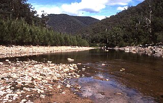
The Coxs River, a perennial river that is part of the Hawkesbury-Nepean catchment, is located in the Central Tablelands, Blue Mountains, and Macarthur regions of New South Wales, Australia.

The Woronora Dam is a heritage-listed concrete gravity dam with an uncontrolled serpentine spillway across the Woronora River, located south of Greater Metropolitan Sydney, in the suburb of Woronora Dam, Sutherland Shire, New South Wales, Australia. The principal purpose of the dam is for potable water supply for Sydney's southern suburbs and the northern suburbs of the Illawarra region. The impounded 71,790-megalitre reservoir is also called Woronora Dam and is sometimes incorrectly called Lake Woronora. The dam was designed by G. E. Haskins, Chief Engineer and the Metropolitan Water, Sewerage and Drainage Board of NSW (MWS&DB) and built from 1927 to 1941 by the MWS&DB. The property is owned by the Sydney Catchment Authority, an agency of the Government of New South Wales. It was added to the New South Wales State Heritage Register on 18 November 1999.

Macarthur is a region in the south-west part of the Greater Sydney area, in the state of New South Wales, Australia. The region includes the local government areas of the City of Campbelltown, Camden Council, and Wollondilly Shire. It covers an area of 3,067 square kilometres and has a population of close to 310,000 residents. The region geographically forms the foothills between the Blue Mountains and Southern Highlands regions.

A wild river or heritage river (Canada) is a river or a river system designated by a government to be protected and kept "relatively untouched by development and are therefore in near natural condition, with all, or almost all, of their natural values intact."

The Kings Tableland is a plateau located in the Blue Mountains in Wollondilly Shire, New South Wales, Australia.

Burragorang or Burragorang Valley is a locality in the Macarthur Region of New South Wales, Australia, in Wollondilly Shire. It is home to Lake Burragorang, which is impounded by Warragamba Dam. It is located within the Blue Mountains National Park – specifically the Nattai National Park.

The Wirrimbirra Sanctuary is a heritage-listed fauna sanctuary, native plant nursery, education centre and flora sanctuary located off the Hume Highway at 1305 Remembrance Drive, in outer south-western Sydney in the settlement of Bargo in the Wollondilly Shire local government area of New South Wales, Australia. It was built in 1962 by the Stead Foundation. The property is owned by the National Trust of Australia. It was added to the New South Wales State Heritage Register on 1 March 2002.
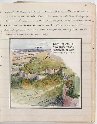
The Coxs River track is a heritage-listed former walking track and road and now walking track at Cox's River Arms, Lake Burragorang/Warragamba Dam, City of Blue Mountains, New South Wales, Australia. The track is also known as the Warragamba Dam - Burragorang Valley - Wentworth Falls Track. The property is owned by the Sydney Catchment Authority, an agency of the Government of New South Wales. It was added to the New South Wales State Heritage Register on 18 November 1999.

The Caloola Club was a bushwalking and outdoors activity club that was based in Sydney, New South Wales, Australia, founded in 1945 and active until 1963, when it merged with the National Parks Association of N.S.W. The club was an influential part of the 'second wave' of the conservation and environmental movement in New South Wales during the post-WWII period.

The Blue Gum Forest is a forest located in Blue Mountains National Park within the Grose Valley of the Blue Mountains in New South Wales west of Sydney, southeastern Australia. It is one of the best-known bushwalking sites in Australia. The forest is located within the UNESCO World Heritage Site known as the Greater Blue Mountains Area. The forest survived through the efforts of early Australian conservationists.


