Interstate 73 (I-73) is a north–south Interstate Highway, currently located entirely within the US state of North Carolina. It travels 93.5 miles (150.5 km), from south of Ellerbe, North Carolina to northeast of Stokesdale, providing a freeway connection to Greensboro and Asheboro. Other than a short 9.5 mi (15.3 km) segment near the Piedmont Triad International Airport west of Greensboro, the interstate runs concurrently with at least one other route.

Gairloch is a village, civil parish and community on the shores of Loch Gairloch in Wester Ross, in the North-West Highlands of Scotland. A tourist destination in the summer months, Gairloch has a golf course, a museum, several hotels, a variety of shops, takeaway restaurants, a community centre, a leisure centre with sports facilities, a local radio station, beaches and nearby mountains. Gairloch is one of the principal villages on the North Coast 500 route.

Montego Bay is the capital of the parish of St. James in Jamaica. The city is the fourth-largest urban area in the country by population, after Kingston, Spanish Town, and Portmore, all of which form the Greater Kingston Metropolitan Area, home to over half a million people. As a result, Montego Bay is the second-largest anglophone city in the Caribbean, after Kingston.

Pedestrian zones are areas of a city or town restricted to use by people on foot or human-powered transport such as bicycles, with non-emergency motor traffic not allowed. Converting a street or an area to pedestrian-only use is called pedestrianisation.

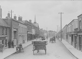
Rathfarnham is a southside suburb of Dublin, Ireland in County Dublin. It is south of Terenure, east of Templeogue, and is in the postal districts of Dublin 14 and 16. It is between the local government areas of Dún Laoghaire–Rathdown and South Dublin.

Budva is a town in the Coastal region of Montenegro. It has 19,218 inhabitants, and it is the centre of Budva Municipality. The coastal area around Budva, called the Budva Riviera, is the center of Montenegrin tourism, known for its well-preserved medieval walled city, sandy beaches and diverse nightlife. Budva is 2,500 years old, which makes it one of the oldest settlements on the Adriatic coast.

Alderley Edge is a village and civil parish in Cheshire, England. In 2011, it had a population of 4,780.

The Marin Headlands are a hilly peninsula at the southernmost end of Marin County, California, United States, located just north of San Francisco across the Golden Gate Bridge, which connects the two counties and peninsulas. The entire area is part of the Golden Gate National Recreation Area. The Headlands are famous for their views of the Bay Area, especially of the Golden Gate Bridge.

Bluefields is the capital of the South Caribbean Autonomous Region in Nicaragua. It was also the capital of the former Kingdom of Mosquitia, and later the Zelaya Department, which was divided into North and South Caribbean Coast Autonomous Regions. It is located on Bluefields Bay at the mouth of the Bluefields River in the municipality of the same name.

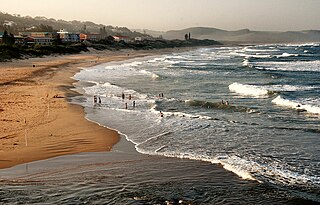
Scottburgh is a coastal resort town located along the south coast of KwaZulu-Natal, South Africa. It situated south of the mouth of the Mpambanyoni River (confuser of birds).

Westmoreland is the westernmost parish in Jamaica, on the south side of the island. It lies south of Hanover, southwest of Saint James, and northwest of Saint Elizabeth, in the county of Cornwall. The chief town and capital is Savanna-la-Mar. Negril, a famous tourist destination, is also situated in the parish.

Strand is a seaside resort town in the Western Cape, South Africa. It forms part of the Eastern Suburbs of the City of Cape Town Metropolitan Municipality, situated on the north-eastern edge of False Bay and near the foot of the Helderberg Mountains. Its geographical position is between Somerset West and Gordon's Bay, and is about 50 km southeast of Cape Town City Bowl. Strand has a population of approximately 50,000. Strand's main attraction is the beach; 5 km of white sandy beach off False Bay.

U.S. Route 101 (US 101) is a major north–south United States Numbered Highway, stretching from Los Angeles, California, to Tumwater, Washington. The California portion of US 101 is one of the last remaining and longest U.S. Routes still active in the state, and the longest highway of any kind in California. US 101 was also one of the original national routes established in 1926. Significant portions of US 101 between the Los Angeles area and the San Francisco Bay Area follow El Camino Real, the commemorative route connecting the former Alta California's 21 missions.
Langland Bay is a popular coastal holiday resort in Gower, Swansea in south Wales. It is a popular surfing beach which regularly meets the European Blue Flag award for quality.

Brunswick Heads is a small town on the north coast of New South Wales, Australia in Byron Shire. At the 2016 census, the town had a population of 1,737 people.

The A149 is commonly known as "The Coast Road" to local residents and tourists, as this road runs along the North Norfolk coast from King's Lynn to Great Yarmouth, via coastal villages.

The history of Bournemouth and human settlement in the surrounding area goes back for thousands of years. Bournemouth is a coastal town on the island of Great Britain in Dorset, England, United Kingdom.

Duporth was situated on Porthpean Road, just outside St Austell in south Cornwall, England, UK. For over 50 years, it was a holiday resort, until its closure in 2006. The site has now been sold to private developers and now contains new houses in the traditional Cornish cottage style.

Vleesbaai, a seaside vacation town, situated between Mossel Bay and Gouritsmond in Western Cape, South Africa.

Kozhikode Beach is a beach on the western side of Kozhikode, situated on the Malabar Coast of India. Kozhikode beach is most crowded beach in kerala. The beach is accessible through four road overbridges in the city. The beach has paved stones and illumination. There is one Lions Park for the children and an aquarium. Kozhikode beach has always been a prominent place for conducting public meetings. The beach road was renamed 'Gandhi Road' in 1934 after Gandhi visited Kozhikode in 1934.


