Brannan Island State Recreation Area is a state park unit of California, United States, preserving a maze of waterways in the Sacramento–San Joaquin River Delta. The recreation area is located in Sacramento County between Rio Vista and Isleton. This park northeast of San Francisco Bay has countless islands and marshes with many wildlife habitats and many opportunities for recreation, including boating, windsurfing and swimming. The 329-acre (133 ha) park was established in 1952.

Grayton Beach State Park is a Florida State Park located between Panama City Beach and Destin, near the unincorporated area of Grayton Beach, on CR 30A, in northwestern Florida. Its sister park is Deer Lake State Park.

Henderson Beach State Park is a Florida State Park located near Destin, in northwestern Florida. The address is 17000 Emerald Coast Parkway.

St. Andrews State Park is a 1,200-acre (4.9 km2) Florida State Park located three miles (5 km) east of Panama City Beach Florida, off U.S. 98. It is the headquarters of one of the state's five AmeriCorps Florida State Parks chapters.

Torrey Pines State Beach is a coastal beach located in the San Diego, California community of Torrey Pines, and is located south of Del Mar and north of La Jolla. Coastal erosion from the adjacent Torrey Pines State Reserve makes for a picturesque landscape. It is a local favorite among surfers and remains a quintessential Southern California beach. Occurrences of bioluminescence have been noted.

Font Hill Beach is located in St Elizabeth, on the south coast of Jamaica, between Black River and Whitehouse. It is within a nature reserve on the Font Hill property owned by the Petroleum Company of Jamaica. It is an attractive, well kept beach with clean golden sand and safe swimming in a roped off area. Beyond the rope there is a shallow reef.

Whitehouse Beach adjoins an area of former salt marsh in Westmoreland, Jamaica. The area is being developed as a tourist resort. It is located next to the small mountainous community of Culloden and about 4 kilometres (2.5 mi) west of the town of White House.

Bluefields Beach Park is a very popular public beach in Bluefields in the south-east of Westmoreland, Jamaica. It gets very busy at weekends and holidays.

Hellshire Beach, Jamaica, is located near Portmore, and famed for its fried fish and safe swimming. It has near white sands with a very small trace of black sand. Exposed when there is a sea running to the south, the waters close to shore are often quite cloudy due to the stirred up sand.

Beaumont Provincial Park is a provincial park located at the southeast end of Fraser Lake, between Fort Fraser and the town of Fraser Lake, British Columbia, approximately 40 km west of Vanderhoof, British Columbia. The park contains the site of the original Fort Fraser.

Challaborough is a village and popular surfing beach in the District of South Hams on the south coast of Devon, England. The village is in the parish of Ringmore, though the eastern part of the small bay and beach lies in Bigbury parish. The beach is popular with surfers from Plymouth and the surrounding area because of its powerful waves.

Preston is a suburb located in the northern part of Paignton in Devon. Preston is a popular destination for family holidays and has two main beaches; Hollicombe, a red sandy beach with cliffs and rock pools, and Preston Sands with rock pools, beach huts and facilities. At low tide it is possible to walk between Preston Sands and the adjoining beaches at Paignton. The ward population at the 2011 census was 10,924.

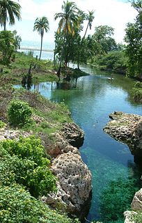
Gut River is a river, beach and small hamlet on an isolated stretch of south facing coastline in Manchester, Jamaica. The name is said by the locals to derive from the German word for good.

Treasure Beach is the name given to a stretch of four Jamaican coves and their associated settlements: Billy's Bay, Frenchman's Bay, Calabash Bay and Great Pedro Bay.

Lady Robinsons Beach is the stretch of beach between the mouth of the Cooks River and the mouth of Georges River on the western shore of Botany Bay in Sydney, New South Wales, Australia. Originally known as Seven Mile Beach, it was renamed after the wife of the then Governor, Sir Hercules Robinson. Isolated settlements separated from the beach by sand dunes were also given the name of Lady Robinson's Beach as their postal address.

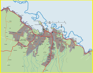
Tuanaimato is a geographical area near Apia, Samoa.

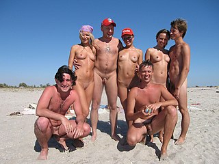
A nude beach, sometimes called a clothing-optional or free beach, is a beach where users are at liberty to be nude. Nude beaches usually have mixed bathing. Such beaches are usually on public lands, and any member of the public is allowed to use the facilities without membership in any movement or subscription to any personal belief. The use of the beach facilities is normally anonymous. Unlike a naturist resort or facility, there is normally no membership or vetting requirement for the use of a nude beach. The use of nude beach facilities is usually casual, not requiring pre-booking. Nude beaches may be official, unofficial, or illegal. However, nude beaches are relatively few and are usually at some distance from cities, and access is at times more difficult than at a regular beach and the facilities at these beaches tend to be very basic with a few notable exceptions. Nude swimming is one of the most common forms of nudity in public. A nude beach should not be confused with a topless beach, where upper body clothing is not required for women or men, although a swimming costume covering the genital area is required for both men and women. A nude beach should be considered as a clothes-free beach.

South Cape Beach State Park is a Massachusetts state park located in the town of Mashpee. It is part of the Waquoit Bay National Estuarine Research Reserve. The park is situated between Waquoit Bay and Vineyard Sound and features barrier beach and dunes, salt marsh, scrub oak and pitch pine woodland and kettle ponds and is managed by the Department of Conservation and Recreation.

Quinsigamond State Park is a public recreation area comprising two day-use areas along the western shore of Lake Quinsigamond in the city of Worcester, Massachusetts. The Regatta Point area is across North Lake Avenue from the University of Massachusetts Medical School, north of Route 9. The Lake Park area is south of Route 9. The park is managed by the Department of Conservation and Recreation.

Newland Head Conservation Park is a protected area located in South Australia within the locality of Waitpinga on the southern coast of the Fleurieu Peninsula 91 km south of the centre of Adelaide, and 7 km southwest of Victor Harbor. Its name is taken from Newland Head that feature prominently at the eastern boundary of the park. The conservation park is classified as an IUCN Category III protected area.


