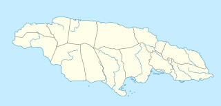
Edithvale is a suburb in Melbourne, Victoria, Australia, 28 km south-east from Melbourne's central business district. Its local government area is the City of Kingston. At the 2016 census, Edithvale had a population of 5,806.

Jerk is a style of cooking native to Jamaica, in which meat is dry-rubbed or wet marinated with a hot spice mixture called Jamaican jerk spice.

Old Nanny Town was a village in the Blue Mountains of Portland Parish, north-eastern Jamaica, used as a stronghold of Jamaican Maroons. They were led in the early 18th century by an Ashanti escaped slave known as Granny Nanny, or Queen Nanny. The town held out against repeated British colonial attacks before being destroyed in 1734.
Queen Nanny, Granny Nanny or Nanny, was an 18th-century leader of the Jamaican Maroons. Much of what is known about her comes from oral history, as little textual evidence exists. She led a community of formerly enslaved Africans called the Windward Maroons. In the early 18th century, they fought a guerrilla war over many years against British authorities in the Colony of Jamaica. According to Maroon legend, Queen Nanny was born in what is today Ghana of the Akan or Ashanti people. According to the oral tradition and at least one documentary source, she was never enslaved. Although widely assumed that she arrived in Jamaica as a slave, how she arrived in Jamaica is not certain.

St Catherine is a parish in the south east of Jamaica. It is located in the county of Middlesex, and is one of the island's largest and most economically valued parishes because of its many resources. It includes the first capital of Jamaica, Spanish Town, originally known as San Jago de la Vega or Santiago de la Vega.

Portmore is a large coastal town in southern Jamaica in Saint Catherine, and a dormitory town for the neighbouring city of Kingston and Spanish Town.

Kingston Harbour in Jamaica is the seventh-largest natural harbour in the world. It is an almost landlocked area of water approximately 16 kilometres (9.9 mi) long by 3.2 kilometres (2.0 mi) wide. Most of it is deep enough to accommodate large ships, even close to shore. It is bordered to the north by the city of Kingston, the capital of Jamaica; to the west by Hunts Bay and the municipality of Portmore; and to the south and east by the Palisadoes strip, which protects it.
The First Maroon War was a conflict between the Jamaican Maroons and the colonial British authorities that started around 1728 and continued until the peace treaties of 1739 and 1740. It was followed about half a century later by the Second Maroon War.
The Second Maroon War of 1795–1796 was an eight-month conflict between the Maroons of Cudjoe's Town, a maroon settlement later re-named after Governor Edward Trelawny at the end of First Maroon War, located near Trelawny Parish, Jamaica in the St James Parish, and the British colonials who controlled the island. The Windward communities of Jamaican Maroons remained neutral during this rebellion and their treaty with the British still remains in force. Accompong Town, however, sided with the colonial militias, and fought against Trelawny Town.

Cockpit Country is an area in Trelawny and Saint Elizabeth parishes in Jamaica. The land is marked by steep-sided hollows, as much as 120 metres (390 ft) deep in places, which are separated by conical hills and ridges. Maroons who had escaped from plantations used the difficult territory for its natural defenses to develop communities outside the control of Spanish or British colonists.

Cattawood Springs is a place in Portland Parish, Jamaica located at latitude 18 04' 00", longitude 76 26' 00".
Jamaican Maroons descend from maroons, Africans who escaped from slavery on the island of Jamaica and established free communities in the mountainous interior, primarily in the eastern parishes. Escaped Africans who were enslaved during Spanish rule over Jamaica (1493–1656) may have been the first to develop such refugee communities.

Moore Town is a Maroon settlement located in the Blue Mountains and John Crow Mountains of Portland, Jamaica, accessible by road from Port Antonio. The easternmost Maroon town, Moore Town is located in the eastern end of the parish. Formerly known as New Nanny Town, Moore Town was founded in 1740 when the Peace Treaty was signed between the British colonial authorities and the Windward Maroons. This treaty allotted the Moore Town Maroons 1000 acres, but Moore Town only received 500. In 1781 the initial 500 acres was augmented with another 500 acres, taking their communal land up to 1,000 acres.

Jamaica was an English colony from 1655 or 1670, and a British Colony from 1707 until 1962, when it became independent. Jamaica became a Crown colony in 1866.

"Kisses for Breakfast" is a song by British singer Melissa Steel featuring Jamaican dancehall artist Popcaan. It was released as Steel's first solo single as a digital download on 27 July 2014. The song entered and peaked at number ten on the UK Singles Chart.
Cudjoe's Town was located in the mountains in the southern extremities of the parish of St James, close to the border of Westmoreland, Jamaica.
Captain Davy was an eighteenth-century Maroon officer at Scott's Hall who gained notoriety by killing the leader of Tacky's Revolt, the most dangerous slave rebellion in eighteenth-century Jamaica.
Samuel Grant (1741-1808), Maroon officer from Charles Town, Jamaica. Sam Grant was an officer of the Jamaican Maroons who made a career out of hunting runaway slaves.
Charles Town is one of four official towns of the Jamaican Maroons. It is located on Buff Bay River in Portland Parish.
Scott's Hall is one of the four official towns of the Jamaican Maroons. It is located in Saint Mary Parish, Jamaica.


