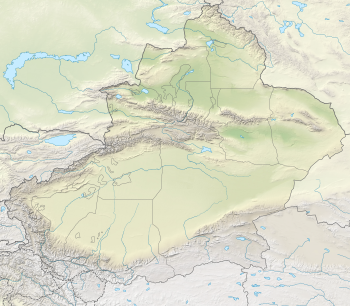
The Tian Shan, also known as the Tengri Tagh or Tengir-Too, meaning the "Mountains of God/Heaven", is a large system of mountain ranges in Central Asia. The highest peak in the Tian Shan is Jengish Chokusu, at 7,439 metres (24,406 ft) high. Its lowest point is the Turpan Depression, which is 154 m (505 ft) below sea level.
The Kunlun Mountains constitute one of the longest mountain chains in Asia, extending for more than 3,000 kilometres (1,900 mi). In the broadest sense, the chain forms the northern edge of the Tibetan Plateau south of the Tarim Basin.
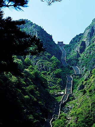
Mount Tai is a mountain of historical and cultural significance located north of the city of Tai'an. It is the highest point in Shandong province, China. The tallest peak is the Jade Emperor Peak, which is commonly reported as being 1,545 meters (5,069 ft) tall.
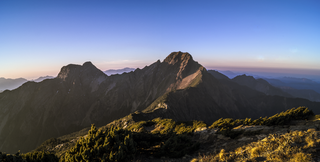
Yu Shan or Yushan, also known as Mount Jade, Jade Mountain, or Mount Yu, and known as Mount Niitaka during Japanese rule, is the highest mountain in Taiwan at 3,952 m (12,966 ft) above sea level, giving Taiwan the 4th-highest maximum elevation of any island in the world. It is the highest point in the western Pacific region outside of the Kamchatka Peninsula. Yushan and its surrounding mountains belong to the Yushan Range. The area was once in the ocean; it rose to its current height because of the Eurasian Plate's movement over the Philippine Sea Plate. Yushan is ranked 40th by topographic isolation.

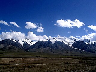
Kongur Tagh or Kongkoerh, is the highest peak in the Pamir Mountains, and also the highest mountain wholly within the Xinjiang Uyghur Autonomous Region, China. With an elevation of 7,649 metres (25,095 ft), it is also the highest mountain outside of the Hindu Kush/Karakoram and Himalaya ranges.

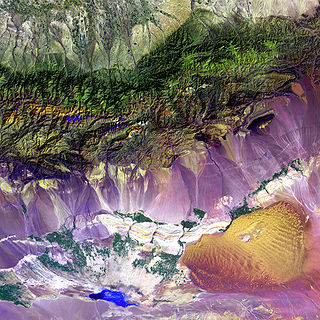
Altyn-Tagh is a mountain range in Northwestern China that separates the Eastern Tarim Basin from the Tibetan Plateau. The western third is in Xinjiang while the eastern part forms the border between Qinghai to the south and Xinjiang and Gansu to the north.
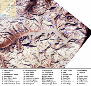
The Baltoro Muztagh is a subrange within the Karakoram mountain range. It spans across the Baltistan region of Gilgit-Baltistan, which is the northernmost political entity of Pakistan, and extends into Xinjiang, China. The crest of this range also serves as part of the border between Pakistan and China.
Ulugh Muztagh or Ulugh Muztag and Muztag Feng, is an extremely remote mountain group on the northern Qinghai-Tibetan Plateau. Located on the border between the Tibetan Autonomous Region and Xinjiang Uyghur Autonomous Region, it is part of the main range of the Kunlun Mountains of East-Central Asia.

Bogda Peak or Bogda Feng is the highest mountain in the Bogda Shan range, in the eastern Tian Shan mountains, China, at 5,445 m (17,864 ft) and the northernmost 5,000 m or higher peak in Eurasia.

Jade Dragon Snow Mountain is a mountain massif or small mountain range in Yulong Naxi Autonomous County, Lijiang, in Yunnan province, China. Its highest peak is named Shanzidou or Shan-Tzu-tou (扇子陡) and it is 5,596 m (18,360 ft) above sea level.

The Hengduan Mountains are a group of mountain ranges in southwest China that connect the southeast portions of the Tibetan Plateau with the Yunnan–Guizhou Plateau. The Hengduan Mountains are primarily large north-south mountain ranges that effectively separate lowlands in northern Myanmar from the lowlands of the Sichuan Basin. These ranges are characterized by significant vertical relief originating from the Indian subcontinent's collision with the Eurasian Plate, and further carved out by the major rivers draining the eastern Tibetan Plateau. These rivers, the Yangtze, Mekong, and Salween, are recognized today as the Three Parallel Rivers UNESCO World Heritage Site.

Ruoqiang County as the official romanized name, also transliterated from Uyghur as Qakilik County, is a county in the Xinjiang Uyghur Autonomous Region, China under the administration of the Bayingolin Mongol Autonomous Prefecture. It covers an area of 198,318 square kilometres (76,571 sq mi), making it the largest county-level division in the country.

Dabancheng District or Dawan Cheng, is one of 7 urban districts of the prefecture-level city of Ürümqi, the capital of Xinjiang Uygur Autonomous Region, Northwest China. Located southeast of the Ürümqi urban area, it contains an area of 5,042 km2 (1,947 sq mi). According to the 2002 census, it has a population of 40,000.

Tianchi is an alpine lake in Xinjiang, Northwest China, situated at 43°53′9.7″N88°7′56.6″E. The name (天池) literally means Heavenly Lake and can refer to several lakes in mainland China and Taiwan. This Tianchi lies on the north side of the Bogda Shan range of the Tian Shan, about 30 kilometres (19 mi) south of Fukang and 45 kilometres (28 mi) east of Ürümqi. It is an alpine drift lake shaped in the Quaternary Glacier period.
Dünkheger, also known as Mount Altun Obo, is the highest peak of Baitag Bogda, a mountain range in the Altai Mountains of Asia. It has an elevation of 3,315 metres (10,876 ft) and is on the international border between Qitai County, China and Mongolia.
The Borohoro Mountains is one of the major ranges of the Tian Shan mountain system. It is almost entirely located within China's Xinjiang Uyghur Autonomous Region, with only a few westernmost peaks being in Kazakhstan.

Cheung Shan, also known as Middle Hill, is a mountain in Hong Kong at 585 metres (1,919 ft) in height. Located to the north of Kowloon Peak and to the south of Tung Shan, it falls within the Ma On Shan Country Park and straddles the border between Wong Tai Sin and Sai Kung districts.