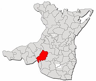
Deleni is a commune in Constanța County, Romania.
Huis ter Heide is a hamlet in the Netherlands and it is part of the Noordenveld municipality in Drenthe. Its population was 124 in 2006.

Urasar is a town in Armenia's Lori Province.
Olszanka is a village in the administrative district of Gmina Nowinka, within Augustów County, Podlaskie Voivodeship, in north-eastern Poland.

Bala Cəfərli is a village in the Qazakh Rayon of Azerbaijan.

Kuczki is a village in the administrative district of Gmina Uniejów, within Poddębice County, Łódź Voivodeship, in central Poland. It lies approximately 7 kilometres (4 mi) north-west of Uniejów, 20 km (12 mi) north-west of Poddębice, and 56 km (35 mi) north-west of the regional capital Łódź.
Rozpęd is a village in the administrative district of Gmina Kobiele Wielkie, within Radomsko County, Łódź Voivodeship, in central Poland. It lies approximately 8 kilometres (5 mi) west of Kobiele Wielkie, 8 km (5 mi) south-east of Radomsko, and 86 km (53 mi) south of the regional capital Łódź.
Wojciechówka is a village in the administrative district of Gmina Białobrzegi, within Białobrzegi County, Masovian Voivodeship, in east-central Poland.
Janowo is a village in the administrative district of Gmina Liw, within Węgrów County, Masovian Voivodeship, in east-central Poland. It lies approximately 9 kilometres (6 mi) south of Węgrów and 71 km (44 mi) east of Warsaw.
Nouga is a commune in the Cercle of Kangaba in the Koulikoro Region of south-western Mali. The principal town lies at Keliegoue. As of 1998 the commune had a population of 7736.
Staszkowo is a village in the administrative district of Gmina Ostróda, within Ostróda County, Warmian-Masurian Voivodeship, in northern Poland. It lies approximately 10 kilometres (6 mi) east of Ostróda and 29 km (18 mi) south-west of the regional capital Olsztyn.
Wilczkowo is a village in the administrative district of Gmina Gryfice, within Gryfice County, West Pomeranian Voivodeship, in north-western Poland. It lies approximately 7 kilometres (4 mi) west of Gryfice and 67 km (42 mi) north-east of the regional capital Szczecin.
Niesłusz is a settlement in the administrative district of Gmina Myślibórz, within Myślibórz County, West Pomeranian Voivodeship, in north-western Poland.

Manojlovce is a village in the municipality of Leskovac, Serbia. According to the 2002 census, the village has a population of 778 people.
Drenova is a village in the municipality of Gornji Milanovac, Serbia. According to the 2002 census, the village has a population of 264 people.

Lunjevica is a village in the municipality of Gornji Milanovac, Serbia. According to the 2002 census, the village has a population of 512 people. Revolutionary Nikola Lunjevica was born in the village.
Semedraž is a village in the municipality of Gornji Milanovac, Serbia. According to the 2002 census, the village has a population of 264 people.
Koigi is a village in Saaremaa Parish, Saare County in western Estonia.
Prvonek is a village in the municipality of Vranje, Serbia. At the 2002 census the village had a population of 203 people.

National Highway 6 is a national highway in southwestern Djibouti. The highway begins at 11°06′32″N42°20′47″E, at a junction with National Highway 1 near Dikhil. It passes through the town of As Eyla and ends at the village of Kouta Bouyya (11°00′55″N41°58′37″E).

