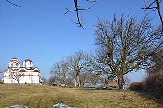
Gornji Tavankut is a village located in the Subotica municipality, in the North Bačka District of Serbia. It is situated in the autonomous province of Vojvodina. The village is ethnically mixed and its population numbering 1,381 people.

Motovilikhinsky City District is one of the seven city districts of the city of Perm in Perm Krai, Russia. Population: 179,961 (2010 Census); 176,564 (2002 Census); 181,605 (1989 Census). It is the second most populous city district of Perm.
Čašić Dolac is a small village on the Rogozna mountain in the municipality of Novi Pazar, Serbia.

Nowiny Kasjerskie is a village in the administrative district of Gmina Knyszyn, within Mońki County, Podlaskie Voivodeship, in north-eastern Poland. It lies approximately 9 kilometres (6 mi) east of Knyszyn, 18 km (11 mi) south-east of Mońki, and 26 km (16 mi) north of the regional capital Białystok.

Kosin is a village in the administrative district of Gmina Góra Świętej Małgorzaty, within Łęczyca County, Łódź Voivodeship, in central Poland. It lies approximately 3 kilometres (2 mi) south-east of Góra Świętej Małgorzaty, 10 km (6 mi) east of Łęczyca, and 30 km (19 mi) north of the regional capital Łódź.

Wójcin is a village in the administrative district of Gmina Paradyż, within Opoczno County, Łódź Voivodeship, in central Poland. It lies approximately 7 kilometres (4 mi) north-west of Paradyż, 19 km (12 mi) west of Opoczno, and 64 km (40 mi) south-east of the regional capital Łódź.

Okołowice is a village in the administrative district of Gmina Pabianice, within Pabianice County, Łódź Voivodeship, in central Poland. It lies approximately 10 kilometres (6 mi) north of Pabianice and 11 km (7 mi) south-west of the regional capital Łódź.

Przyborów is a village in the administrative district of Gmina Czarna, within Dębica County, Subcarpathian Voivodeship, in south-eastern Poland. It lies approximately 7 kilometres (4 mi) south-east of Czarna, 7 km (4 mi) west of Dębica, and 49 km (30 mi) west of the regional capital Rzeszów.

Jastrzębnik is a village in the administrative district of Gmina Żabia Wola, within Grodzisk Mazowiecki County, Masovian Voivodeship, in east-central Poland. It lies approximately 3 kilometres (2 mi) east of Żabia Wola, 12 km (7 mi) south-east of Grodzisk Mazowiecki, and 28 km (17 mi) south-west of Warsaw.

Chełchy is a village in the administrative district of Gmina Sypniewo, within Maków County, Masovian Voivodeship, in east-central Poland. It lies approximately 3 kilometres (2 mi) north-east of Sypniewo, 25 km (16 mi) north-east of Maków Mazowiecki, and 94 km (58 mi) north of Warsaw.

Niemczewo is a village in the administrative district of Gmina Drobin, within Płock County, Masovian Voivodeship, in east-central Poland. It lies approximately 4 kilometres (2 mi) east of Drobin, 31 km (19 mi) north-east of Płock, and 88 km (55 mi) north-west of Warsaw.

Stegna is a village in the administrative district of Gmina Iłów, within Sochaczew County, Masovian Voivodeship, in east-central Poland. It lies approximately 19 km (12 mi) north-west of Sochaczew and 68 km (42 mi) west of Warsaw.

Nowy Dworek is a village in the administrative district of Gmina Świebodzin, within Świebodzin County, Lubusz Voivodeship, in western Poland. It lies approximately 10 kilometres (6 mi) north of Świebodzin, 44 km (27 mi) north of Zielona Góra, and 48 km (30 mi) south of Gorzów Wielkopolski.

Mojuszewska Huta is a village in the administrative district of Gmina Sierakowice, within Kartuzy County, Pomeranian Voivodeship, in northern Poland. It lies approximately 6 kilometres (4 mi) east of Sierakowice, 16 km (10 mi) west of Kartuzy, and 44 km (27 mi) west of the regional capital Gdańsk.

Grodziska is a village in the administrative district of Gmina Dźwierzuty, within Szczytno County, Warmian-Masurian Voivodeship, in northern Poland. It lies approximately 6 kilometres (4 mi) east of Dźwierzuty, 20 km (12 mi) north of Szczytno, and 36 km (22 mi) east of the regional capital Olsztyn.

Rogojevac is a village in the Kragujevac city area in the Šumadija District, Serbia. According to the 2011 census there were 394 inhabitants. Bronze Age graves of nomads from the steppes of Russia were found in the village vicinity.
Zornitsa is a village in Aksakovo Municipality, in Varna Province, Bulgaria.

Trešnjevak is a village in the municipality of Stanovo, Serbia. According to the 2002 census, the village has a population of 24 people.
Ağaçlı is a village in the District of Söke, Aydın Province, Turkey. As of 2010, it had a population of 500 people.
Kopilovtsi is a village in Kyustendil Municipality, Kyustendil Province, south-western Bulgaria.


