Bogroy

Last updated

Bogroy
Badenoch and Strathspey UK location map.svg
Red pog.svg
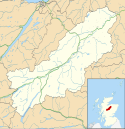
Bogroy
Location within the Badenoch and Strathspey area
OS grid reference NH901231
Council area
Country Scotland
Sovereign state United Kingdom
Post town CARRBRIDGE
Postcode district PH23
Police Scotland
Fire Scottish
Ambulance Scottish
List of places
UK
Scotland
57°17′08″N3°49′29″W / 57.28567°N 3.82463°W / 57.28567; -3.82463

Bogroy is a small crofting village, located 0.5 miles northwest of Carrbridge, in Strathspey, in the county of Inverness-shire, Scottish Highlands and is in the Scottish council area of Highland. [1] It lies off the A9 road on the A938 road, west of Skye of Curr, east of Findhom Bridge and northwest of Boat of Garten. The Dulnain river passes close to Bogroy.

Related Research Articles

<span class="mw-page-title-main">Roxborough, Philadelphia</span> Neighborhood in Philadelphia, Pennsylvania, United States

Roxborough is a neighborhood in Northwest Philadelphia, Pennsylvania, United States. It is bordered to the southwest, along the Schuylkill River, by the neighborhood of Manayunk, along the northeast by the Wissahickon Creek section of Fairmount Park, and to the southeast by the neighborhood of East Falls. Beyond Roxborough to the northwest is Montgomery County. Roxborough's ZIP Code is 19128. Most of Roxborough is in Philadelphia's 21st Ward.

<span class="mw-page-title-main">Sleat</span>

Sleat is a peninsula and civil parish on the island of Skye in the Highland council area of Scotland, known as "the garden of Skye". It is the home of the clan MacDonald of Sleat. The name comes from the Scottish Gaelic Slèite, which in turn comes from Old Norse sléttr, which well describes Sleat when considered in the surrounding context of the mainland, Skye and Rùm mountains that dominate the horizon all about Sleat.

<span class="mw-page-title-main">Great Glen</span> Scottish valley along geological fault line

The Great Glen, also known as Glen Albyn or Glen More, is a glen in Scotland running for 62 miles (100 km) from Inverness on the edge of the Moray Firth, in an approximately straight line to Fort William at the head of Loch Linnhe. It follows a geological fault known as the Great Glen Fault, and bisects the Scottish Highlands into the Grampian Mountains to the southeast and the Northwest Highlands to the northwest.

<span class="mw-page-title-main">Ben Wyvis</span> Mountain in Highland, Scotland, UK

Ben Wyvis is a mountain in Easter Ross, in the northern Highlands of Scotland. It lies north-west of Dingwall, in the council area of Highland, and the county of Ross and Cromarty. Ben Wyvis is a large winding and undulating ridge running roughly north–south for about 5 km, the highest point of which is Glas Leathad Mòr at 1,046 metres (3,432 ft). Geologically, the ridge is composed of Moine pelitic gneiss. The mountain is prominent in views of the area, presenting a whale-back shape above the farmland of Strathconon.

<span class="mw-page-title-main">Carrbridge</span> Village in Badenoch and Strathspey, Scotland

Carrbridge is a village in Badenoch and Strathspey in the Scottish Highlands. It lies off the A9 on the A938, west of Skye of Curr and southeast of Tomatin, near Bogroy. It has the oldest stone bridge in the Highlands and the nearby ancient pine forest contains the Landmark Forest Adventure Park.

<span class="mw-page-title-main">Beinn Bhàn (Applecross)</span> 896m high mountain in Scotland

Beinn Bhàn is a mountain in the highlands of Scotland, lying on the Applecross peninsula, on the north side of Loch Kishorn.

<span class="mw-page-title-main">Clisham</span> Mountain in the Isle of Lewis

The Clisham is a mountain on North Harris, Lewis and Harris in the Outer Hebrides of Scotland. At 799 metres (2,621 ft), it is the highest mountain in the Outer Hebrides and the archipelago's only Corbett. Climbers often encounter light rain and boggy and muddy terrain.

Rafford is a village in Moray, Scotland. It is approximately 2.5 miles (4 km) southeast of the town of Forres, and 5.5 miles (9 km) northwest of the village of Dallas.

<span class="mw-page-title-main">Slioch</span> Mountain in Scotland

Slioch is a mountain in the Scottish Highlands situated in Wester Ross, eight kilometres north of the village of Kinlochewe. Slioch reaches an elevation of 981 metres and towers above the southeastern end of Loch Maree to give one of the best known and most photographed sights in the Highlands. VisitScotland, the Scottish national tourist agency, has used video footage of Slioch in its television advertisements.

<span class="mw-page-title-main">Gaor Bheinn</span> Mountain in Scotland

Gaor Bheinn, also known in English as Gulvain, is a mountain in the Northwest Highlands of Scotland. It is in Lochaber, south of Loch Arkaig and north of the road west of Fort William. It is composed of banded granite and shaped like a letter Y, with two tops connected by a ridge running from northeast to southwest, with the northern top 6 m higher than the one to the south. Crags drop at either end, and steep slopes fall away to either side. The south ridge path is really a stream bed, so in wet conditions an easier if longer ascent from Na Socachan is to walk up Allt a Choire Reidh towards Gualann nan Osna and climb the south top's north-west ridge.

The Northwest Highlands are located in the northern third of Scotland that is separated from the Grampian Mountains by the Great Glen. The region comprises Wester Ross, Assynt, Sutherland and part of Caithness. The Caledonian Canal, which extends from Loch Linnhe in the south-west, via Loch Ness to the Moray Firth in the north-east splits this area from the rest of the country. The city of Inverness and the town of Fort William serve as gateways to the region from the south.

<span class="mw-page-title-main">Pennsylvania Route 696</span> State highway in Pennsylvania, US

Pennsylvania Route 696 is a 16.0-mile-long (25.7 km) state highway located in Franklin and Cumberland counties in Pennsylvania. The southern terminus is at PA 997 in Greene Township. The northern terminus is at PA 997 in Hopewell Township. PA 696 begins at PA 997 adjacent to an interchange with Interstate 81 (I-81) and heads northeast through farmland parallel to the interstate. The route turns north and has an interchange with I-81 before it continues into Shippensburg, where it has a brief concurrency with U.S. Route 11 and PA 533 in the downtown area. Past Shippensburg, PA 696 runs north through more farmland and heads to Newburg, where it has a short concurrency with PA 641. The route heads northwest from here to its terminus at PA 997.

<span class="mw-page-title-main">A861 road</span> Road in Scotland

The A861 road is a circuitous, primarily coastal, road in Lochaber, within the Highland council area of Scotland.

<span class="mw-page-title-main">Pennsylvania Route 997</span> State highway in Pennsylvania, US

Pennsylvania Route 997 is a 49.0-mile (78.9 km) route that is located in Franklin and Cumberland counties in central Pennsylvania in the United States. This route runs from the Maryland state line south of Waynesboro, where the road continues into that state as Maryland Route 64, north to PA 233 in the Upper Mifflin Township community of McCrea.

<span class="mw-page-title-main">Kettins</span> Human settlement in Scotland

Kettins is a village in Perth and Kinross, Scotland about 14 miles northeast of Perth and 11 miles northwest of Dundee. It is 1 mile from Coupar Angus, north of the A923 road.

The Switchback was a railway line in the East End of Glasgow, Scotland, constructed by the Caledonian Railway (CR). Connecting the lines at Rutherglen on the south side of the city with Robroyston on the north side, this route also served a number of industrial sidings and rail yards.

<span class="mw-page-title-main">Bridge of Tilt</span> Human settlement in Scotland

Bridge of Tilt is a village in Perthshire, Scotland, built around the River Tilt, near its confluence with the River Garry. It is 5+34 miles northwest of Pitlochry. The newer part of the village is continuous with Blair Atholl, only separated by the River Tilt. The village is located primarily on the B8079 between Pitlochry and Dunalastair Water, but the older part of the village is located further up the River Tilt. The A9 runs past the River Garry to the south of Bridge of Tilt, and connects the village with Newtonmore and Inverness in the north and Pitlochry, Perth and Stirling in the south.

<span class="mw-page-title-main">Inchmore, Kirkhill</span> Human settlement in Scotland

Inchmore in the Highland council area of Scotland, just south of the Beauly Firth. It is 0.9 miles southeast (1.5 km) southeast of the village of Kirkhill and 6.2 miles (10 km) west of Inverness. The A862 runs directly through the middle of the village.

Dunbar is an unincorporated community in Good Hope Township, Itasca County, Minnesota, United States. The community is located northwest of Squaw Lake at the junction of Itasca County Roads 32 and 149. State Highway 46 is nearby.

<span class="mw-page-title-main">Wards of Renfrewshire</span>

Renfrewshire is one of the 32 council areas of Scotland, formally established in 1996 to succeed the Renfrew district within the Strathclyde region, both of which were abolished; the headquarters are at Paisley.

References

  1. "Bogroy: Overview". Gazetteer for Scotland. Retrieved 5 November 2018.