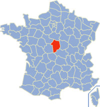
The arrondissement of Bourges is an arrondissement of France in the Cher department in the Centre-Val de Loire region. It has 131 communes.
The following is a list of the 19 cantons of the Cher department, in France, following the French canton reorganisation which came into effect in March 2015:
The Canton of Les Aix-d'Angillon is a former canton in the Cher département and in the Centre region of France. It was disbanded following the French canton reorganisation which came into effect in March 2015. It consisted of 12 communes, which joined the canton of Saint-Germain-du-Puy in 2015.
The Canton of Baugy is a former canton situated in the Cher département and in the Centre region of France. It was disbanded following the French canton reorganisation which came into effect in March 2015. It consisted of 17 communes, which joined the canton of Avord in 2015.
The Canton of Chârost is a canton situated in the Cher département and in the Centre-Val de Loire region of France.
The Canton of Henrichemont is a former canton situated in the Cher département and in the Centre region of France. It was disbanded following the French canton reorganisation which came into effect in March 2015.
The Canton of Léré is a former canton situated in the Cher département and in the Centre region of France. It was disbanded following the French canton reorganisation which came into effect in March 2015. It consisted of 7 communes, which joined the canton of Sancerre in 2015.
The Canton of Levet is a canton situated in the Cher département and in the Centre region of France. It was disbanded following the French canton reorganisation which came into effect in March 2015. It consisted of 13 communes, which joined the new canton of Trouy in 2015.
The Canton of Saint-Doulchard is a canton situated in the Cher département and in the Centre-Val de Loire region of France.
The Canton of Saint-Martin-d’Auxigny is a canton situated in the Cher département and in the Centre-Val de Loire region of France.
The Canton of Sancergues is a former canton situated in the Cher département and in the Centre region of France. It was disbanded following the French canton reorganisation which came into effect in March 2015. It consisted of 18 communes, which joined the new canton of Avord in 2015.
The Canton of Sancerre is a canton situated in the Cher département and is in the Centre-Val de Loire region of France.
The Canton of Vailly-sur-Sauldre is a former canton situated in the Cher département and in the Centre region of France. It was disbanded following the French canton reorganisation which came into effect in March 2015. It consisted of 11 communes, which joined the canton of Sancerre in 2015.
The Canton of Argent-sur-Sauldre is a former canton situated in the Cher département and in the Centre region of France. It was disbanded following the French canton reorganisation which came into effect in March 2015. It consisted of 4 communes, which joined the canton of Aubigny-sur-Nère in 2015.
The Canton of Aubigny-sur-Nère is a canton situated in the Cher département and in the Centre-Val de Loire region of France.
The Canton of Lury-sur-Arnon is a former canton situated in the Cher département and in the Centre region of France. It was disbanded following the French canton reorganisation which came into effect in March 2015. It consisted of 9 communes, which joined the canton of Mehun-sur-Yèvre in 2015.
The Canton of Mehun-sur-Yèvre is a canton situated in the Cher département and in the Centre-Val de Loire region of France.
The Canton of Vierzon-1 is a canton situated in the Cher département and in the Centre-Val de Loire region of France. It covers the northern part of the commune of Vierzon.
The Canton of Vierzon-2 is a canton situated in the Cher département and in the Centre-Val de Loire region of France.
The Communauté d'agglomération Bourges Plus is the communauté d'agglomération, an intercommunal structure, centred on the city of Bourges. It is located in the Cher department, in the Centre-Val de Loire region, central France. It was created October 21, 2002. Its population was 100,705 in 2014, of which 68,869 in Bourges proper.