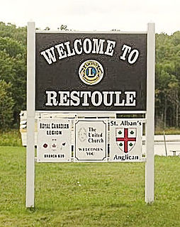
Restoule is a community and designated place in geographic Patterson Township in the Centre Unorganized Part of Parry Sound District in Central Ontario, Canada. It is situated on the Restoule River between Commanda Lake, and Restoule Lake and is part of the Almaguin Highlands region.

The Restoule River is a river in Parry Sound District in Central Ontario, Canada. It rises at Commanda Lake in geographic Patterson Township at the community of Restoule. It then flows north into Restoule Lake then north into Stormy Lake at Restoule Provincial Park, at the end of Ontario Highway 534. It then heads west into geographic Hardy Township to its mouth at the French River.

Oastler Lake Provincial Park is a provincial park in the municipality of Seguin, Parry Sound District in Central Ontario, Canada. The nearest town, just to the northwest, is Parry Sound.

Night Hawk Lake is a lake in the city of Timmins, Cochrane District in northeastern Ontario, Canada. It is in the James Bay drainage basin and is the source of the Frederick House River, which flows via the Abitibi River and Moose River to James Bay. Night Hawk Lake is the largest lake within the boundaries of the City of Timmins.

Redstone Lake is a lake located in geographic Guilford Township in the Municipality of Dysart et al, Haliburton County in Central Ontario, Canada. It is in the Great Lakes Basin and is part of the Gull River system. At its longest, it is approximately 6.5km.
Bull Lake is a lake in geographic Devonshire Township in the municipality of Sioux Narrows-Nestor Falls, Kenora District, Ontario, Canada. It is about 570 metres (1,870 ft) long and 260 metres (853 ft) wide, and lies at an elevation of 358 metres (1,175 ft) about 15 kilometres (9.3 mi) northeast of the community of Sioux Narrows. The primary outflow is an unnamed creek to Mac Lake, whose waters flow via the Black River into Lake of the Woods.

Otter Lake is a lake in geographic Foley Township in the municipality of Seguin, Parry Sound District in Central Ontario, Canada. Otter Lake was originally named 'Nigge-Cu-Bing' by the original First Nations inhabitants.
Bob's Lake is a lake in geographic Patterson Township in the Unorganized Centre Part of Parry Sound District in Central Ontario, Canada. It is in the Great Lakes Basin, and the nearest community is Restoule, 6 kilometres (4 mi) to the east. It is located in the Almaguin Highlands.
Riley Lake is a lake in geographic Code Township in the municipality of Sioux Narrows-Nestor Falls, Kenora District in Northwestern Ontario, Canada. It is part of the Hudson Bay drainage basin.
Wallbridge is an unorganized geographic township in Parry Sound District, Ontario, Canada. Part of the census subdivision of Unorganized Centre Parry Sound District, the township includes the communities of Britt, Byng Inlet and Harris Lake and the rail sidings of Drocourt and North Magnetawan. Although not an incorporated municipality, Britt and Byng Inlet are jointly served by a local services board.
Lake George is a lake in Chippewa County, Michigan, United States, and Algoma District, Northwestern Ontario, Canada, that lies between Sugar Island in Michigan on the west and the Ontario mainland on the east.
Rabbit Lake is a small lake in Parry Sound District in Central Ontario, Canada. It is part of the Great Lakes Basin, lies in geographic Wilson Township, and is within Island Lake Forest and Barrens Conservation Reserve. The lake exits at the southwest via an unnamed creek, then flows via the Still River to Byng Inlet on Georgian Bay, Lake Huron.
Sixteen Mile Creek is a stream in the municipality of Lake of Bays, District Municipality of Muskoka in Central Ontario, Canada. It is part of the Great Lakes Basin and flows from Hickory Lake to its mouth at the Boyne River. The Boyne River flows to the Lake of Bays, then via the Muskoka River, and the Moon River and Musquash River to Georgian Bay on Lake Huron.
The Boyne River is a river in the municipality of Lake of Bays, District Municipality of Muskoka in Central Ontario, Canada. It is part of the Great Lakes Basin, and flows from Fowler Lake to its mouth at Dwight Bay on the Lake of Bays near the community of Dwight on Ontario Highway 60. The Lake of Bays flows via the Muskoka River, then the Moon River and Musquash River to Georgian Bay on Lake Huron.

The Boyne River is a river in the municipality of Grey Highlands, Grey County in Southwestern Ontario, Canada. It is part of the Great Lakes Basin, and lies entirely within geographic Artemesia Township.
The Boyne River is a river in Simcoe County and Dufferin County in Central Ontario, Canada. It is part of the Great Lakes Basin, and is a left tributary of the Nottawasaga River. The rivers falls within the jurisdiction of the Nottawasaga Valley Conservation Authority.

The Beaver River is a river in Grey County and Simcoe County in Southern Ontario, Canada. It is part of the Great Lakes Basin, and is a tributary of Lake Huron. The river's drainage basin is under the auspices of Grey Sauble Conservation.
Wolverine Lake is a lake in geographic Hanlan Township and geographic Bannerman Township in Cochrane District in Northeastern Ontario, Canada. It is in the James Bay drainage basin and is in the Valentine River system.
Gibson Lake is a lake in geographic Brimacombe Township, Algoma District in Northeastern Ontario, Canada. It is part of the Great Lakes Basin and lies adjacent to and east of Ontario Highway 17 in Lake Superior Provincial Park.
Gibson Lake is a lake in geographic Monestime Township and geographic Olynik Township in Algoma District in Northeastern Ontario, Canada. It is part of the Great Lakes Basin and lies about 4 kilometres (2.5 mi) east of the northern terminus of Ontario Highway 810.

