
Gadchiroli district is an administrative district in Maharashtra, India. The city of Gadchiroli is the administrative headquarters of the district.

Chandrapur district is a district in the Nagpur Division in the Indian state of Maharashtra. Chandrapur was the largest district in India until the Gadchiroli and Sironcha tehsils were separated as Gadchiroli district in 1981. In 2011, the district population was 2,204,307.
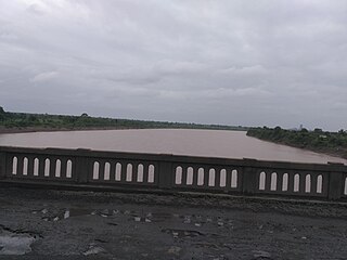
Gadchiroli ( [ɡəɖt͡ʃiɾoliː]) is a city and a municipal council in Gadchiroli district in the state of Maharashtra, central India. It is located on eastern side of Maharashtra, and is the administrative headquarters of the district. Gadchiroli is called the lung of Maharashtra as almost 70% of this district is covered by forests having 21% of the total forest cover of the state. The main river flowing through city is the Wainganga River. The landscape is lush and green during the monsoon season which is prone to flooding. Gadchiroli is known for its forests. Teak is grown commercially and bamboos are used for various crafts.
Pombhurna is a town and a tehsil in Chandrapur subdivision of Chandrapur district in Nagpur revenue Division in the Berar region in the state of Maharashtra, India. Earlier this tehsil was under Gondpimpari Taluka prior to Split from Mul.
Sindewahi is a town and Nagar Panchayat in Chandrapur district, Maharashtra, India. Notable villages in this tehsil are Navargaon, Ladbori and Ramala. Nagpur, the nearest large city, is about 130 kilometres (81 mi) away. According to the 2011 census it has a population of 12914 living in 3214 households.
Korpana is a City and a tehsil in Rajura subdivision of Chandrapur district in Nagpur revenue Division in the Vidarbha region in the state of Maharashtra, India. This is Last Tehsil Place In Chandrapur District. The telanaga border and Yavatmal district .Also this taluka is leading in cement production in Maharashtra. It has 4 big cement factories in the country and 1 coal mine.The taluka covers a total of 113 villages.
Jiwati is a town and a tehsil in Rajura subdivision of Chandrapur district in Nagpur revenue Division in the state of Maharashtra, India. 17 September is celebrated as Muktisangram Diwas in Jiwati as well as Korpana and Rajura talukas. Manikgad fort is a tourist spot in Jiwati taluka which is 12 km away from taluka headquarters. According to 2011 census the population of Jiwati town is 3,764 of which 1,888 are male and 1,876 are female. According to census 2011 information the sub-district code of Jiwati Block (CD) is 04076. Total area of jiwati tehsil is 559 km2. Jiwati tehsil has a population of 61,820 people. Jiwati tehsil has a population density of 110.6 inhabitants per square kilometre. There are about 13,656 houses in the sub-district. There are about 82 villages in Jiwati tehsil.
Ralegaon is Tehsil place town in Yavatmal District of Maharashtra (India). It is located in Vidarbha region of Maharashra. Geographically it is located northwest from Yavatmal. It is located 42 km away from Yavatmal and 21 km away from the Kalamb which is on Nagpur-Yavatmal road. And just 41 km from city Wardha.
The Painganga River is the chief river of the Buldhana district, Hingoli district, Nanded district, Yavatmal district, Chandrapur district and Washim district in the Maharashtra state in India. It flows along the southeast boundaries of the district in a winding, meandering course. It is deeply entrenched and difficult to navigate. It rises in the Ajantha range and is a major tributary of the Wardha River, the other major river in the district. It is also divided Marathwada and Vidarbha near Umarkhed and Himayatnagar.
Vijay Namdevrao Wadettiwar is an Indian politician, Former Cabinet Minister in the Government of Maharashtra in India and Leader of Opposition in Maharashtra Legislative Assembly. He is leader of Indian National Congress Maharashtra.

Khed taluka is a taluka in the subdivision, near Pune city in Pune district of the state of Maharashtra in India. Rajgurunagar is the headquarter of the taluka. The taluka is known for being the birthplace of Santaji Jagnade.The name of city is rajgurunagar on the name of Shaheed Shivram Hari Rajguru.

Bramhapuri is a town and eponymous headquarters of Bramhapuri taluka in Chandrapur district in the state of Maharashtra, India.
Maharashtra Major State Highway 9 also MSH 9 is a Major State Highway that runs south through Nagpur, and Chandrapur districts in the state of Maharashtra. This state highway touches numerous cities and villages VIZ. Nagpur, Umred, Nagbhid, Mul and Chandrapur. Tadoba Andhari Tiger Project and Umred Karhandla Wildlife Sanctuary are along with this highway.
Ballarpur Assembly constituency is one of the 288 Vidhan Sabha constituencies of Maharashtra state, western India. This constituency is located in Chandrapur district. The delimitation of the constituency happened in 2008.
Chandrapur Assembly constituency is one of the 288 Vidhan Sabha constituencies of Maharashtra state, western India. This constituency is located in Chandrapur district. The delimitation of the constituency happened in 2008.
Bramhapuri Assembly constituency is one of the 288 Vidhan Sabha constituencies of Maharashtra state, western India. This constituency is located in Chandrapur district, and is part of Gadchiroli–Chimur since the 2009 elections.
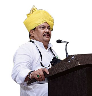
Suresh Narayan Dhanorkar, also called Balubhau Dhanorkar or Balu Dhanorkar, was an Indian politician who was the elected member of the Lok Sabha from Chandrapur constituency. He was a member of the Indian National Congress political party. He was the only candidate for the INC to be elected as MP from Maharashtra.
Mudza is a village in Bramhapuri tehsil of Chandrapur district in the state of Maharashtra, India. The village had a population of 3659 as on census of 2011.
List of talukas in Chandrapur district, Maharashtra India. 15 talukas of Chandrapur district.
Doma is a large village of Chimur Taluka in Chandrapur district of Maharashtra, India.
