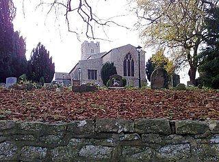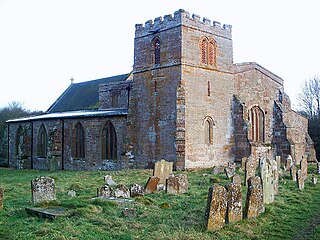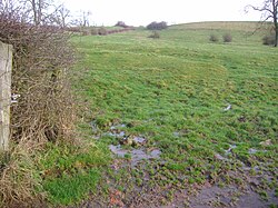
Braunston is a village and civil parish in West Northamptonshire, England, next to the border with Warwickshire. At the 2011 Census, the parish had a population of 1,759. Braunston is situated just off the A45 main road and lies between the towns of Daventry and Rugby. Braunston is categorised by the Office for National Statistics as Suburbs and Small Towns: Suburbs There are 776 households in the village.
Calverton is a civil parish in the unitary authority area of the City of Milton Keynes, Buckinghamshire, England and just outside the Milton Keynes urban area, near Stony Stratford. The parish consists of one village, Lower Weald and two hamlets: Upper Weald and Middle Weald. Lower Weald is the largest of the three settlements, and Manor Farm, the parish church and the former parochial school are within its boundaries.

Fleet Marston is a civil parish and deserted medieval village in the Aylesbury Vale district of Buckinghamshire, England, about 2.5 miles (4 km) northwest of the centre of Aylesbury. The parish measures about 2.5 miles (4 km) north – south, but east – west it is nowhere more than about 3⁄4 mile (1.2 km) wide. It is bounded to the southeast by the River Thame, to the east by a stream that joins the Thame, and to the west by field boundaries. It has an area of 934 acres (378 ha).

Haversham is a village in the City of Milton Keynes unitary authority area, in Buckinghamshire, England. It is situated to the north of the Milton Keynes urban area, near Wolverton and about 5 miles (8 km) north of Central Milton Keynes. With Little Linford, it forms the civil parish of Haversham-cum-Little Linford.

Lillingstone Lovell is a village and civil parish in north Buckinghamshire, England. It is located around 4 miles (6.4 km) north of Buckingham and 8 miles (13 km) west of Milton Keynes, and around 5 miles (8 km) south of Towcester in the neighbouring county of Northamptonshire. Silverstone Circuit is located just over 2 miles (3.2 km) north-west of Lillingstone Lovell.

Thornton is a village and civil parish on the River Great Ouse about 3.5 miles (5.6 km) north-east of Buckingham in the unitary authority area of Buckinghamshire.

Wolverton is a constituent town of Milton Keynes, England. It is located in north-west Milton Keynes, beside the West Coast Main Line, the Grand Union Canal and the river Great Ouse. It is the administrative seat of Wolverton and Greenleys civil parish.

Nicholas de Crioll, of a family seated in Kent, was Constable of Dover Castle and Keeper of the Coast during the early 1260s. His kinsman Bertram de Criol had distinguished himself in these offices during the preceding 20 years and both were near predecessors of the eminent Warden of the Cinque Ports, Stephen de Pencester.

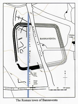
Bannaventa or Benaventa was a Romano-British fortified town which was on the Roman road later called Watling Street, which today is here, as in most places, the A5 road. Bannaventa straddles the boundaries of Norton and Whilton, Northamptonshire, England, villages highly clustered 1 kilometre (0.62 mi) and double that away, respectively.

Barby is a village and civil parish about 5 miles (8 km) north of Daventry in Northamptonshire, England. The 2011 Census recorded the parish population as 2,336. Barby is located right off the M45 motorway a short spur from the M1 motorway to the A45 Trunk Road.

Wolfhampcote is an abandoned village and civil parish in the English counties of Warwickshire and Northamptonshire, which it straddles.

This history of Milton Keynes details its development from the earliest human settlements, through the plans for a 'new city' for 250,000 people in northern Southeast England, its subsequent urban design and development, to the present day. Milton Keynes is the largest settlement and only city in Buckinghamshire, founded in 1967. At the 2021 census, the population of its urban area was estimated to have exceeded 256,000.

Althorp is a lost village within the grounds of the Althorp estate in the English county of Northamptonshire. The village is recorded in the Domesday Book. In the 15th century, the manor was held by the Catesby family who were probably responsible for clearing the settlement, for by 1505, the records show that there were no tenants. In 1508, the parish, including the cleared settlement of Althorp, was sold to John Spencer of Wormleighton in Warwickshire. By 1577, the land in the parish had been divided into four large sheep pastures. Althorp remains a civil parish.

The lost village of Braunstonbury lies in low ground south-west of the village of Braunston in the English county of Northamptonshire. Its site is on the eastern bank of the River Leam, which also marks the border between Northamptonshire and Warwickshire. Adjacent to the site on the west side of the river Leam is the site of the lost village of Wolfhampcote which straddled the county border of both counties.
The lost village of Coton is located around the environs of the hamlet of Coton and Coton Manor House in the English county of Northamptonshire.

The lost village of Onley is in the parish of Barby in the English county of Northamptonshire. The site is bordered on the north by the M45 motorway. On the east are Onley and Rye Hill prisons, and on the south-west is the A45 road. The Oxford Canal and the disused trackbed of the Great Central Railway run close to the eastern boundary.
William Gage was a major landowner and the father of the Tudor courtier Sir John Gage KG.
Sir John Gage was a major landowner and grandfather of the Tudor courtier Sir John Gage KG.
Eleanor St Clere was the heiress of a substantial number of manors and grandmother of the Tudor courtier Sir John Gage KG.


