Braunstonbury

Last updated
Braunstonbury
Lost Settlement
Site of Braunstonbury 22 Jan 2008 (1).JPG
The site of Braunstonbury
Northamptonshire UK location map.svg
Red pog.svg
Braunstonbury
Braunstonbury within Northamptonshire
Coordinates: 52°16′50″N1°13′10″W / 52.28056°N 1.21944°W / 52.28056; -1.21944 Coordinates: 52°16′50″N1°13′10″W / 52.28056°N 1.21944°W / 52.28056; -1.21944
Country England
State Northamptonshire
Region East Midlands
District Daventry
Municipality Braunston
grid reference SP533656

The lost village of Braunstonbury lies in low ground south-west of the village of Braunston in the English county of Northamptonshire. [1] Its site is on the eastern bank of the River Leam, which also marks the border between Northamptonshire and Warwickshire. [2] Adjacent to the site on the west side of the river Leam is the site of the lost village of Wolfhampcote which straddled the county border of both counties.

Braunston village in the United Kingdom

Braunston is a village and civil parish in the county of Northamptonshire, England. It has a population of 1,759. Braunston is situated just off the A45 main road and lies between the towns of Rugby and Daventry.

England Country in north-west Europe, part of the United Kingdom

England is a country that is part of the United Kingdom. It shares land borders with Wales to the west and Scotland to the north. The Irish Sea lies west of England and the Celtic Sea to the southwest. England is separated from continental Europe by the North Sea to the east and the English Channel to the south. The country covers five-eighths of the island of Great Britain, which lies in the North Atlantic, and includes over 100 smaller islands, such as the Isles of Scilly and the Isle of Wight.

Northamptonshire County of England

Northamptonshire, archaically known as the County of Northampton, is a county in the East Midlands of England. In 2015 it had a population of 723,000. The county is administered by Northamptonshire County Council and by seven non-metropolitan district councils. It is known as "The Rose of the Shires".

Contents

History

Very little information is known about Braunstonbury, probably because it was regarded as part of the nearby village of Braunston. It has never been listed separately in taxation records. It is thought that the settlement was part of the 11th-century manor which belonged to William Trusbott. The settlement passed to his daughter, Hilary de Bulliers, who in turn left the village to the Abbey of Lilleshall in the county of Shropshire. At the time of the dissolution of the monasteries the settlement and land was sold to the Earl of Rutland, who already owned property in the vicinity. An estate map of 1785 [3] shows the area lacking any buildings although the undoubted medieval boundaries of Braunstonbury are shown.

Lilleshall Hall

Lilleshall Hall is a large former country house and estate in the fields of Lilleshall, Shropshire, England.

Shropshire County of England

Shropshire is a county in England, bordering Wales to the west, Cheshire to the north, Staffordshire to the east, and Worcestershire and Herefordshire to the south. Shropshire Council was created in 2009, a unitary authority taking over from the previous county council and five district councils. The borough of Telford and Wrekin has been a separate unitary authority since 1998 but continues to be included in the ceremonial county.

Remains Today

The remains of the village lie within an almost square area of land bounded to the north by a low valley which was once occupied by fishponds. On the western boundary are the remains of a bank approximately 1.5 to 2 metres high. On the southern boundary is a low bank which runs into the remains of a (now disused) railway line that was built across part of the southern boundary. There are also the remains of a low bank on the eastern boundary of the village. Cutting across the north-west corner of the site is a hollowed way which was once the lane that connected the village to nearby Braunston. In the north-west corner there is a very defined rectangular ditch around a raised platform where once stood a medieval manor house. The rest of the village can be made out by extensive earthworks and some traces of stonework can be found. A large quantity of medieval pottery dating from the 14th and 15th centuries has been found along the edge of a stream that runs along the northern boundary of the settlement. The stream once fed the fishponds that filled the low valley here. [4]

Fish pond body of standing water, man-made and non perennial, used for pisciculture

A fish pond, or fishpond, is a controlled pond, artificial lake, or reservoir that is stocked with fish and is used in aquaculture for fish farming, or is used for recreational fishing or for ornamental purposes. In the medieval European era it was typical for monasteries and castles to have a fish pond.

Manor house country house that historically formed the administrative centre of a manor

A manor house was historically the main residence of the lord of the manor. The house formed the administrative centre of a manor in the European feudal system; within its great hall were held the lord's manorial courts, communal meals with manorial tenants and great banquets. The term is today loosely applied to various country houses, frequently dating from the late medieval era, which formerly housed the gentry.

Pottery Craft of making objects from clay

Pottery is the process of forming vessels and other objects with clay and other ceramic materials, which are fired at high temperatures to give them a hard, durable form. Major types include earthenware, stoneware and porcelain. The place where such wares are made by a potter is also called a pottery. The definition of pottery used by the American Society for Testing and Materials (ASTM), is "all fired ceramic wares that contain clay when formed, except technical, structural, and refractory products." In archaeology, especially of ancient and prehistoric periods, "pottery" often means vessels only, and figures etc. of the same material are called "terracottas". Clay as a part of the materials used is required by some definitions of pottery, but this is dubious.

In the Vicinity

The area around the lost settlement is rich in industrial archaeology. The remains of the original route of the Oxford Canal, which was abandoned in the 1830s, can be traced through the area. There are also the remains of two abandoned railway lines, the first being the old Weedon to Leamington Spa railway, which closed in 1963, and the second being the Great Central Railway, which closed in 1966. The former passes over the southern boundaries of the village and quite close to Wolfhampcote church.

Industrial archaeology Archaeological sub-discipline

Industrial archaeology (IA) is the systematic study of material evidence associated with the industrial past. This evidence, collectively referred to as industrial heritage, includes buildings, machinery, artifacts, sites, infrastructure, documents and other items associated with the production, manufacture, extraction, transport or construction of a product or range of products. The field of industrial archaeology incorporates a range of disciplines including archaeology, architecture, construction, engineering, historic preservation, museology, technology, urban planning and other specialties, in order to piece together the history of past industrial activities. The scientific interpretation of material evidence is often necessary, as the written record of many industrial techniques is often incomplete or nonexistent. Industrial archaeology includes both the examination of standing structures and sites that must be studied by an excavation.

Oxford Canal canal in the United Kingdom

The Oxford Canal is a 78-mile (126 km) narrow canal in central England linking Oxford with Bedworth via Banbury and Rugby. Completed in 1790, it connects to the River Thames at Oxford and is integrated with the Grand Union Canal—combined for 5 miles (8 km) close to the villages of Braunston and Napton-on-the-Hill, a canal which soon after construction superseded much of its traffic.

Leamington Spa spa town in Warwick, central Warwickshire, England

Royal Leamington Spa, commonly known as Leamington Spa or simply Leamington, is a spa town in Warwickshire, England. Originally a small village called Leamington Priors, it grew into a spa town in the 18th century following the popularisation of its water which was reputed to have medicinal qualities. In the 19th century, the town experienced one of the most rapid expansions in England. It is named after the River Leam, which flows through the town.

Related Research Articles

Deserted medieval village A former settlement which was abandoned during the Middle Ages

In the United Kingdom, a deserted medieval village (DMV) is a former settlement which was abandoned during the Middle Ages, typically leaving no trace apart from earthworks or cropmarks. If there are fewer than three inhabited houses the convention is to regard the site as deserted; if there are more than three houses, it is regarded as a shrunken medieval village. There are estimated to be more than 3,000 DMVs in England alone.

Barby, Northamptonshire village in United Kingdom

Barby is a village and civil parish about 5 miles (8 km) north of Daventry in Northamptonshire, England. The 2011 Census recorded the parish population as 2,336. Barby is located right off the M45 motorway a short spur from the M1 motorway to the A45 Trunk Road.

Staverton, Northamptonshire village in United Kingdom

Staverton is a village and civil parish in the south-west of Northamptonshire, England. It is 2.3 miles west of Daventry, 7.9 miles east of Southam and 15.3 miles east of Leamington Spa. It straddles the A425 road from Daventry to Leamington. The Jurassic Way long distance footpath between Banbury and Stamford passes through the village.

Hellidon farm village in the United Kingdom

Hellidon is a village and civil parish about 5 miles (8 km) south-west of Daventry in Northamptonshire, England. The parish area is about 1,600 acres (650 ha). The village lies 520 feet (160 m)–590 feet (180 m) above sea level on the north face of an ironstone ridge. Its highest point is 670 feet (200 m) above sea level, at Windmill Hill about 0.5 miles (800 m) south-east of the village. The Leam and several streams feeding it rise in the parish. The 2011 Census recorded a parish population of 256. The Jurassic Way long-distance footpath linking Banbury, Oxfordshire and Stamford, Lincolnshire passes through.

Willoughby, Warwickshire village in the United Kingdom

Willoughby is a village and civil parish about 5 miles (8 km) south of Rugby, Warwickshire, England. The village is about 4.5 miles (7 km) northwest of Daventry in neighbouring Northamptonshire and the eastern boundary of the parish forms part of the county boundary.
Wolfhampcote village in United Kingdom

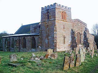
Wolfhampcote is an abandoned village and civil parish in the English counties of Warwickshire and Northamptonshire, which it straddles.

West Farndon hamlet in Northamptonshire, UK

West Farndon is a hamlet and deserted medieval village about 34 mile (1.2 km) southwest of Hinton, Northamptonshire, in the civil parish of Woodford cum Membris.

Thornton-le-Street village in United Kingdom

Thornton-le-Street is a village and parochial and civil parish in the Hambleton district of North Yorkshire, England. It is part of the civil parish of Thornton-le-Moor and Thornton-le-Street for District purposes. As the population remained less 100 at the 2011 Census details are included in the civil parish of Thornton-le-Moor. It is situated on the A168, about three miles north of Thirsk and about 5.3 miles (8.5 km) south east of the county town of Northallerton.

Arbury Hill Highest point in Northamptonshire, England

Arbury Hill, at 225 m (738 ft), is the joint highest point in the English county of Northamptonshire. It is 9 km (5.6 mi) southwest of the town of Daventry.

Braunston and Willoughby railway station

Braunston and Willoughby railway station was a station on the former Great Central Main Line. It served the small village of Willoughby which it was located next to, and the larger but more distant village of Braunston. The station opened with the line on 15 March 1899.

Althorp (lost settlement) Lost settlement in England

Althorp is a lost village within the grounds of the Althorp estate in the English county of Northamptonshire. The village is recorded in the Domesday Book. In the 15th century, the manor was held by the Catesby family who were probably responsible for clearing the settlement, for by 1505, the records show that there were no tenants. In 1508, the parish, including the cleared settlement of Althorp, was sold to John Spencer of Wormleighton in Warwickshire. By 1577, the land in the parish had been divided into four large sheep pastures. Althorp remains a civil parish.

Braunston Cleves or Fawcliff Lost Settlement in Northamptonshire, England

The lost village of Braunston Cleves or Fawcliff once stood north of the village of Braunston in the English county of Northamptonshire. The village stood on the southwest slope of Cleve’s hill within the parish of Braunston. The history of this settlement is virtually unknown. It is thought that the settlement was part of the 11th-century manor which belonged to William Trusbott. The settlement passed to his daughter, Agatha Meinfelin, who in turn left the village to Delapré Abbey in Northampton. A charter of Edward III confirming the possessions of Delapré Abbey mentions a place called Fawcliff near Braunston. Nothing is known of why the village was deserted but it had certainly been destroyed by the 18th century.

Onley (lost settlement) Lost settlement in England

The lost village of Onley is in the parish of Barby in the English county of Northamptonshire. The site is bordered on the north by the M45 motorway. On the east are Onley and Rye Hill prisons, and on the south-west is the A45 road. The Oxford Canal and the disused trackbed of the Great Central Railway run close to the eastern boundary.

Church Charwelton (lost settlement) Lost Settlement in Northamptonshire, England

The lost village of Church Charwelton lies south-east of the village of Charwelton in the English county of Northamptonshire. Its site is on the north-east bank of the River Cherwell. The Jurassic Way long-distance footpath passes across the site.
Chacombe a village located in South Northamptonshire, United Kingdom

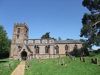
Chacombe is an English village and civil parish in South Northamptonshire, about 3 miles (5 km) north-east of the Oxfordshire town of Banbury. It has sometimes been spelt Chalcombe. The parish is bounded to the west by the River Cherwell, to the north by a tributary of it, and to the south-east by the Banbury–Syresham road. The 2011 Census recorded the parish population as 659.

Hinton, Northamptonshire village in Northamptonshire, UK

Hinton is a village about 6.5 miles (10.5 km) south of Daventry in Northamptonshire. The village is the largest settlement in the civil parish of Woodford cum Membris, the others being the village of Woodford Halse and hamlet of West Farndon.

Ulnaby village in United Kingdom

Ulnaby is an abandoned village and scheduled ancient monument in the grounds of Ulnaby Hall Farm, near High Coniscliffe, County Durham, England. The toft village was occupied from the late-13th to the 16th century and temporary buildings were erected in the 19th century. Ulnaby Hall farm appears to have been built in the late-16th century, supplanting a high status medieval manorial enclosure associated with the original village. It is thought that the village shrank because of the change from labour-intensive arable farming to pasture, before being abandoned and the site was subsumed into the farm as pasture.

References

  1. ’OS’ Explorer Map, Rugby & Daventry 222, ISBN   978-0-319-23734-2
  2. An Inventory of Archaeological Sites in North-West Northamptonshire, (1981) HMSO, page 22. ISBN   0-11-700900-8
  3. An Inventory of Archaeological Sites in North-West Northamptonshire, page 22
  4. An Inventory of Archaeological Sites in North-West Northamptonshire, page 23