Brebes (town)

Last updated
Brebes District
Kecamatan Brebes
Brebes (district) montage 2015.jpg
Sights in Brebes (clockwise from top) : Randusanga Beach, Ciblon Waterboom, Alun alun Brebes, Great Mosque of Brebes, Karangbirahi Stadium
Map of Brebes District, Brebes Regency.png
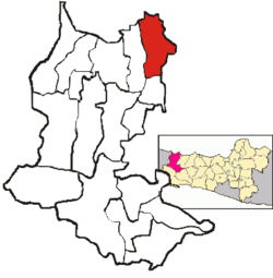
Location Brebes District in Brebes Regency
Coordinates: 6°52′30″S109°03′10″E / 6.87500°S 109.05278°E / -6.87500; 109.05278
Country Indonesia
Province Central Java
Regency Brebes
Government
  CamatM. Amrin Alfi Umar, S.IP, M.Si [1]
Area
  Total
92.23 km2 (35.61 sq mi)
Population
 (end 2023 estimate) [2]
  Total
189,721
  Density2,100/km2 (5,300/sq mi)
Time zone UTC+07.00 (WIB)
Postal Code
52211 to 52219
Area code 0283

Brebes District is an administrative district ( Indonesian: Kecamatan) containing the capital of Brebes Regency, in Central Java Province of Indonesia. It is bordered by the Java Sea to the north (the coastal desa of Randusanga Kulon including the lower reaches and mouth of the Pemali River), by Tegal City (West Tegal District and Margadana District) and Tegal Regency (Dukuhturi District and Adiwerna District) to the east, by Jatibarang District to the south and by Wanasari District to the west. It covers 92.23 km2 and had a population of 157,149 at the 2010 Census [3] and 182,421 at the 2020 Census; [4] the official estimate as at end 2023 was 189,721. [2]

Contents

History

In early January 1950, ADI/TII forces led by Amir Fatah briefly occupied Brebes. Later, they retreated from the town after facing a battle from the Indonesian National Armed Forces (TNI). [5]

Administrative Villages

Brebes District is divided into the following twenty-three villages (five which have the status of urban kelurahan and are indicated by asterisks below, and eighteen rural desa), tabulated below with their areas and their populations according to the end-2023 official estimates, [2] together with their postcodes.

Kode
Wilayah
NameArea
(km2)
Pop'n
Estimate
end 2023
Post
code
33.29.09.2001 Banjaranyar 2.037,59852216
33.29.09.1002 Brebes (town) *3.2622,07952212
33.29.09.1003 Gandasuli *1.149,19252215
33.29.09.2004 Kaligangsa Kulon 2.819,08552217
33.29.09.2005 Kaligangsa Wetan 2.446,95652217
33.29.09.2006 Kalimati 2.293,00752219
33.29.09.2007 Kaliwlingi 24.729,07652219
33.29.09.2008 Kedunguter 3.598,55052219
33.29.09.2009 Krasak 1.737,00152219
33.29.09.2010 Lembarawa 2.586,15252219
33.29.09.1011 Limbangan Kulon *1.974,48752219
33.29.09.1012 Limbangan Wetan *3.899,89552218
33.29.09.2013 Padasugih 1.516,72352214
33.29.09.2014 Pagejugan 4.3611,48152219
33.29.09.1015 Pasarbatang *4.6122,50952211
33.29.09.2016 Pemaron 2.116,28052219
33.29.09.2017 Pulosari 2.297,79852213
33.29.09.2018 Randusanga Kulon 13.018,00352219
33.29.09.2019 Randusanga Wetan 6.212,35452219
33.29.09.2020 Sigambir 0.954,18752219
33.29.09.2021 Tengki 1.406,94152219
33.29.09.2022 Terlangu 1.765,51852219
33.29.09.2023 Wangandalem 1.574,84952214
TotalsBrebes District92.23189,721

References

  1. Ita (3 May 2015). "4.491 Relawan Kader Pendata Mulai Lakukan Pendataan Keluarga" (in Indonesian). Vimanews. Retrieved 12 May 2015.
  2. 1 2 3 Badan Pusat Statistik, Jakarta, 26 September 2024, Kecamatan Brebes Dalam Angka 2024 (Katalog-BPS 1102001.3329170).
  3. Biro Pusat Statistik, Jakarta, 2011.
  4. Badan Pusat Statistik, Jakarta, 2021.
  5. Jayusman, Jayusman (2000). Gerakan DI/TII Amir Fatah 1949-1950 suatu pemberontakan kaum santri di daerah Tegal-Brebes (Thesis). Universitas Indonesia. p. 123.