
The Graian Alps are a mountain range in the western part of the Alps.
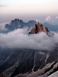
The Aiguille du Midi is a 3,842-metre-tall (12,605 ft) mountain in the Mont Blanc massif within the French Alps. It is a popular tourist destination and can be directly accessed by cable car from Chamonix that takes visitors close to Mont Blanc.
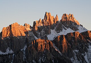
Croda da Lago is a small mountain chain in the central Dolomites in Veneto, northern Italy, just east of the Giau Pass. The highest peak of the group, the Cima d'Ambrizzola has an elevation of 2,715 metres. The range is very popular with hikers and mountain cyclists.

Pomagagnon is a mountain of the Dolomites in Belluno, northern Italy. It has an elevation of 2,450 metres (8,038 ft) and is the southernmost mountain of the Cristallo Group, towering 1,200 metres (3,937 ft) over the resort of Cortina d'Ampezzo. The mountain is part of the "Natural Park of the Ampezzo Dolomites".
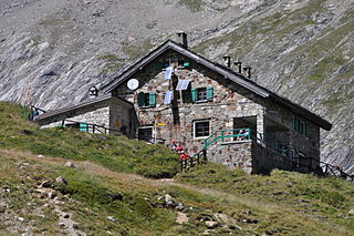
Rifugio Elisabetta is a refuge in the Italian Alps at an altitude of 2,195 m, which provides a convenient overnight stage for walkers undertaking the Tour du Mont Blanc. It is located 3 km north-east of the Col de la Seigne, at the south-west end of the Mont Blanc massif, and provides good views of Mont Blanc and the Aiguille Noire de Peuterey. Because of its popularity, plus the fact that there are no other huts along this part of the Tour du Mont Blanc, walkers are advised to book in advance during the peak periods in July and August.
The Aiguille des Glaciers is a mountain in the Mont Blanc massif of the Graian Alps. It lies on the borders of Savoie and Haute-Savoie in France and Aosta Valley in Italy.

Aiguille de Leschaux is a mountain in the Mont Blanc massif on the border of Haute-Savoie, France and Aosta Valley, Italy.

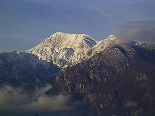
Aiguille de la Grande Sassière is a mountain in the Graian Alps, on the boundary between the Aosta Valley and the French department of Savoie.

Maira Valley is a valley in south-west of Piedmont in the Province of Cuneo, Italy.
Monte Bondone is a mountain of Trentino, northern Italy, located west of the provincial capital of Trento. It has an elevation of 2,180 metres (7,152 ft) and includes a ski resort on one side. It is the highest mountain of the Garda Prealps and with a prominence of 1,685 metres (5,528 ft) qualifies as an Ultra. It lies between the Etschtal valley in the east and the Sarca valley in the west. Due to its location high above the city, it is often called the mountain of Trento.

Aiguille de Chambeyron (3,412m) is a mountain of the Cottian Alps and is the highest mountain of Alpes-de-Haute-Provence in southeast France. Together with its neighbour Brec de Chambeyron, it is the dominant peak of the upper Ubaye Valley. The mountain is located near the border with Italy, just west of the Main chain of the Alps. It is the culminating point of the Massif du Chambeyron and is also the highest peak in the Alps south of Monte Viso.

Monte Terza Grande is a mountain of the Carnic Alps in Belluno, Veneto in north-eastern Italy. It is the highest mountain of the Southern Carnics and is part of a small Dolomitic group known as the "Dolomiti Pesarine". It resembles a pyramid from the north and south and a rocky massif from the east or west, and boasts a northwest face that is one kilometre high. It was first climbed in 1820.

Becco di Mezzodì (2,603m) is a mountain of the Croda da Lago chain, a small mountain group in the central Dolomites. It is located above the resort of Cortina d'Ampezzo in Belluno, northern Italy. The mountain's name means Midday Peak in the local dialect, as the sun appears directly above the peak at midday from Cortina. The climb usually starts from the Refuge Croda da Lago on the road to the Giau Pass. Climbing gear and slings are required.

Becca di Luseney (3,502m) is a mountain of the Pennine Alps in Aosta Valley, northwest Italy. It has a pyramidal look on all four sides, and its north face is covered with a glacier. A huge rockfall from its southwest face came down in 1952, completely destroying the village of Chamen and other settlements in the Valpelline valley. The mountain was first climbed in 1866.

Testa Grigia (3,315m) is a mountain on the Italian side of the Monte Rosa Massif in the Pennine Alps. It is the highest mountain of the ridge that separates the Lys valley (Gressoney-La-Trinité) from the Ayas Valley, in Aosta Valley.

Punta Lavina (3,308m) is a mountain of the Graian Alps located on the border of Aosta Valley and Piedmont, Italy. It is located between the Aostan Cogne Valley in the north and the Piedmontese Soana Valley in the South. The mountain has an elegant pyramidal shape which is easily recognisable from both Canavese and Turin. It lies entirely within the Gran Paradiso National Park.

Trogkofel is a mountain of the Carnic Alps lying on the border of Friuli, Italy and Carinthia, Austria. It is located on the main ridge of the Carnics between the Aip Valley to the south and the Gail Valley in the north, and is the second highest mountain on the eastern ridge after Gailtaler Polinik. The mountain is known as Crete Rosse, meaning Red Rocky Mountain in Friuli.

Gartnerkofel is a mountain of the Carnic Alps in Carinthia, Austria. It is located on the main chain of the Carnics above the Naßfeld Pass, near the border with Italy. The nearest town is Hermagor-Pressegger See. The mountain has two summits, and ravines fall down from its northern slopes, which are separated by rocky ridges. The normal route is from the northwest, from where it an easy climb across the ridge to the summit. The mountain is also a popular ski touring destination.

Bessanèse, is a mountain of the Graian Alps on the France and Italy border.

The Aiguilles d'Entrèves is a mountain peak in the Mont Blanc massif of the Alps. It is situated at the head of the Glacier du Géant, and its rocky summit ridge forms part of the frontier between France and Italy. It lies east of the Tour Ronde, between the Col d'Entrèves and the Col Occidental de Toule. It has a steep, sound face of red granite and can be readily accessed from the Torino Hut/Pointe Helbronner.

