Breggia, Switzerland

Last updated
Breggia
Valle di Muggio 2.jpg
Muggio Valley
Breggia CoA.png
Location of Breggia
Breggia, Switzerland
Switzerland adm location map.svg
Red pog.svg
Breggia
Reliefkarte Tessin blank.png
Red pog.svg
Breggia
Coordinates: 45°52′N9°02′E / 45.867°N 9.033°E / 45.867; 9.033
Country Switzerland
Canton Ticino
District Mendrisio
Government
   Mayor Sindaco
Area
[1]
  Total25.5 km2 (9.8 sq mi)
Elevation
704 m (2,310 ft)
Population
 (31 December 2018) [2]
  Total1,988
  Density78/km2 (200/sq mi)
Time zone UTC+01:00 (Central European Time)
  Summer (DST) UTC+02:00 (Central European Summer Time)
SFOS number 5269
Surrounded by Castel San Pietro, Moltrasio (IT-CO), Schignano (IT-CO)
Website www.comunebreggia.ch
SFSO statistics

Breggia is a municipality in the district of Mendrisio in the canton of Ticino in Switzerland. On 25 October 2009 the municipalities of Bruzella, Cabbio, Caneggio, Morbio Superiore, Muggio and Sagno merged into the municipality of Breggia. [3]

Contents

History

Bruzella is first mentioned in 852 as Brusella. [4] Cabbio is first mentioned in 1188 as Cabio. [5] Caneggio is first mentioned in 1209 as Canegio. In 1335 it was mentioned as Canezio. [6] Morbio Superiore is first mentioned in 1116 as Morbio de Supra. [7] Muggio is first mentioned in 852 as Mugio. [8] Sagno is first mentioned around 1296-99 as Sagnio. [9]

Brusella

Until 1609 it was united territorially with Monte, and until 1649 it was part of the parish of Caneggio. The Church of S. Siro is first mentioned in 1579. It was rebuilt in the 18th century, and restored in 1973.

Traditionally, cheese production and forestry (production of timber and charcoal) were the main economic sources. This was supplemented by periodic waves of emigration. By 1985, agriculture only employed six people. At the beginning of the 21st century, the population was largely made of retirees and commuters. [4]

Cabbio

The village was mentioned in 1299 as a part of the holdings of Como Cathedral and Rusca Castle in Como. It was part of the parish of Muggio until the first half of the 17th century, and part of the political municipality until 1673. It was part of the parish of Balerna until the early 19th century. Until 1805, Cabbio also included the village of Casima (now part of Castel San Pietro. The parish church of S. Salvatore was first mentioned in 1579. It was rebuilt in 1780-95 and newly consecrated in 1818. [5]

The village economy was traditionally based on forest and alpine farming, as well as emigration to other countries. [5]

Caneggio

Roman era graves were discovered in Campora. [6]

The village was part of the parish of Bruzella. They separated in 1649, and Caneggio, probably in the same century, joined the parish of Balerna. The church of S. Maria Assunta is first mentioned in 1566. In 1715, it was rebuilt and renovated in 1971-75. [6]

The village had limited farming land, so the local economy was based on alpine pastures and forestry. Due to the limited land, many residents of the village emigrated to other countries. With the rise of the services sector in the second half of the 20th century the population stabilized. The residents are now mostly commuters. [6]

Morbio Superiore

In the Middle Ages (first mentioned in 1299) the village was owned by Como Cathedral and the Benedictine monastery of S. Abbondio in Como. The church of S. Vittore in Balerna also owned property in the village. From 1591 until the 17th century, Morbio and Sagno were a vice parish under the mother church at Balerna. In 1802 Morbio Superiore was a separate parish. [7]

The parish church of S. Giovanni Evangelista was first mentioned in 1227. In the 18th century, it was totally rebuilt and then renovated in 1957. The chapel of San Martino, originally an Early Middle Ages romanesque building stands on the site of what might be an Ostrogoth watchtower from the 6th century. The Chapel of S. Anna is from the late Baroque period. [7]

Formerly, the village was surrounded by vineyards, tobacco and mulberry cultivation, of which only the vineyards remain. In the last decades of the 20th century, Morbio Superiore developed into a residential community. Since 1960, Lattecaldo has been the headquarters of the Cantonal Forestry School. In 2000, four-fifths of the workforce worked outside the community. [7]

Muggio

The Muggio valley has been inhabited since ancient times, and by the 9th century farmers had settled in the village. It was included in the 1299 listing of land owned by Como Cathedral. At that time it was part of the parish of Cabbio. In 1673 it became a vice-parish, which was supported, until the 19th century, by the mother church at Balerna. [8]

The Church of San Lorenzo was first mentioned in 1578. In 1760 it was rebuilt and it was renovated several times, most recently in 2003-04. [8]

The inhabitants lived on agriculture and animal husbandry as well as emigration, especially of artists, to other countries. Several large waves of emigration occurred between 1850 and 1940. Since the 1950s the population has continued to decline. [8]

Sagno

Scattered finds from the Bronze Age suggest that the valley was settled prehistorically. During the Middle Ages it was part of the Pieve of Balerna. Together with Morbio Superiore it formed a vice-parish, which depended on the mother church at Balerna. They broke away in the 17th century and in 1802 became an independent parish. [9]

The parish church of San Michele Arcangelo was first mentioned in 1330, but is of much older origin. In 1789-99 it was rebuilt in the Classicist style and it was renovated in 1982-83. [9]

In 1843, near Mount Bisbino, a violent political conflict, the so-called Fatti del Bisbino broke out. Throughout Ticino in the 1830s and 1840s, there had been a conflict between the conservative, catholic side and the liberals. Following a religious celebration at Monte Bisbino, on 2 July 1843 a troupe of about 20 people were heading home, amusing themselves with singing. A group of radicals encountered the troupe and an argument broke out. A priest was wounded, and several members of the liberal group; Briester Bernasconi, one of his servants and Charles Casartelli, were killed. Reprisals for the attack led to the deaths of the Bruzella pastor, Father Michael Cereghetti, and the baker Antonio Ferrari. [10] [11]

Agriculture and livestock constitute the main long-term sources of income. This was supplemented, by a seasonal migration, especially of bricklayers and stonemasons from Italy. Starting in the 1970s, the population increased slightly. In 2000 about four-fifths of the working population of Sagno were commuters, mostly to Chiasso. [9]

Coat of arms

The present municipal coat of arms, adopted on the occasion of the creation of the new municipality, shows a branch of chestnut with 6 leaves and 6 chestnuts to represent the 6 former municipalities, and in the bottom left the River Breggia. [12]

Geography

Breggia River Breggia River 20091025 3342.jpg
Breggia River

Breggia has an area, as of 1997, of 25.48 square kilometers (9.84 sq mi). Of this area, 2.31 km2 (0.89 sq mi) or 9.1% is used for agricultural purposes, while 20.98 km2 (8.10 sq mi) or 82.3% is forested. Of the rest of the land, 0.99 km2 (0.38 sq mi) or 3.9% is settled (buildings or roads), 0.08 km2 (20 acres) or 0.3% is either rivers or lakes and 0.24 km2 (0.093 sq mi) or 0.9% is unproductive land. [13]

Historic Population

The historical population is given in the following chart: [4] [5] [6] [7] [8] [9] [14]

Breggia, Switzerland

Crime

In 2014 the crime rate, of the over 200 crimes listed in the Swiss Criminal Code (running from murder, robbery and assault to accepting bribes and election fraud), in Breggia was 23.9 per thousand residents. This rate is lower than average, at only 55.1% of the rate in the district, 43.6% of the cantonal rate and 37.0% of the average rate in the entire country. During the same period, the rate of drug crimes and violations of immigration, visa and work permit laws was 0 per thousand residents. [15]

Weather

Between 1961 and 1990 Bruzella had an average of 104.4 days of rain or snow per year and on average received 1,680 mm (66 in) of precipitation. The wettest month was May during which time Bruzella received an average of 213 mm (8.4 in) of rain or snow. During this month there was precipitation for an average of 13.1 days. The driest month of the year was December with an average of 74 mm (2.9 in) of precipitation over 5.8 days. [16]

Between 1981 and 2010 Morbio Superiore had an average of 97.9 days of rain or snow per year and on average receives 1,610.7 mm (63.41 in) of precipitation. The wettest month is May during which time Morbio Superiore receives an average of 196.7 mm (7.74 in) of rain or snow. During this month there is precipitation for an average of 12.2 days. The driest month of the year is February with an average of 65.2 mm (2.57 in) of precipitation over 4.8 days. [17]

Related Research Articles

<span class="mw-page-title-main">Faido</span> Municipality in Ticino, Switzerland

Faido is the capital of the district of Leventina in the Italian-speaking canton of Ticino in southern Switzerland.

<span class="mw-page-title-main">Municipalities of the canton of Ticino</span>

There are 106 municipalities in the canton of Ticino, Switzerland,. Municipalities (comuni) are grouped in circles (circoli) which are part of districts (distretti).

<span class="mw-page-title-main">Chiasso</span> Municipality in Ticino, Switzerland

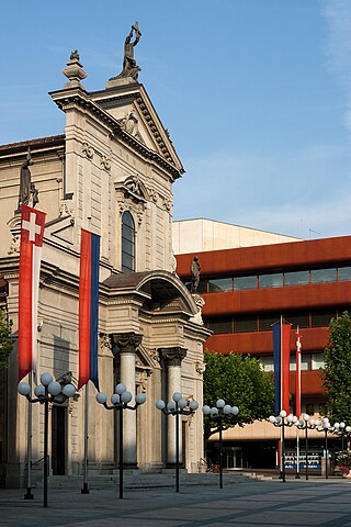
Chiasso is a municipality in the district of Mendrisio in the canton of Ticino in Switzerland.
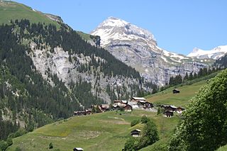
<span class="mw-page-title-main">Aadorf</span> Municipality in northern Switzerland

Aadorf is a municipality in the district of Münchwilen in the canton of Thurgau in Switzerland. In 1996 Ettenhausen, Guntershausen bei Aadorf, and Wittenwil merged into Aadorf.

<span class="mw-page-title-main">Gadmen</span> Former municipality in Bern, Switzerland

Gadmen is a small village and a former municipality in the Interlaken-Oberhasli administrative district in the canton of Bern in Switzerland.

<span class="mw-page-title-main">Braunau, Switzerland</span> Municipality in Thurgau, Switzerland

Braunau is a municipality in the district of Münchwilen in the canton of Thurgau in Switzerland.

<span class="mw-page-title-main">Eschlikon</span> Municipality in Thurgau, Switzerland

Eschlikon is a municipality in the district of Münchwilen in the canton of Thurgau in Switzerland.

Morbio Superiore was a municipality in the canton of Ticino in Switzerland in the hills above Chiasso. It is located in the district of Mendrisio. On 25 October 2009 the municipalities of Bruzella, Cabbio, Caneggio, Morbio Superiore, Muggio and Sagno merged into the municipality of Breggia.

Muggio was a municipality in the district of Mendrisio in the canton of Ticino in Switzerland. On 25 October 2009 the municipalities of Bruzella, Cabbio, Caneggio, Morbio Superiore, Muggio and Sagno merged into the municipality of Breggia.

Cabbio was a municipality in the district of Mendrisio in the canton of Ticino in Switzerland. On 25 October 2009. the municipalities of Bruzella, Cabbio, Caneggio, Morbio Superiore, Muggio, Sagno, and Breggia merged into the municipality of Breggia

Bruzella was a municipality in the district of Mendrisio in the canton of Ticino in Switzerland. On 25 October 2009 the municipalities of Bruzella, Cabbio, Caneggio, Morbio Superiore, Muggio and Sagno merged into the municipality of Breggia.

Caneggio is a former municipality in the district of Mendrisio in the canton of Ticino in Switzerland. On 25 October 2009 the municipalities of Bruzella, Cabbio, Caneggio, Morbio Superiore, Muggio, and Sagno merged into the municipality of Breggia

Sagno is a former municipality in the district of Mendrisio in the canton of Ticino in Switzerland; it is now part of the new municipality of Breggia. On 25 October 2009 the municipalities of Bruzella, Cabbio, Caneggio, Morbio Superiore, Muggio, Sagno merged into Breggia.

<span class="mw-page-title-main">Stabio</span> Municipality in Ticino, Switzerland

Stabio is a municipality in the district of Mendrisio in the canton of Ticino in Switzerland.

<span class="mw-page-title-main">Alto Malcantone</span> Municipality in Ticino, Switzerland

Alto Malcantone is a municipality in the district of Lugano in the canton of Ticino in Switzerland. It was formed on 13 March 2005 from the earlier municipalities of Arosio, Breno, Fescoggia, Mugena and Vezio.

<span class="mw-page-title-main">Vella</span> Former municipality in Graubünden, Switzerland

Vella is a village and a former municipality in the district of Surselva in the canton of Graubünden in Switzerland. The municipalities of Cumbel, Degen, Lumbrein, Morissen, Suraua, Vignogn, Vella, and Vrin merged on 1 January 2013 into the new municipality of Lumnezia.

<span class="mw-page-title-main">Bözberg</span> Municipality in Aargau, Switzerland

Bözberg is a municipality in the district of Brugg in canton of Aargau in Switzerland. It ceased to exist in 1873, when it was split into the two new municipalities Oberbözberg and Unterbözberg. On 1 January 2013 the former municipalities of Gallenkirch, Linn, Oberbözberg and Unterbözberg merged to form the new municipality of Bözberg.

<span class="mw-page-title-main">Gambarogno</span> Municipality in Ticino, Switzerland

Gambarogno is a municipality in the district of Locarno in the canton of Ticino in Switzerland. It was created on 25 April 2010 through the merger of the municipalities of Caviano, Contone, Gerra, Indemini, Magadino, Piazzogna, San Nazzaro, Sant'Abbondio and Vira.
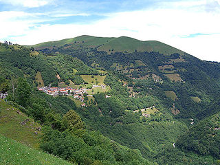
<span class="mw-page-title-main">Albula/Alvra</span> Municipality in Graubünden, Switzerland

Albula/Alvra is a municipality in the Albula Region in the canton of Graubünden in Switzerland. On 1 January 2015, the former municipalities of Alvaschein, Mon, Stierva, Tiefencastel, Alvaneu, Brienz/Brinzauls, and Surava merged to form the new municipality of Albula/Alvra.

<span class="mw-page-title-main">Tresa, Switzerland</span> Municipality in Ticino, Switzerland

Tresa is a municipality in the district of Lugano in the canton of Ticino in Switzerland. It was created on 18 April 2021 through the merger of Croglio, Monteggio, Ponte Tresa and Sessa.

References

  1. "Arealstatistik Standard - Gemeinden nach 4 Hauptbereichen". Federal Statistical Office. Retrieved 13 January 2019.
  2. "Ständige Wohnbevölkerung nach Staatsangehörigkeitskategorie Geschlecht und Gemeinde; Provisorische Jahresergebnisse; 2018". Federal Statistical Office. 9 April 2019. Retrieved 11 April 2019.
  3. Amtliches Gemeindeverzeichnis der Schweiz, Mutationsmeldungen 2009 / Répertoire officiel des communes de Suisse, Mutations 2009 / Elenco ufficiale dei Comuni della Svizzera, Mutazione 2009 (PDF) (Report). Federal Statistical Office. 2009. 2772. Archived from the original (PDF) on 18 November 2010. Retrieved 6 March 2010.
  4. 1 2 3 Bruzella in German , French and Italian in the online Historical Dictionary of Switzerland .
  5. 1 2 3 4 Cabbio in German , French and Italian in the online Historical Dictionary of Switzerland .
  6. 1 2 3 4 5 Caneggio in German , French and Italian in the online Historical Dictionary of Switzerland .
  7. 1 2 3 4 5 Morbio Superiore in German , French and Italian in the online Historical Dictionary of Switzerland .
  8. 1 2 3 4 5 Muggio in German , French and Italian in the online Historical Dictionary of Switzerland .
  9. 1 2 3 4 5 Sagno in German , French and Italian in the online Historical Dictionary of Switzerland .
  10. Hikr.com description (in Italian)
  11. Seippel, Paul (1899). Die Schweiz im neunzehnten Jahrhundert. Schmid & Francke. p.  227 . Retrieved 31 January 2011.
  12. Breggia municipal website: Stemma Comunale
  13. Altitudine, superficie, secondo il genere di utilizzazione, rilevazione 1992/1997, e densità della popolazione, nel 2000 (in Italian) accessed 25 October 2010
  14. Federal Statistical Office STAT-TAB Bevölkerungsentwicklung nach Region, 1850-2000 Archived March 17, 2012, at the Wayback Machine (in German) accessed 29 January 2011
  15. Statistical Atlas of Switzerland accessed 5 April 2016
  16. "Temperature and Precipitation Average Values-Table, 1961-1990" (in German, French, and Italian). Federal Office of Meteorology and Climatology - MeteoSwiss. Retrieved 8 May 2009., the weather station elevation is 620 meters above sea level.
  17. "Temperature and Precipitation Average Values-Table, 1981-2010" (in German, French, and Italian). Federal Office of Meteorology and Climatology - MeteoSwiss. Retrieved 27 April 2016., the weather station elevation is 440 meters above sea level.