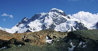
The Breithorn is a mountain range of the Pennine Alps with its highest peak of the same name, located on the border between Switzerland and Italy. It lies on the main chain of the Alps, approximately halfway between the Matterhorn and Monte Rosa and east of the Theodul Pass. Most of the massif is glaciated and includes several subsidiary peaks, all located east of the main summit: the Central Breithorn, the western Breithorn Twin, the Gendarm and the Roccia Nera. The main summit is sometimes distinguished by the name Western Breithorn. The nearest settlements are Zermatt (Valais) and St-Jacques.

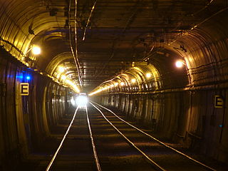
The Twin Peaks Tunnel is a 2.27-mile-long (3.65 km) light rail/streetcar tunnel in San Francisco, California. The tunnel runs under Twin Peaks and is used by the K Ingleside, L Taraval, M Ocean View and S Shuttle lines of the Muni Metro system.

The Klein Matterhorn is a peak of the Pennine Alps, overlooking Zermatt in the Swiss canton of Valais. At 3,883 metres (12,740 ft) above sea level, it is the highest place in Europe that can be reached by aerial tramway or gondola lift, as well as by any other means of transport. The Klein Matterhorn is part of the Breithorn massif and overlooks on its south side the almost equally high flat glacier named Breithorn Plateau, just north of the international border with Italy. The name "Klein Matterhorn" is a reference to its much larger neighbour, the Matterhorn, which lies 7 km (4.3 mi) away across the Theodul Pass.

Monte Rosa is a mountain massif in the eastern part of the Pennine Alps, on the border between Italy and Switzerland (Valais). The highest peak of the massif, amongst several peaks of over 4,000 m (13,000 ft), is the Dufourspitze, the second highest mountain in the Alps and western Europe, after Mont Blanc. The east face of the Monte Rosa towards Italy has a height of about 2,400 metres (7,900 ft) and is the highest mountain wall of the Alps.
The Breithorn is a mountain located in the Pennine Alps on the border between Switzerland (Valais) and Italy.

Lyskamm, also known as Silberbast, is a mountain in the Pennine Alps lying on the border between Switzerland and Italy. It consists of a five-kilometre-long ridge with two distinct peaks. The mountain has gained a reputation for seriousness because of the many cornices lying on the ridge and the frequent avalanches, thus leading to its nickname the Menschenfresser.

The Blüemlisalp is a massif of the Bernese Alps, in the territory of the municipalities of Kandersteg and Reichenbach im Kandertal.

Castor is a mountain in the Pennine Alps on the border between Valais, Switzerland and the Aosta Valley in Italy. It is the higher of a pair of twin peaks, the other being Pollux, named after the Gemini twins of Roman mythology. Castor's peak is at an elevation of 4,225 m (13,862 ft), and it lies between Breithorn and the Monte Rosa. It is separated from Pollux by a pass at 3,847 m (12,621 ft), named Passo di Verra in Italian and Zwillingsjoch in German.

The Central Breithorn is a peak of the Breithorn range in the Pennine Alps, located on the border between Switzerland and Italy, between the canton of Valais and the region of Aosta Valley. It is located east of the main summit of the Breithorn and west of the western Breithorn Twin.

The Eastern Breithorn but also referred as the western Breithorn Twin, is a peak of the Pennine Alps, located on the border between Switzerland and Italy, between the canton of Valais and the region of Aosta Valley. It is part of the Breithorn range, located east of the Theodul Pass. It lies between the Central Breithorn and its other twin, the Gendarm. On its north side it overlooks the Breithorn Glacier.
The Gendarm, but also known as eastern Breithorn Twin is a peak of the Pennine Alps, located on the border between Switzerland and Italy, between the canton of Valais and the region of Aosta Valley. It is part of the Breithorn range, located east of the Theodul Pass. It is located just east of its other twin, the western Breithorn Twin, and west of the Roccia Nera.

The Roccia Nera is a peak of the Breithorn range in the Pennine Alps, on the boundary between the Aosta Valley and canton of Valais. It is the easternmost summit of the Breithorn massif, located east of the Gendarm. It overlooks the Schwarztor pass on its east side.

The Breithorn, is a mountain of the Bernese Alps, located on the border between the Swiss cantons of Bern and Valais. It is part of the border between Lauterbrunnental and the Lötschental. It lies approximately halfway between the Tschingelhorn and the Grosshorn. The Rock-Tower of the Subpeak Kleines Breithorn is located south of the Main Peak.

The Breithorn is a mountain of the Bernese Alps, located east of Blatten in the canton of Valais. It lies between the Bietschhorn and the Schinhorn, on the range separating the Lötschental from the main Rhone valley (south). Its summit is the tripoint between the Lötschental and two other smaller valleys: the Baltschiedertal and the valley of the Beichgletscher.

The Breithorn is a mountain of the Swiss Lepontine Alps, overlooking Simplon in the canton of Valais. It is part of the Monte Leone massif.

Gobba di Rollin is a mountain of the Pennine Alps, straddling the border between Switzerland and Italy. It is located south of the Breithorn and it is largely covered by ice, the summit area being particularly flat. On the north side is the Breithorn Plateau of the Theodul Glacier, on the east side is the Verraz Glacier and on the south is the Glacier d'Aventine.

Theodul Pass, elevation 3,295 metres (10,810 ft), is a high mountain pass across the eastern Pennine Alps, connecting Zermatt in the Swiss canton of Valais and Breuil-Cervinia in the Italian region of Aosta Valley. Theodul Pass is the lowest and the easiest pass between the valleys of Zermatt and Valtournanche.

The Steinernes Meer is a high karst plateau in the Northern Limestone Alps. As one of the nine sub-ranges of the Berchtesgaden Alps the Steinernes Meer belongs partly to Bavaria and partly to Salzburg.

Ulrich Almer was a Swiss mountain guide. He made many premieres in the Alps, at the beginning with his father Christian Almer, one of the great guides of the golden age of mountaineering, and was one of the first Swiss guides to visit the Caucasus.


