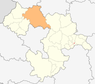
Svoge Municipality is located in western Bulgaria and is a part of Sofia Province. It covers a territory of 868,6 km2 and has a population of around 21,000 people, more than 1/3 of which lives in the town of Svoge itself. The municipality also includes 37 villages. The municipality is one of the largest by area in the country. It neighbours Montana Province, Vratsa Province & Sofia province.
Bukovets is a village in Svoge Municipality, Sofia Province, western Bulgaria.
Dobravitsa is a village in Svoge Municipality, Sofia Province, western Bulgaria.
Druzhevo is a village in Svoge Municipality, Sofia Province, western Bulgaria.
Elenov dol is a village in Svoge Municipality, Sofia Province, western Bulgaria.
Gabrovnitsa is a village in Svoge Municipality, Sofia Province, western Bulgaria.
Goubislav is a village in Svoge Municipality, Sofia Province, western Bulgaria.
Iskrets is a village in Svoge Municipality, Sofia Province, western Bulgaria.

Levishte is a village in Svoge Municipality, Sofia Province, western Bulgaria.
Manastirishte is a village in Svoge Municipality, Sofia Province, western Bulgaria.
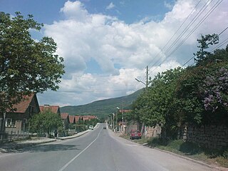
Milanovo is a village in Svoge Municipality, Sofia Province, western Bulgaria. It has a mayor office, a village square and a church. Milanovo is located above the village of Lakatnik and on the main road to the town of Varshets.
Opletnya is a village in Svoge Municipality, Sofia Province, western Bulgaria.

Tserovo is a village in Svoge Municipality, Sofia Province, western Bulgaria.
Zanoge is a village in Svoge Municipality, Sofia Province, western Bulgaria.

Zasele is a village in Svoge Municipality, Sofia Province, western Bulgaria.
Zimevitsa is a village in Svoge Municipality, Sofia Province, western Bulgaria.
Kamenik is a village in Boboshevo Municipality, Kyustendil Province, south-western Bulgaria.
Karpachevo is a village in Letnitsa Municipality, Lovech Province, northern Bulgaria.

Devetaki is a village in Lovech Municipality, Lovech Province, northern Bulgaria.

Dabova mahala is a village in Brusartsi Municipality, Montana Province, north-western Bulgaria.
