Sofia Province is a province (oblast) of Bulgaria. The province does not include Sofia in its territories, but Sofia remains its administrative center. The province borders on the provinces of Pernik, Kyustendil, Blagoevgrad, Pazardzhik, Plovdiv, Lovech, Vratsa, Montana, and "Sofia City Province", and borders with Serbia to the northwest.

Botevgrad is a town in western Bulgaria. It is located in Sofia Province and is close to Pravets. Botevgrad lies 47 km from Sofia.

The Yantra is a river in northern Bulgaria, a right tributary of the Danube. It is 285 km (177 mi) long, and has a watershed of 7,862 km2 (3,036 sq mi). Its average discharge at the mouth is 47 m3/s (1,700 cu ft/s).

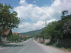
Svoge is a town in western Bulgaria, part of Sofia Province. It is located in the gorge of the Iskar River, at the place where the mountains Mala planina, Golema planina, and Ponor meet, 40 km north of the capital Sofia. Svoge is the main town of the Svoge Municipality which is one of the largest municipalities in Bulgaria and includes also 37 villages & the town of Svoge itself. By Decree No. 546 of the Presidium of the National Assembly on 7 September 1964 Svoge was declared as a city.

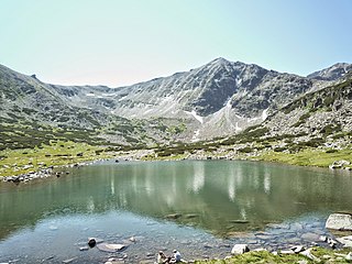
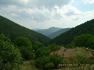
Leskovdol is a mountainous village in Western Bulgaria situated in Golema mountain, part of the Balkan mountain range. It is located 45 kilometers north from Sofia within Svoge Municipality. According to the 2021 census the settlment has 65 inhabitants. Several places of interest are located nearby Leskovdol with Seven Altars monastery, Izdremets peak and a section of the Kom–Emine long-distance footpath being the main ones.
Thompson is a village in central western Bulgaria, part of Svoge municipality, Sofia Province. As of 2008, it has a population of 838 and the mayor is Kiril Tsvetanov. Thompson lies at 42°56′N23°23′E, 729 metres above mean sea level.
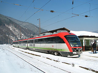
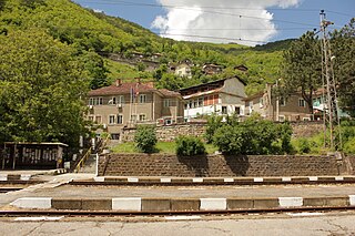
Lakatnik is a small village located in Svoge Municipality, near the Lakatnik rocks. The village has a train station called Gara Lakatnik on the train line Sofia - Mezdra located 8 km north of the village. During the years the train station turned into in a separate settlement.
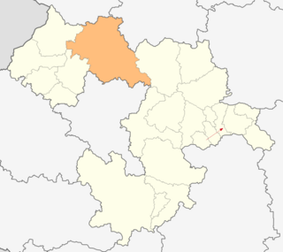
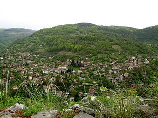
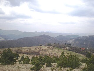
Svoge Municipality is located in western Bulgaria and is a part of Sofia Province. It covers a territory of 868,6 km2 and has a population of around 21,000 people, more than 1/3 of which lives in the town of Svoge itself. The municipality also includes 37 villages. The municipality is one of the largest by area in the country. It neighbours Montana Province, Vratsa Province & Sofia province.
Bov is a village in Svoge Municipality, Sofia Province, western Bulgaria. The village has a train station called Gara Bov on the train line Sofia - Mezdra located 2 km west of the village. During the years the train station turned into in a separate settlement.
Breze is a village in Svoge Municipality, Sofia Province, western Bulgaria.
Bukovets is a village in Svoge Municipality, Sofia Province, western Bulgaria.
Gara Bov is a village in Svoge Municipality, Sofia Province, western Bulgaria.
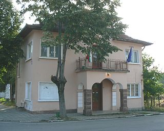
Milanovo is a village in Svoge Municipality, Sofia Province, western Bulgaria. It has a mayor office, a village square and a church. Milanovo is located above the village of Lakatnik and on the main road to the town of Varshets.
Opletnya is a village in Svoge Municipality, Sofia Province, western Bulgaria.
Rebrovo is a village in Svoge Municipality, Sofia Province, western Bulgaria.
Izvorska Planina is a mountain range in Kraishte region on the border of western Bulgaria and southeastern Serbia. Its highest summit is Plocha at 1,242 meters above sea level. It is part of the Milevska-Konyavska range.
Zavalska Planina is a mountain range in Pernik Province, western Bulgaria, forming the westernmost part of the Zavalska–Plana chain of the Srednogorie mountain range system.
The Sovolyanska Bistritsa is a river in western Bulgaria, a right tributary of the Struma. The river is situated in the southern reaches of the Kraishte geographical region and is 51 km long. It drains the northern slopes of the mountain ranges of Osogovo and Lisets, the southern slopes of the Chudinska planina, the whole Kamenitsa Valley and part of the Kyustendil Valley.

The Treklyanska reka is a river in western Bulgaria, a right tributary of the Struma. The river is situated in the Kraishte geographical region and is 50 km long. It drains the eastern slopes of the mountain ranges of Karvav Kamak, Milevska Planina and Kobilska Planina, the northern and eastern slopes of the Zemenska Planina, the western and southern slopes of the Penkyovska Planina and the western slopes of the Rudina Planina.
The Batuliyska reka is a 40 km-long river in western Bulgaria, a right tributary of the river Iskar.