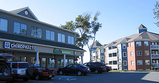
Bridgeview, Nova Scotia

Last updated

Bridgeview is a Residential subdivision, developed by B.D (Burnett David) Stevens in the 1960s. Located in the community of Rockingham on Mainland Halifax, just off the Bedford Highway, it is considered to be part of the Halifax Regional Municipality, Nova Scotia, and is found on the shore of the Bedford Basin in Halifax Harbour.

BD Stevens, known as one of the greatest church builders in Atlantic Canada, that inspired the writing of a book entitled “The Man Who Built Churches”, and a developer responsible for several subdivisions throughout Halifax, seemed to have a fondness for Bridgeview, having built homes for the majority of his adult children to live in this neighbourhood - Laurie Stevens (Marilyn), Jean Pierce (Arden), Audrey Keeping (Clyde), Elsie Lewis (Lou), and Shelia Munro (John).

“Birdland”, as it was affectionately called by its residents in the 1970s and 1980s, acquired this nickname as all of streets were named after birds - Flamingo Drive, Kingfisher Crescent, Dove Street, Canary Crescent, Nightingale Drive, Swan Crescent, Skylark Street, to name a few.

Flamingo Drive, the main road of the subdivision, is 1.54km in length and runs from the Bedford Highway winding its way up the hill to what used to be a dead end, a wooded area leading to a path commonly known as the “buggy trail”. This has since been developed and is now the Residential subdivision, Knightsridge, which connects Bridgeview subdivision to the Dunbruck Highway.

D.J. Butler Park, sometimes referred to as “Bridgeview Park”, is found at the top of Flamingo Drive. What once held a baseball field (home to the Bridgeview Pirates, a Sobeys sponsored little league baseball team), a tennis court, basketball court and playground, has since become a popular playground, basketball and tennis court.

In the 1970s and early 1980s, Bridgeview was also home to CJCH radio broadcaster and politician, Gerald “ Jer Bear” Lawrence.

33 and 31 Kingfisher Crescent, Bridgeview Nova Scotia 33 and 31 Kingfisher Crescent, early 1970s.jpg
33 and 31 Kingfisher Crescent, Bridgeview Nova Scotia

Related Research Articles

<span class="mw-page-title-main">North End, Halifax</span> Subdivision in Nova Scotia, Canada

The North End of Halifax is a neighbourhood of Halifax, Nova Scotia occupying the northern part of Halifax Peninsula immediately north of Downtown Halifax.

<span class="mw-page-title-main">Eastern Passage, Nova Scotia</span> Community in Nova Scotia, Canada

Eastern Passage is an unincorporated suburban community in Halifax Regional Municipality Nova Scotia, Canada.

Lakeview is a small residential community in the Halifax Regional Municipality that located approximately 20 minutes outside of Halifax Peninsula Nova Scotia. It consists of one street plus a small subdivision.

Highway 102 is a north–south highway in the Canadian province of Nova Scotia that runs from Halifax to Onslow, immediately north of the town of Truro. It is the busiest highway in Atlantic Canada.

<span class="mw-page-title-main">Cole Harbour, Nova Scotia</span> Community in Nova Scotia, Canada

Cole Harbour is a former village and current community located in Nova Scotia, Canada that is part of the Halifax Regional Municipality.

<span class="mw-page-title-main">Clayton Park, Nova Scotia</span> Community in Nova Scotia, Canada

Clayton Park is a community within Halifax, Nova Scotia, Canada.

<span class="mw-page-title-main">Manor Park, Nova Scotia</span> Neighbourhood in Halifax Regional Municipality, Nova Scotia, Canada

Manor Park is a neighbourhood of Dartmouth, Nova Scotia, Canada. The main entrance to the neighbourhood is from the east on Portland Street. A secondary entrance, from the west, is by way of Celtic Drive, rising from the low-lying area around Lake Banook.

Rockingham is a community located within the urban area of the Municipality of Halifax, in Nova Scotia, Canada.

<span class="mw-page-title-main">Conrose Park</span>

Conrose Park, also known as the Horsefield, is a Canadian urban park in Halifax, Nova Scotia in the western area of the Halifax Peninsula.

<span class="mw-page-title-main">Nova Scotia Trunk 1</span> Highway in Nova Scotia

Trunk 1 is part of the Canadian province of Nova Scotia's system of Trunk Highways.

Timberlea is a community located within the Municipality of Halifax in Nova Scotia, Canada.

<span class="mw-page-title-main">Fairview, Nova Scotia</span> Urban Community in Nova Scotia, Canada

Fairview is a community within the urban area of Halifax in Nova Scotia, Canada.

Burnside Drive is a four-lane divided roadway, with a speed limit of 80 km/h, that serves the Burnside Business Park in the Halifax Regional Municipality (HRM) community of Dartmouth, Nova Scotia. The road parallels Highway 118, running north from exit 3 of Highway 111 to Akerley Boulevard, a western extension of Highway 107. Although some maps produced by the province show Burnside Drive, as well as a portion of Akerley Boulevard, as part of Highway 107, these roads are actually maintained by the HRM, and Highway 107 becomes Akerley Boulevard about halfway between Highway 118 and Burnside Drive.

<span class="mw-page-title-main">Bayers Lake Business Park</span> Business area in Halifax, Nova Scotia

Bayers Lake Business Park is a business park in Halifax, Nova Scotia west of Clayton Park.

Russell Lake West is a planned residential subdivision and commercial development in the eastern part of the community of Dartmouth in the Halifax Regional Municipality, Nova Scotia. The area began construction in 2006 with the creation of Exit 8 on Highway 111, providing access from the southwest to the area via Mount Hope Avenue, which as of October 2011, Exit 8 also provides direct access into the Woodside Industrial Park. Russell Lake West is located next to the community of Woodside and a park and walking trails provide direct access to and from Woodside. The subdivision covers 251 ha, and houses approximately 3,200 people. and houses approximately 3,200 people.

Fernleigh, Nova Scotia is a residential subdivision in Fairview on Mainland Halifax within the Halifax Regional Municipality Nova Scotia on the shore of the Bedford Basin in Halifax Harbour.

Leiblin Park, Nova Scotia is a residential neighbourhood in Halifax on the Mainland Halifax within the Halifax Regional Municipality, Nova Scotia.

Forest Hills is a subdivision in the community of Cole Harbour and in the Canadian province of Nova Scotia, located in the Halifax Regional Municipality.

<span class="mw-page-title-main">Gorsebrook Park</span>

Gorsebrook Park is a 19-acre Canadian urban park located in the South End of Halifax, Nova Scotia.

References

Coordinates: 44°40′15″N63°39′18.9″W / 44.67083°N 63.655250°W / 44.67083; -63.655250