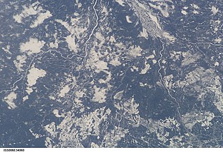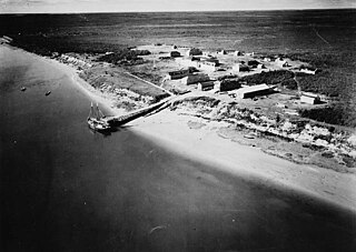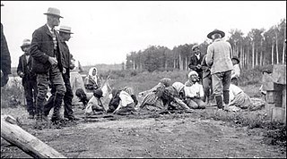
The Nelson River is a river of north-central North America, in the Canadian province of Manitoba. The river drains Lake Winnipeg and runs 644 kilometres (400 mi) before it ends in Hudson Bay. Its full length is 2,575 kilometres (1,600 mi), it has mean discharge of 2,370 cubic metres per second (84,000 cu ft/s), and has a drainage basin of 1,072,300 square kilometres (414,000 sq mi), of which 180,000 square kilometres (69,000 sq mi) is in the United States.

The Batchawana River is a river in Algoma and Sudbury Districts of Ontario, Canada, which empties into Batchawana Bay on Lake Superior north of Sault Ste. Marie, Ontario.

The English River is a river in Kenora District and Thunder Bay District in Northwestern Ontario, Canada. It flows through Lac Seul to join the Winnipeg River at Tetu Lake as a right tributary. The river is in the Hudson Bay drainage basin, is 615 kilometres (382 mi) long and has a drainage basin of 52,300 square kilometres (20,200 sq mi). There are several hydroelectric plants on this river.

The Kenogami River is a river in the James Bay drainage basin in Thunder Bay and Cochrane districts in Northern Ontario, Canada, which flows north from Long Lake near Longlac to empty into the Albany River. The river is 320 kilometres (199 mi) in length and its name means "long water" in the Cree language. A portion of the river's headwaters have been diverted into the Lake Superior drainage basin.

The Hayes River is a river in Northern Manitoba, Canada, that flows from Molson Lake to Hudson Bay at York Factory. It was historically an important river in the development of Canada and is now a Canadian Heritage River and the longest naturally flowing river in Manitoba.
The Shamattawa First Nation is a remote First Nations community in northern Manitoba, Canada, located in the reserve of Shamattawa 1.
The Berens River is a river in the provinces of Manitoba and Ontario, Canada. It flows west from an unnamed lake in Kenora District, Ontario, and discharges its waters into Lake Winnipeg near the community and First Nation of Berens River, Manitoba. The river has a number of lakes along its course, and many rapids.
The Sturgeon River is a river in the Hudson Bay drainage basin in Manitoba and Ontario, Canada. It flows west from its source in Unorganized Kenora District, Northwestern Ontario, through Sturgeon Lake, and takes in the right tributary Hayhurst River just before reaching its mouth at the Echoing River in Northern Region, Manitoba. The Echoing River flows via the Gods River and the Hayes River to Hudson Bay.
The Kabinakagami River is a river in Cochrane and Algoma Districts in northeastern Ontario, Canada. It is part of the James Bay drainage basin and is a right tributary of the Kenogami River.
The Whitefish River is a river in Census Division 21 in the Northern Region of Manitoba, Canada. It is in the Hudson Bay and Nelson River drainage basins and is a left tributary of the Saskatchewan River.

Mammamattawa is a dispersed rural community and unincorporated place in the Unorganized North Part of Cochrane District in northeastern Ontario, Canada. It is located at the mouth of the Kabinakagami River at the Kenogami River, just 2 kilometres (1.2 mi) downstream of the mouth of the Nagagami River at the Kenogami, in the James Bay drainage basin.
Weir River is a locality in Census division 23 in Northern Manitoba, Canada,. It lies on the eponymous Weir River.
The Weir River is a river in the Hudson Bay drainage basin in census division 23 in Northern Manitoba, Canada. Its flows from Weir Lake to the Nelson River as a left tributary, 70 kilometres (43 mi) upstream of that river's mouth at Hudson Bay.
The Owl River is a river in the Hudson Bay drainage basin in census division 23 in Northern Manitoba, Canada. It flows from Fly Lake to Hudson Bay.
O'Day is an unincorporated area and railway point in Census division 23 in Northern Manitoba, Canada.
The Black Duck River is a river in the provinces of Manitoba and Ontario, Canada. Flowing northeast from Hosea Lake in Kenora District in Northwestern Ontario, the river criss-crosses the Manitoba-Ontario border before reaching to its mouth at Hudson Bay in the Northern Region of Manitoba just west of Manitoba's easternmost point where the inter-provincial border meets the bay.

The Grass River is a historically important waterway in the Hudson Bay drainage basin in the Northern Region of Manitoba, Canada. It begins at the Cranberry Lakes approximately 27 kilometres (17 mi) east of Cranberry Portage and runs northeast 500 kilometres (310 mi) to its mouth on the Nelson River. The river was a critical route for earlier European explorers and was part of the "Upper Tract" of the fur trade into Canadian interior.
English River 66 is a First Nations reserve in Cochrane District, Ontario, Canada, located adjacent to the settlement of Mammamattawa and just downstream of the mouth of the Kabinakagami River at the Kenogami River. It is one of two reserves of the Constance Lake First Nation, and has an area of 3,108 hectares.
The Deer River is a river in Census division 23 in Northern Manitoba, Canada. It is in the Hudson Bay drainage basin and is a right tributary of the Dog River.
The Dog River is a river in Census division 23 in Northern Manitoba, Canada. It is in the Hudson Bay drainage basin and is a right tributary of the Churchill River.


