Related Research Articles

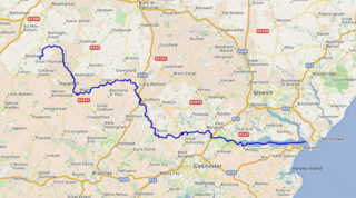
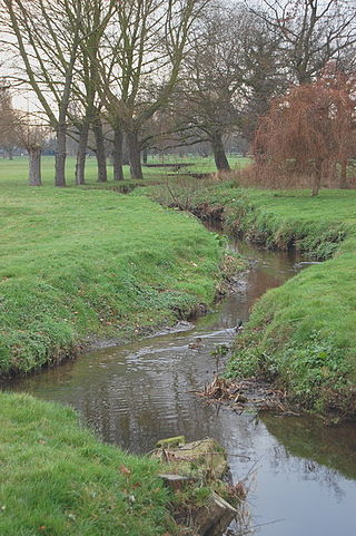
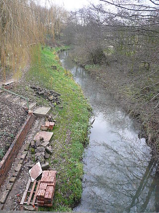
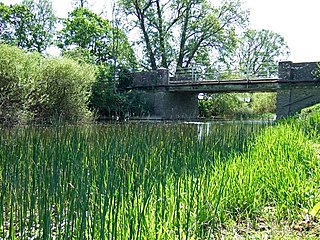
The River Stour is a river in Kent, England that flows into the North Sea at Pegwell Bay. Above Plucks Gutter, where the Little Stour joins it, the river is normally known as the Great Stour. The upper section of the river, above its confluence with the East Stour at Ashford is sometimes known as the Upper Great Stour or West Stour. In the tidal lower reaches, the artificial Stonar Cut short cuts a large loop in the natural river.

The River East Stour is one of the tributaries of the Great Stour in Kent. The East Stour, 10.3 miles (16.5 km) long,) rises on the Greensand ridge at Postling north of Hythe as a number of small streams. It then flows under the M20 motorway to continue in a westward direction: the river meanders across the Low Weald plain, passing Mersham on the way. The East Stour's confluence with the Great Stour is on both sides of Pledge's Mill at the foot of East Hill, Ashford.
The Little Stour is one of the tributaries of the River Stour in the English county of Kent. The upper reaches of the river is known as the Nailbourne, whilst the lower reaches were once known as the Seaton Navigation.
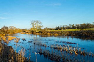
The River Stour is a major river in East Anglia, England. It is 47 miles (76 km) long and forms most of the county boundary between Suffolk to the north, and Essex to the south. It rises in eastern Cambridgeshire, passes to the east of Haverhill, through Cavendish, Sudbury, Bures, Nayland, Stratford St Mary and Dedham. It becomes tidal just before Manningtree in Essex and joins the North Sea at Harwich.

The River Goyt is a tributary of the River Mersey in North West England.
The River Stour is a 61 mi (98 km) river which flows through Wiltshire and Dorset in southern England, and drains into the English Channel. The catchment area for the river and its tributaries is listed as 480 square miles (1,240 km2).

The Stour(, rhymes with "flour") is a river flowing through the counties of Worcestershire, the West Midlands and Staffordshire in the West Midlands region of England. The Stour is a major tributary of the River Severn, and is about 25 miles (40 km) in length. It has played a considerable part in the economic history of the region.

The River Allen is a river in the county of Dorset in South West England. It flows for 14 miles (23 km) to its confluence with the River Stour immediately south of Wimborne Minster, between that town and the village of Oakley. It has two main tributaries, the Gussage Stream and the Crichel Stream.
Pyl Brook is a small stream in southwest London. It is a tributary of Beverley Brook, which is a tributary of the River Thames. Pyl Brook has two sources. The 5.3 kilometre main brook rises in Sutton Common in Sutton and flows through the London Borough of Merton to join Beverley Brook at Beverley Park in New Malden. The 3.9 kilometre East Pyl Brook also rises in Sutton and flows through Merton, joining the main Pyl east of Grand Drive in Raynes Park.

The River Dun is a tributary of the River Kennet, flowing through Wiltshire and Berkshire in England. Its main source is in the parish of Great Bedwyn, Wiltshire and it flows 16 kilometres (10 mi) in a northeasterly direction into Berkshire. It discharges into the Kennet at Hungerford, which has a smaller average flow and width upstream of that point.

The Aylesford Stream is a 5.4 kilometre long tributary of the East Stour, itself a tributary of the Great Stour in Kent. The stream's source is north of the M20, between Wye with Hinxhill and West Brabourne, and runs through Willesborough and then between Newtown and South Willesborough to join the East Stour just west of Ashford Designer Outlet.

Ruckinge Dyke is a tributary of the Great Stour, joining with the East Stour and then the Great Stour at Pledge's Mill at the bottom of East Hill in Ashford, Kent, England.
Whitewater Dyke is a tributary of the Great Stour river, joining with the East Stour and then the Great Stour at Pledge's Mill at the bottom of East Hill in Ashford, Kent, England.

Sarre Penn is a tributary of the River Stour in Kent, England, joining with the River Wantsum near Sarre, where it is known locally as the Fishbourne Stream.
Kennington Stream is a tributary of the Great Stour river in Ashford, Kent, England.
Whitehall Dyke is a tributary of the Great Stour river in Kent, England.
The River Roach is a river that flows entirely through the English county of Essex. It is one of four main streams that originate in the Rayleigh Hills to the west, and flow east. They then flow towards the centre of the Rochford Basin, a circular feature which may have been caused by an asteroid impact in the Late Oligocene or Early Miocene periods. To the east of Rochford, the river becomes tidal, and is governed by the Crouch Harbour Authority. It joins the River Crouch between Wallasea Island and Foulness Island. To the west of Rochford, there is some doubt as to which of the four streams is officially the Roach.
The River Doe Lea is a river which flows near Glapwell and Doe Lea in Derbyshire, England. The river eventually joins the River Rother near Renishaw. The river contained 1,000 times the safe level of dioxins in 1991, according to a statement made by Dennis Skinner, (MP) in the House of Commons in 1992. The river flows through the site of the former Coalite plant near Bolsover, where coke, tar and industrial chemicals were manufactured until the plant closed in 2004.
The Smestow Brook, sometimes called the River Smestow, is a small river that plays an important part in the drainage of Wolverhampton, South Staffordshire, and parts of Dudley in the United Kingdom, and has contributed to the industrial development of the Black Country. It is the most important tributary of the River Stour, Worcestershire and part of the River Severn catchment.
The River Lydden is a 15.25 miles (24.55 km) tributary of the River Stour that flows through Blackmore Vale in Dorset, England.
References
- ↑ "The Stour Catchment Abstraction Management Strategy" (PDF). The Environment Agency. May 2003. Archived from the original (PDF) on 17 February 2006.
- ↑ The Environment Agency Archived 16 March 2007 at the Wayback Machine The Stour CFMP Scoping Report - March 2005
| | This Kent location article is a stub. You can help Wikipedia by expanding it. |