Brooks Township, Michigan

Last updated

Brooks Township, Michigan
USA Michigan location map.svg
Red pog.svg
Brooks Township, Michigan
Location within the state of Michigan
Usa edcp location map.svg
Red pog.svg
Brooks Township, Michigan
Brooks Township, Michigan (the United States)
Coordinates: 43°25′35″N85°45′11″W / 43.42639°N 85.75306°W / 43.42639; -85.75306
Country United States
State Michigan
County Newaygo
Area
  Total34.1 sq mi (88.2 km2)
  Land31.8 sq mi (82.2 km2)
  Water2.3 sq mi (6.0 km2)
Elevation
653 ft (199 m)
Population
 (2000)
  Total3,671
  Density115.6/sq mi (44.6/km2)
Time zone UTC-5 (Eastern (EST))
  Summer (DST) UTC-4 (EDT)
FIPS code 26-11060 [1]
GNIS feature ID1625989 [2]

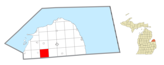
Brooks Township is a civil township of Newaygo County in the U.S. state of Michigan. As of the 2000 census, the township population was 3,671.

Contents

Communities

Geography

According to the United States Census Bureau, the township has a total area of 34.0 square miles (88 km2), of which 31.8 square miles (82 km2) is land and 2.3 square miles (6.0 km2) (6.75%) is water.

Demographics

As of the census [1] of 2000, there were 3,671 people, 1,441 households, and 1,050 families residing in the township. The population density was 115.6 inhabitants per square mile (44.6/km2). There were 1,978 housing units at an average density of 62.3 per square mile (24.1/km2). The racial makeup of the township was 96.21% White, 0.19% African American, 0.46% Native American, 0.27% Asian, 0.03% Pacific Islander, 1.72% from other races, and 1.12% from two or more races. Hispanic or Latino of any race were 3.60% of the population.

There were 1,441 households, out of which 32.8% had children under the age of 18 living with them, 61.3% were married couples living together, 6.8% had a female householder with no husband present, and 27.1% were non-families. 22.8% of all households were made up of individuals, and 7.8% had someone living alone who was 65 years of age or older. The average household size was 2.54 and the average family size was 2.99.

In the township the population was spread out, with 27.1% under the age of 18, 5.4% from 18 to 24, 27.2% from 25 to 44, 26.3% from 45 to 64, and 14.1% who were 65 years of age or older. The median age was 39 years. For every 100 females, there were 102.4 males. For every 100 females age 18 and over, there were 103.1 males.

The median income for a household in the township was $42,434, and the median income for a family was $50,440. Males had a median income of $40,882 versus $27,073 for females. The per capita income for the township was $19,088. About 9.6% of families and 11.1% of the population were below the poverty line, including 13.4% of those under age 18 and 9.4% of those age 65 or over.

Related Research Articles

<span class="mw-page-title-main">Merritt Township, Michigan</span> Civil township in Michigan, United States

Merritt Township is a civil township of Bay County in the U.S. state of Michigan. The township's population was 1,441 as of the 2010 census. It is included in the Bay City Metropolitan Statistical Area.
<span class="mw-page-title-main">Grant Township, Huron County, Michigan</span> Civil township in Michigan, United States

Grant Township is a civil township of Huron County in the U.S. state of Michigan. As of the 2000 census, the township population was 833.

Berlin Township is a civil township of Ionia County in the U.S. state of Michigan. As of the 2000 census, the township population was 2,787.

Easton Township is a civil township of Ionia County in the U.S. state of Michigan. The population was 2,835 at the 2000 census.

Ionia Township is a civil township of Ionia County in the U.S. state of Michigan. The population was 3,669 at the 2000 census. The city of Ionia is mostly within the township, but is administratively autonomous.

<span class="mw-page-title-main">Keene Township, Michigan</span> Township in Michigan, United States

Keene Township is a civil township of Ionia County in the U.S. state of Michigan. The population was 1,660 at the 2000 census.

Orange Township is a civil township of Ionia County in the U.S. state of Michigan. The population was 1,040 at the 2000 census.

Portland Township is a civil township of Ionia County in the U.S. state of Michigan. The population was 2,460 at the 2000 census. The City of Portland is situated in the south central portion of the township, but is administratively autonomous.

<span class="mw-page-title-main">Rollin Township, Michigan</span> Civil township in Michigan, United States

Rollin Township is a civil township of Lenawee County in the U.S. state of Michigan. The population was 3,176 at the 2000 census.

Ashland Township is a civil township of Newaygo County in the U.S. state of Michigan. As of the 2020 census, the township population was 2,764. The city of Grant is adjacent to the township. The township was established in 1854.

Greenwood Township is a civil township of Oceana County in the U.S. state of Michigan. As of the 2000 census, the township population was 1,154.

<span class="mw-page-title-main">Georgetown Township, Michigan</span> Charter township in Michigan, United States

Georgetown Charter Township is a charter township of Ottawa County in the U.S. state of Michigan. The population was 46,985 at the time of the 2010 census. The city of Hudsonville is adjacent to the township and the unincorporated community of Jenison is within the township, which includes about half the township's population.

<span class="mw-page-title-main">Freeland, Michigan</span> Census-designated place & unincorporated community in Michigan, United States

Freeland is a census-designated place in Tittabawassee Township, Saginaw County in the U.S. state of Michigan. It is part of the Saginaw-Midland-Bay Metropolitan Area. As of the 2000 census, the CDP population was 5,147. The CDP covers an area in the central portion of Tittabawassee Township. The Freeland post office, ZIP code 48623, serves nearly the entire township, as well as portions of Midland and Williams townships to the north, Frankenlust and Kochville townships to the east, Thomas and Richland townships to the south, and Ingersoll Township to the west.

Fremont Township is a civil township of Sanilac County in the U.S. state of Michigan. As of the 2000 census, the township population was 913.

Wheatland Township is a civil township of Sanilac County in the U.S. state of Michigan. The population was 416 at the 2020 census.

Sherman Township is a civil township of St. Joseph County in the U.S. state of Michigan, located just north of Sturgis. The population was 3,248 at the 2000 census.

<span class="mw-page-title-main">Hamilton Township, Van Buren County, Michigan</span> Township in Michigan, United States

Hamilton Township is a civil township of Van Buren County in the U.S. state of Michigan. As of the 2000 census, the township population was 1,797.

<span class="mw-page-title-main">Waverly Township, Van Buren County, Michigan</span> Township in Michigan, United States

Waverly Township is a civil township of Van Buren County in the U.S. state of Michigan. The population was 2,554 at the 2010 census. Waverly Township was established in 1842.

Leonidas Township is a civil township of St. Joseph County in the U.S. state of Michigan. The population was 1,239 at the 2000 census.

Lockport Township is a civil township of St. Joseph County in the U.S. state of Michigan. The population was 3,814 at the 2000 census.

References

Notes

  1. 1 2 "U.S. Census website". United States Census Bureau . Retrieved January 31, 2008.
  2. U.S. Geological Survey Geographic Names Information System: Brooks Township, Michigan
  3. Romig 1986, p. 81.

Sources