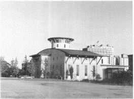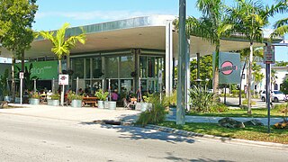
Boardman Township is one of the fourteen townships of Mahoning County, Ohio, United States. A suburb directly south of Youngstown, Boardman is one of two major retail hubs in the Mahoning Valley, the other being Niles. The 2020 census found 40,213 people in the township. Large portions of the township constitute the census-designated place of Boardman, designated by the US Census Bureau, although they are not contiguous.

Struthers is a city in Mahoning County, Ohio, United States. The population was 10,713 at the 2010 census. It is part of the Youngstown-Warren-Boardman, OH-PA Metropolitan Statistical Area.

Youngstown is a city in the U.S. state of Ohio, and the largest city and county seat of Mahoning County. According to the 2020 United States Census, Youngstown had a city population of 60,068. The Youngstown-Warren-Boardman, OH-PA Metropolitan Statistical Area, with a population of 541,243 is the 107th-largest metropolitan area in the United States.

Delridge is a district in West Seattle, Washington, United States that stretches along Delridge Way, an arterial that follows the eastern slope of the valley of Longfellow Creek, from near its source just within the southern city limits north to the West Seattle Bridge over the Duwamish River.

East Side is one of the 77 official community areas of Chicago, Illinois. It is on the far south side of the city, between the Calumet River and the Illinois-Indiana state line, 13 miles (21 km) south of downtown Chicago. The neighborhood has a park on Lake Michigan, Calumet Park, and a forest, Eggers Grove Forest Preserve. The forest preserve has hiking/walking trails, picnic grounds and birdwatching. It is served by U.S. Highway 12, U.S. Highway 20, and U.S. Highway 41.

The Youngstown Historical Center of Industry and Labor, located in Youngstown, Ohio, preserves the history of the steel industry that dominated the Youngstown area's economic life for much of the 20th century. The museum is owned by the Ohio History Connection and operated by Youngstown State University. The facility, which was designed by noted architect Michael Graves, is reminiscent of a steel mill, complete with stylized smoke stacks.
Brier Hill is a neighborhood in Youngstown, Ohio, that was once viewed as the city's "Little Italy" district. The neighborhood, which was the site of the city's first Italian settlement, stretches along the western edge of Youngstown's lower north side and encircles St. Anthony's Church, an Italian-American Roman Catholic parish. Each year, at the end of August, the Brier Hill Fest attracts thousands of visitors from Northeast Ohio and Western Pennsylvania.
Smoky Hollow is a neighborhood in Youngstown, Ohio. Located northeast of Youngstown's downtown, Smoky Hollow is now part of the campus of Youngstown State University. The district has long been in a state of decline, but plans are now underway to transform Smoky Hollow into a large field built to serve the University.

The Youngstown Iron Sheet and Tube Company, based in Youngstown, Ohio, was an American steel manufacturer. Officially, the company was created on November 23, 1900, when Articles of Incorporation of the Youngstown Iron Sheet and Tube Company were filed with the Ohio Secretary of State at Columbus. It acquired the Mark Manufacturing Company in 1923. Youngstown Sheet and Tube remained in business until 1977. A Youngstown resident acquired the name, trademark, and logo in 2014 and opened a small business promoting the economic redevelopment of Youngstown.

North Heights is a neighborhood in Youngstown, Ohio, located on the city's upper North Side. The neighborhood's name derives from the fact that it sits at a higher elevation than the Wick Park District, Youngstown State University, and Downtown Youngstown. The neighborhood is bordered on the north by Liberty Township, with Gypsy Lane marking the city limit ; Belmont Avenue to the west; Redondo Road and Crandall Park to the south; and Fifth Avenue to the east.

Hazelton is a neighborhood in Youngstown, Ohio, located on the city's east side. It is bordered by the cities of Struthers and Campbell. In the early 20th century, the neighborhood was alternately referred to as "the East End".
Fosterville is a neighborhood in Youngstown, Ohio, that is located on the south-southwestern side of the city. In the course of a recent revitalization effort, called "Youngstown 2010", the original Fosterville neighborhood has been subdivided into two distinct neighborhood areas: Idora and Warren.

The Youngstown–Warren–Boardman, OH–PA Metropolitan Statistical Area, typically known as the Mahoning Valley or the Steel Valley, is a metropolitan area in Northeast Ohio and Western Pennsylvania the United States, with the city of Youngstown, Ohio, at its center. According to the US Census Bureau, the metropolitan statistical area (MSA) includes Mahoning and Trumbull counties in Ohio and Mercer County in Pennsylvania. As of the 2020 census, the metro area had a population of 541,243. This area has a large commuter population that works in Cleveland and Pittsburgh and their metropolitan areas. It is located in the Rust Belt, a region which stretches from Minneapolis in the west to Scranton in the east.

The Upper Eastside is a neighborhood in Miami, Florida, United States. It is north of Edgewater, east of Little Haiti, south of the village of Miami Shores, and sits on Biscayne Bay. In geographical order from south to north and east to west, it contains the subdivisions of Magnolia Park, Bay Point, Morningside, Bayside, Belle Meade, Shorecrest, and Palm Grove. The MiMo District along Biscayne Boulevard in the area is host to many art galleries, shops and restaurants.

Westwood is an urban-suburban neighborhood of Cincinnati, Ohio. It is located north of Price Hill, west of Fairmount, and southwest of Mount Airy.
Ottawa is a neighborhood in west central Toledo, Ohio, bordered by Secor Road to the West, Dorr Street to the South, Central Ave. to the North, and Upton and Monroe to the East and North. It derives its name from the Ottawa Indians that settled in the area in the early 18th century, as well as Ottawa Park, a prominent recreational area located within the community.

North Avondale is an economically diverse neighborhood in Cincinnati, Ohio. It is home to Xavier University and the Avon Woods Preserve. The population was 3,229 at the 2010 census.

The economy of Youngstown, Ohio, flourished in the 19th and early 20th centuries, with steel production reaching all-time highs at that time. The steel boom led to an influx of immigrants to the area looking for work, as well as construction of skyscrapers in the area. The city's population peaked at 170,002 in 1930, just at the onset of the Great Depression. World War II also brought a great demand for steel. After World War II, demand for steel dropped off dramatically, and industrial base of Youngstown began to see a decline.

Newport Village Historic District is a neighborhood in Boardman, Ohio. The neighborhood is bordered by the City of Youngstown, Ohio to the north and east, Glenwood Avenue to the west, and Forest Glen Estates Historic District to the south. Newport Village is known for its quaint tree-lined residential streets and early twentieth century Tudor revival and colonial revival architecture.

Nebo is a neighborhood in Struthers, Ohio. It is located on the east end of the city, south of the Mahoning River. The district historically contained a significant Slavic American population.


