Bulls Ferry

Last updated
Palisades Medical Center Palisades Med Center jeh.JPG
Palisades Medical Center
Bull's Ferry Road travels from Boulevard East atop the cliffs to the waterfront. 10.2.09BullsFerryRoadByLuigiNovi.jpg
Bull's Ferry Road travels from Boulevard East atop the cliffs to the waterfront.

Bulls Ferry (also Bull's Ferry) is an area along the Hudson River, just north of Weehawken Port Imperial in the towns of West New York, Guttenberg and North Bergen in New Jersey. It takes its name from a pre-Revolutionary settlement belonging to the Bull family, who operated a row-and-sail ferry to the burgeoning city of New York across the river.[ citation needed ]

During the Revolutionary War, the British built and occupied a blockhouse in the area of Bull's Ferry, an area known to the British as Block House Point. This fort was the site of several skirmishes between the British and American forces. [1] [2] [3] [4] Brigadier General Anthony Wayne led American troops from New Bridge on a raid against the blockhouse on July 20, 1780, in the Battle of Bull's Ferry. [5] [6] After the raid, the blockhouse was abandoned when British troops decamped to the fort at Bergen Neck. [7]

Like Burdett's Landing to the north, Bull's Ferry was a crucial crossing point well into the 19th century. Ferry service continued for several decades until steam ferries, notably from Hoboken, replaced the earlier, brute-force rowing service. Larger terminals to the north at Edgewater and south at the West Shore Railroad Terminal operated until the 1950s. Modern ferries still commute to Manhattan out of Port Imperial in Weehawken, Hoboken and Paulus Hook in Jersey City (as well as Sandy Hook on the Jersey shore).[ citation needed ]

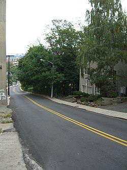
A number of roads ran down the Hudson Palisades to the ferry slip. Bull's Ferry Road was the original name of Park Avenue and Woodcliff Avenues up on the palisades in North Hudson, [8] [9] and is still used for a street winding around the Stonehenge Tower and descending from Boulevard East to River Road in North Bergen. [10] Another, simply called Ferry Road, passes under the Galaxy Towers which overlook the neighborhood. The slip itself was close to the part of Edgewater once known as Shadyside. [11]

Since the 1980s, previous industrial and maritime uses of the area at the foot of the Palisades have given way to residential, institutional and recreational development, including the Palisades Medical Center [12] and the Hudson River Waterfront Walkway. The district's major thoroughfare is commonly known as River Road, which is served by New Jersey Transit routes 158 and 188 and NY Waterway buses, with connecting service to Weehawken Port Imperial.[ citation needed ]

In April 2011, Guttenberg, and North Bergen agreed to jointly build a park south of Palisades Medical Center, which would include a waterfront promenade. [13] The Hudson River Waterfront Walkway is an esplanade along the water's edge from Bayonne to Fort Lee. [14]

See also

Related Research Articles

<span class="mw-page-title-main">North Bergen, New Jersey</span> Township in Hudson County, New Jersey, United States

North Bergen is a township in the northern part of Hudson County, in the U.S. state of New Jersey. As of the 2020 United States census, the township's population was 63,361, an increase of 2,588 (+4.3%) from the 2010 census count of 60,773, which in turn reflected an increase of 2,681 (+4.6%) from the 58,092 counted in the 2000 census. The township was incorporated in 1843. It was much diminished in territory by a series of secessions. Situated on the Hudson Palisades, it is one of the hilliest municipalities in the United States. Like neighboring North Hudson communities, North Bergen is among those places in the nation with the highest population density and a majority Hispanic population.

<span class="mw-page-title-main">Timeline of Jersey City, New Jersey-area railroads</span>

For the purposes of this article, the Jersey City area extends North to Edgewater, South to Bayonne and includes Kearny Junction and Harrison but not Newark. Many routes east of Newark are listed here.

Paterson Plank Road is a road that runs through Passaic, Bergen and Hudson Counties in northeastern New Jersey. The route, originally laid in the colonial era, connects the city of Paterson and the Hudson River waterfront. It has largely been superseded by Route 3, but in the many towns it passes it has remained an important local thoroughfare, and in some cases been renamed.

<span class="mw-page-title-main">County Route 505 (New Jersey)</span>

County Route 505 is a county highway in the U.S. state of New Jersey. The highway extends 20.64 miles from John F. Kennedy Boulevard in Union City to the New York state line in Northvale.

<span class="mw-page-title-main">Hackensack Plank Road</span>

The Hackensack Plank Road, also known as Bergen Turnpike, was a major artery which connected the cities of Hoboken and Hackensack, New Jersey. Like its cousin routes, the Newark Plank Road and Paterson Plank Road, it travelled over Bergen Hill and across the Hackensack Meadows from the Hudson River waterfront to the city for which it was named. It was originally built as a colonial turnpike road as Hackensack and Hoboken Turnpike. The route mostly still exists today, though some segments are now called the Bergen Turnpike. It was during the 19th century that plank roads were developed, often by private companies which charged a toll. As the name suggests, wooden boards were laid on a roadbed in order to prevent horse-drawn carriages and wagons from sinking into softer ground on the portions of the road that passed through wetlands. The company that built the road received its charter on November 30, 1802. The road followed the route road from Hackensack to Communipaw that was described in 1679 as a "fine broad wagon-road."

<span class="mw-page-title-main">Bergen Hill</span> Lower part of the Hudson Palisades, New Jersey, United States

Bergen Hill refers to the lower Hudson Palisades in New Jersey, where they emerge on Bergen Neck, which in turn is the peninsula between the Hackensack and Hudson Rivers, and their bays. In Hudson County, it reaches a height of 260 feet.

<span class="mw-page-title-main">Hudson River Waterfront Walkway</span> Park in the United States of America

The Hudson River Waterfront Walkway, also known as the Hudson River Walkway, is a promenade along the Hudson Waterfront in New Jersey. The ongoing and incomplete project located on Kill van Kull and the western shore of Upper New York Bay and the Hudson River was implemented as part of a New Jersey state-mandated master plan to connect the municipalities from the Bayonne Bridge to the George Washington Bridge with an urban linear park and provide contiguous unhindered access to the water's edge.

<span class="mw-page-title-main">North Hudson, New Jersey</span>

North Hudson is the area in the northern part of Hudson County, New Jersey, situated on the west bank of the Hudson River, mostly atop the Hudson Palisades. It comprises Weehawken, Union City, West New York, Guttenberg, and North Bergen.

<span class="mw-page-title-main">Weehawken Terminal</span> Former intermodal terminal in Weehawken, New Jersey

Weehawken Terminal was the waterfront intermodal terminal on the North River in Weehawken, New Jersey for the New York Central Railroad's West Shore Railroad division, whose route traveled along the west shore of the Hudson River. It opened in 1884 and closed in 1959. The complex contained five ferry slips, sixteen passenger train tracks, car float facilities, and extensive yards. The facility was also used by the New York, Ontario and Western Railway. The terminal was one of five passenger railroad terminals that lined the Hudson Waterfront during the 19th and 20th centuries; the others were located at Hoboken, Pavonia, Exchange Place and Communipaw, with Hoboken being the only one still in use.

<span class="mw-page-title-main">Hudson Waterfront</span> Place in Hudson and Bergen

The Hudson Waterfront is an urban area of northeastern New Jersey along the lower reaches of the Hudson River, the Upper New York Bay and the Kill van Kull. Though the term can specifically mean the shoreline, it is often used to mean the contiguous urban area between the Bayonne Bridge and the George Washington Bridge that is approximately 19 miles (31 km) long. Historically, the region has been known as Bergen Neck, the lower peninsula, and Bergen Hill, lower Hudson Palisades. It has sometimes been called the Gold Coast.

<span class="mw-page-title-main">Woodcliff, North Bergen</span>

Woodcliff is a neighborhood in northeastern North Bergen, New Jersey. The center of area is a large Hudson County park known as North Hudson Park, which refers to the collective name of the municipalities in northern part of the county, and is officially named for James J. Braddock, an American boxer who was a resident the township.

<span class="mw-page-title-main">Shadyside, Edgewater</span>

Shadyside is the southernmost neighborhood of Edgewater, New Jersey that overlaps the waterfront of neighboring North Bergen, New Jersey. It likely takes its name from the fact that its position on the west bank of the Hudson River is sometimes in the shadow of the Hudson Palisades. It lies north of the neighborhood Bulls Ferry, a major river crossing of the period. Shadyside was developed in the late 19th century as a manufacturing village, and railroad terminal for New York, Susquehanna and Western Railway at the end of the Edgewater Tunnel, and site of a major explosion at a glucose plant in 1906. North of this are the neighborhoods of Sunnyside, Undercliff, and Burdett's Landing . The Public Service Railway operated streetcar lines from the Edgewater Ferry Terminal.

<span class="mw-page-title-main">Pershing Road (Weehawken)</span>

Pershing Road is a road located entirely in Weehawken, New Jersey that travels for 0.42 miles (0.68 km) on the Hudson Palisades between Boulevard East and Weehawken Port Imperial, and carries the designation Hudson County Route 682. At County Route 505, the road meets 48th Street, one of the very few two-way streets in the urban grid of North Hudson, which travels west to Bergenline Avenue and Kennedy Boulevard. It is named for World War I hero John J. Pershing. Earlier names have included Clifton Road, named for the estate on whose land it was located, and Hillside Road, which would speak to its location.

<span class="mw-page-title-main">Boulevard East</span> County road in New Jersey, U.S.

Boulevard East is a two-way, mostly two lane, scenic county road in the North Hudson, New Jersey municipalities of Weehawken, West New York, Guttenberg and North Bergen. Apart from small sections at either end, the road runs along the crest of the Hudson Palisades, affording it views of the Hudson River and the New York City skyline. Developed at the turn of the 20th century, the residential road is characterized by an eclectic mix of 20th-century architecture, including private homes as well as mid and high-rise apartment buildings, mostly on its western side, with a promenade and parks along its eastern side. It is also the setting for Edward Hopper's 1934 painting East Wind Over Weehawken, which is considered one of his best works.

<span class="mw-page-title-main">North Hudson County Railway</span>

The North Hudson Railway Company built and operated a streetcar system in Hudson County and southeast Bergen County, New Jersey before and after the start of the 20th century. It was founded by Hillric J. Bonn who became the first President in 1865 and served for 26 years until his death, and eventually taken over by the Public Service Railway. In its endeavors to overcome the formidable obstacle of ascending the lower Hudson Palisades, or Bergen Hill, it devised numerous innovative engineering solutions including funicular wagon lifts, an inclined elevated railway, an elevator and viaducts.

<span class="mw-page-title-main">Palisade Avenue (Hudson Palisades)</span>

Palisade Avenue is the name given to a historic road which parallels the eastern crest of Hudson Palisades in northeastern New Jersey. It travels between Jersey City and Fort Lee, passing through Jersey City Heights, North Hudson, and Cliffside Park, with various parts carrying Hudson and Bergen county route designations. The avenue re-aligns itself at several places along its route as it crosses traditional municipal boundaries created in the 19th century. As a primary route running along the top of the Hudson Palisades, many segments offer scenic views of the Hudson River and the New York skyline.

<span class="mw-page-title-main">Port Imperial</span>

Port Imperial is an intermodal transit hub on the Weehawken, New Jersey, waterfront of the Hudson River across from Midtown Manhattan, served by New York Waterway ferries and buses, Hudson–Bergen Light Rail, and NJT buses. The district lies under and at the foot of Pershing Road, a thoroughfare traveling along the face of the Hudson Palisades, which rise to its west. The Hudson River Waterfront Walkway runs along the shoreline and is abutted by recently constructed residential neighborhoods, Lincoln Harbor to the south and Bulls Ferry to the north.

<span class="mw-page-title-main">Edgewater Branch</span>

The Edgewater Branch was a branch of the New York, Susquehanna and Western Railway (NYS&W) that ran about 3.174 miles (5.108 km) through eastern Bergen County, New Jersey in the United States. Starting from a rail junction at the Little Ferry Yard, it went east through the Edgewater Tunnel to Undercliff to the Hudson Waterfront.

References

  1. Leiby, Adrian C. (May 1980). The Revolutionary War in the Hackensack Valley Subtitle: The Jersey Dutch and the Neutral Ground, 1775-1783, Rutgers University Press. ISBN   0-8135-0898-3 Pages 253-254
  2. Braistted, Todd. "American v. American: The 1781 Battle of Fort Lee" Archived July 23, 2011, at the Wayback Machine , Palisades Interstate Park, New Jersey Section, May/June 1006
  3. Payette, Pete. "New Jersey" North American Forts: 1526 - 1956 , February 21, 2011
  4. Lossing, Benson J. "The Hudson, From the Wilderness to the Sea.", 1866, New York Public Library, accessed May 5, 2011.
  5. Karels, Carol (2007). Bergen County in the American Revolution. South Carolina: History Press. ISBN   978-1-59629-358-8.
  6. "City and Suburban News", The New York Times , June 5, 1880
  7. 1780 Archived October 4, 2010, at the Wayback Machine , The Hermitage, accessed May 11, 2011.
  8. Bulls Ferry Road
  9. Twentieth Anniversary 1919 - 1939 West Hoboken Post No. 14 Union City, New Jersey; The American Legion; Department of New Jersey; Page 31
  10. Hudson County New Jersey Street Map. Hagstrom Map Company, Inc. 2008. ISBN   0-88097-763-9.
  11. Baptista, Robert J. (October 13, 2007). "The Chemical Industry of Shadyside (Edgewater), New Jersey". ColorantsHistory.org. Archived from the original on October 17, 2007.
  12. "Palisades Medical Center Celebrates 25 Years on the North Bergen Waterfront" (Press release). September 23, 2003. Archived from the original on May 4, 2006.
  13. Mestanza, Jean-Pierre (May 5, 2011), "North Bergen and Guttenberg agree to build and share park on waterfront", The Jersey Journal, retrieved 2011-05-05
  14. Hevesi, Dennis (August 15, 1999), "A River Walk's Piecemeal Birth", The New York Times, retrieved 2011-05-05

Coordinates: 40°47′38″N73°59′47″W / 40.7938°N 73.9965°W / 40.7938; -73.9965