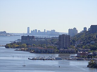
Route 495 is a 3.45-mile-long (5.55 km) state highway in Hudson County, New Jersey, in the United States that connects the New Jersey Turnpike at exits 16E-17 in Secaucus to New York State Route 495 (NY 495) inside the Lincoln Tunnel in Weehawken, providing access to Midtown Manhattan in New York City. The road is owned and operated by the New Jersey Turnpike Authority (NJTA) between the New Jersey Turnpike and Route 3, the New Jersey Department of Transportation (NJDOT) between Route 3 and Park Avenue near the Union City–Weehawken border, and by the Port Authority of New York and New Jersey (PANYNJ) east of Park Avenue, including the helix used to descend the New Jersey Palisades to reach the entrance of the Lincoln Tunnel. Route 495 is mostly a six-lane freeway with a reversible bus lane used during the morning rush hour. The bus lane, which runs the entire length of the freeway, continues into the Lincoln Tunnel's center tube.

North Bergen is a township in the northern part of Hudson County, in the U.S. state of New Jersey. As of the 2020 United States census, the township's population was 63,361, an increase of 2,588 (+4.3%) from the 2010 census count of 60,773, which in turn reflected an increase of 2,681 (+4.6%) from the 58,092 counted in the 2000 census. The township was incorporated in 1843. It was much diminished in territory by a series of secessions. Situated on the Hudson Palisades, it is one of the hilliest municipalities in the United States. Like neighboring North Hudson communities, North Bergen is among those places in the nation with the highest population density and a majority Hispanic population.

Bergenline Avenue is a station on the Hudson–Bergen Light Rail (HBLR). The intermodal facility is located on 49th Street between Bergenline Avenue and Kennedy Boulevard in Union City, New Jersey, near its border with West New York and North Bergen. The station is the first and only completely underground station on the network and opened for service on February 25, 2006.
Paterson Plank Road is a road that runs through Passaic, Bergen and Hudson Counties in northeastern New Jersey. The route, originally laid in the colonial era, connects the city of Paterson and the Hudson River waterfront. It has largely been superseded by Route 3, but in the many towns it passes it has remained an important local thoroughfare, and in some cases been renamed.

Western Slope is a neighborhood in The Heights, Jersey City, New Jersey on the cuesta, or gradual decline, of the western side of the New Jersey Palisades between The Boulevard and Tonnele Avenue.

The Hackensack Plank Road, also known as Bergen Turnpike, was a major artery which connected the cities of Hoboken and Hackensack, New Jersey. Like its cousin routes, the Newark Plank Road and Paterson Plank Road, it travelled over Bergen Hill and across the Hackensack Meadows from the Hudson River waterfront to the city for which it was named. It was originally built as a colonial turnpike road as Hackensack and Hoboken Turnpike. The route mostly still exists today, though some segments are now called the Bergen Turnpike. It was during the 19th century that plank roads were developed, often by private companies which charged a toll. As the name suggests, wooden boards were laid on a roadbed in order to prevent horse-drawn carriages and wagons from sinking into softer ground on the portions of the road that passed through wetlands. The company that built the road received its charter on November 30, 1802. The road followed the route road from Hackensack to Communipaw that was described in 1679 as a "fine broad wagon-road."

Bergen Hill refers to the lower Hudson Palisades in New Jersey, where they emerge on Bergen Neck, which in turn is the peninsula between the Hackensack and Hudson Rivers, and their bays. In Hudson County, it reaches a height of 260 feet.

Bergenline Avenue is a major commercial district in the North Hudson section of Hudson County, New Jersey, United States. The north–south streets passes through Union City, West New York, Guttenberg, and North Bergen. Its southern end is at Union City's Second Street, the north boundary of Washington Park. From there north to 47th Street, the street is one-way southbound; New York Avenue and Kennedy Boulevard serve northbound traffic. Between 48th and 49th Streets, elevators on the west side provide access to the underground Bergenline Avenue station of the Hudson-Bergen Light Rail. After passing through West New York and Guttenberg and into North Bergen, the street meets North Hudson Park, running along its west side from 79th Street to the Bergen County line through the community of Nungesser's and crosses Kennedy Boulevard. The northernmost 0.04 miles (0.064 km) of the route from Kennedy Boulevard to the Bergen County line is designated as County Route 721. North of the county line the street name becomes Anderson Avenue, which is the major commercial district for Fairview, Cliffside Park, and Fort Lee.

The Hudson Waterfront is an urban area of northeastern New Jersey along the lower reaches of the Hudson River, the Upper New York Bay and the Kill van Kull. Though the term can specifically mean the shoreline, it is often used to mean the contiguous urban area between the Bayonne Bridge and the George Washington Bridge that is approximately 19 miles (31 km) long. Historically, the region has been known as Bergen Neck, the lower peninsula, and Bergen Hill, lower Hudson Palisades. It has sometimes been called the Gold Coast.

New Durham is a neighborhood in North Bergen Township in Hudson County, New Jersey, United States. It is located near the foot of Union Turnpike and Bergen Turnpike, and south of the Tonnelle Avenue Station of the Hudson Bergen Light Rail. It is one of the few residential areas along the otherwise industrial/commercial Tonnelle Ave, and site of one of the town's main post offices.

Transfer Station is the name of a section of Hudson County, New Jersey, which radiates from the intersection where Paterson Plank Road crosses Summit Avenue at 7th Street. It is near the tripoint where the borders of Jersey City Heights, North Bergen, and Union City intersect, which is a few blocks to the southwest of the station, at the intersection of Secaucus Road and Kennedy Boulevard.

County Route 617 is 4.55 miles (7.32 km) long and follows one street, Summit Avenue along the ridge of the Hudson Palisades in Hudson County, New Jersey. Its southern end is CR 622, or Grand Street, at Communipaw Junction in the Bergen-Lafayette Section of Jersey City. Its northern end is CR 691, 32nd Street, a section of the Bergen Turnpike, in Union City.

Pershing Road is a road located entirely in Weehawken, New Jersey that travels for 0.42 miles (0.68 km) on the Hudson Palisades between Boulevard East and Weehawken Port Imperial, and carries the designation Hudson County Route 682. At County Route 505, the road meets 48th Street, one of the very few two-way streets in the urban grid of North Hudson, which travels west to Bergenline Avenue and Kennedy Boulevard. It is named for World War I hero John J. Pershing. Earlier names have included Clifton Road, named for the estate on whose land it was located, and Hillside Road, which would speak to its location.

Boulevard East is a two-way, mostly two lane, scenic county road in the North Hudson, New Jersey municipalities of Weehawken, West New York, Guttenberg and North Bergen. Apart from small sections at either end, the road runs along the crest of the Hudson Palisades, affording it views of the Hudson River and the New York City skyline. Developed at the turn of the 20th century, the residential road is characterized by an eclectic mix of 20th-century architecture, including private homes as well as mid and high-rise apartment buildings, mostly on its western side, with a promenade and parks along its eastern side. It is also the setting for Edward Hopper's 1934 painting East Wind Over Weehawken, which is considered one of his best works.

Nungessers is the name of the confluence of roads that meet at the Hudson and Bergen county line at North Bergen and Fairview in northeastern New Jersey. The area is the former site of the Nungesser's Gutenberg Racetrack, a late 19th-century gaming and gambling venue. The neighborhood just south of Nungesser's is called the Racetrack Section and the municipality of Guttenberg is nearby. A White Castle, an early drive-in fast-food chain, originally built in the 1930s has long been a landmark in the neighborhood, as has adjacent North Hudson Park.

The George Washington Bridge Plaza, also known as GWB Plaza or Bridge Plaza, is the convergence of roads and highways around the George Washington Bridge toll plaza in Fort Lee, New Jersey, United States. The plaza is located north of and parallel to Fort Lee's Main Street. The surrounding busy area is characterized by a mix of commercial and residential uses and an architectural variety that includes parking lots, strip malls, houses, gas stations, mid-rise office buildings and high-rise condominiums. Just to the east is Fort Lee Historic Park, Palisades Interstate Park and the bridge's western tower.

The Grove Church Cemetery is a nonsectarian cemetery, located on the western slope of the Hudson Palisades, along with several other cemeteries in a string of green open space, in Hudson County, New Jersey, United States. The Grove Church, who owns the cemetery, is one of the oldest religious bodies in the area, and it has had an operating cemetery since 1847. Throughout its history, prominent families have been buried there, as well as American Civil war veterans. There have also been reports of vandalism and misuse of the property since the 19th century, and in 2007 some of the cemetery grounds were occupied by the homeless.

Maisland, or Mais Land, was an area in Hudson County, New Jersey.
The Hudson County Park System owns and operates several county parks in Hudson County, New Jersey. It has its roots in the City Beautiful movement around the turn of the twentieth century. The system comprises eight parks comprising 716.52 acres (290.0 ha). Additionally, the county owns acreage in preservation areas in the New Jersey Meadowlands


