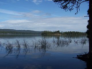
The Lake of the Arbuckles is a reservoir located in southern Oklahoma, 8 miles (13 km) southwest of Sulphur in Murray County. The lake covers 2,350 acres (950 ha) and is a principal water supply reservoir for the city of Ardmore, some 30 mi (48 km) to the southwest. It also supplies water to the cities of Sulphur, Davis, Wynnewood and a large oil refinery near Wynnewood. The lake also provides flood control, fish and wildlife habitat and recreation opportunities.

Wilson Lake is a reservoir in the U.S. state of Kansas, on the border of Russell County and Lincoln County. Built and managed by the U.S. Army Corps of Engineers for flood control, it is also used for wildlife management and recreation. Several parks are located along its shoreline, including Wilson State Park.

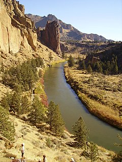
The Crooked River is a tributary, 125 miles (201 km) long, of the Deschutes River in the U.S. state of Oregon. The river begins at the confluence of the South Fork Crooked River and Beaver Creek. Of the two tributaries, the South Fork Crooked River is the larger and is sometimes considered part of the Crooked River proper. A variant name of the South Fork Crooked River is simply "Crooked River". The Deschutes River flows north into the Columbia River.
The Central Utah Project is a US federal water project that was authorized for construction under the Colorado River Storage Project Act of April 11, 1956, as a participating project. In general, the Central Utah Project develops a portion of Utah's share of the yield of the Colorado River, as set out in the Colorado River Compact of 1922.

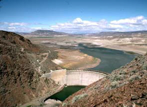
Owyhee Reservoir or Owyhee Lake is a reservoir on the Owyhee River in Malheur County, Oregon, United States. Located in far Eastern Oregon near the Idaho border, the reservoir is Oregon's longest at 52 miles (84 km). The 13,900-acre (56 km2) lake is home to several species of fish, including crappie, rainbow trout, largemouth bass, smallmouth bass, yellow perch, and brown bullhead. An artificial lake, it was created in 1932 with the completion of the Owyhee Dam. The lake supplies water for irrigation for 1,800 farms covering 118,000 acres of land in Eastern Oregon and Southwestern Idaho. Seasonal Lake Owyhee State Park is located on the northeast shore and includes a boat ramp.

Warm Springs Reservoir is a reservoir on the boundary between Harney and Malheur counties in the U.S. state of Oregon. It is located 13 miles (21 km) southwest of Juntura at an elevation of 3,406 feet (1,038 m). The lake's primary inflow and outflow are both the Malheur River.

The Prineville Reservoir is in the high desert hills of Central Oregon, Oregon, United States. The reservoir is on the Crooked River 14 miles (22.5 km) southeast of Prineville, and 29 miles (46.7 km) east of Bend. This reservoir is a popular retreat for most of Central Oregon. It is near the geographic center of Oregon. Prineville Reservoir State Park is managed by the Oregon Parks and Recreation Department.

Hyatt Reservoir is a reservoir in Jackson County, Oregon, United States, 14 miles (23 km) east of Ashland. Impounded by Hyatt Dam, the water is used for irrigation and recreation. A local irrigation district built the dam in 1923.

Deer Creek State Park a state park in south western Wasatch County, Utah, United States, featuring large Deer Creek Dam and Reservoir. The park is located near the town of Charleston in the southwest corner of the Heber Valley.

Howard Prairie Lake is a reservoir located 4,526 feet (1,380 m) above sea level in Jackson County, Oregon, United States. It is 18 miles (29 km) east of Ashland. The lake is formed by the 100-foot (30 m) tall Howard Prairie Dam, which impounds Beaver Creek, in the Klamath River watershed.

McKay Reservoir is a reservoir in Umatilla County of the U.S. state of Oregon. It is an impoundment of McKay Creek, a tributary of the Umatilla River. The reservoir is located 6 miles (9.7 km) south of Pendleton on U.S. Route 395. The reservoir has a capacity of 65,534 acre feet (80,835,000 m3) of water. The reservoir and land that immediately surrounds it are designated as the McKay Creek National Wildlife Refuge. The reservoir and creek that it impounds are named for Dr. William C. McKay. McKay was an early settler in the Pendleton, Oregon area. He settled near the mouth of McKay Creek about 1851. The place was originally called Houtama. He died in Pendleton in 1893.

Agate Lake is a reservoir located 1,510 feet (460 m) above sea level in Jackson County, Oregon, United States. It is 13 miles (21 km) northeast of Medford, just north of Roxy Ann Peak. The lake is formed by the 86-foot (26 m) tall Agate Dam, which impounds Dry Creek, in the Rogue River watershed.

Keith Sebelius Lake, formerly known as Norton Reservoir, is a man-made reservoir on Prairie Dog Creek in northwest Kansas. Built and managed by the U.S. Bureau of Reclamation, it is used for flood control, irrigation, recreation, and local water supply. Prairie Dog State Park is located on its shore.

Waconda Lake, also known as Glen Elder Reservoir, is a reservoir in Mitchell County and Osborne County, Kansas, United States. Built and managed by the U.S. Bureau of Reclamation for flood control and irrigation, it is also used for recreation. Glen Elder State Park is located on its north shore.

Bully Creek is a 62-mile (100 km) long tributary of the Malheur River, located in the U.S. state of Oregon. It drains 601 square miles (1,557 km2) of Malheur County. Arising in the Blue Mountains, it flows generally southeast to its confluence with the Malheur River near Vale.

Lovewell Reservoir is a reservoir in Jewell County, Kansas, United States. Built and managed by the U.S. Bureau of Reclamation, it is used for flood control, irrigation, and recreation. Lovewell State Park is located on its north shore.

Cedar Bluff Reservoir is a reservoir in Trego County, Kansas, United States. Built and managed by the U.S. Bureau of Reclamation for irrigation and area water supply, it is also used for flood control and recreation. Cedar Bluff State Park is located on its shore.

Agency Valley Dam is a dam in Oregon, United States, built on the North Fork Malheur River in the eastern part of the state, immediately north of the small town of Beulah in Malheur County. The dam impounds the river to create Beulah Reservoir.

Webster Reservoir is a reservoir in Rooks County, Kansas, United States. Built and managed by the U.S. Bureau of Reclamation, it is used for flood control, irrigation, and recreation. Webster State Park is located on its shore.

Antelope Reservoir is a large body of water impounded for irrigation in a semi-arid region of southeastern Oregon in the United States. Located near the small city of Jordan Valley in Malheur County, it is about 10 miles (16 km) west of Oregon's border with Idaho. Although the lake is formed by a dam across Jack Creek, most of the water enters the reservoir via the Antelope Feeder Canal. It diverts water to the reservoir from nearby Jordan Creek at a point near the Idaho border. Jack Creek, which carries minor outflows from the reservoir, empties into Jordan Creek further downstream.


