Bundibugyo

Last updated

Bundibugyo
Bundibugyo.jpg
Uganda location map.svg
Red pog.svg
Bundibugyo
Location in Uganda
Coordinates: 00°42′45″N30°03′36″E / 0.71250°N 30.06000°E / 0.71250; 30.06000 Coordinates: 00°42′45″N30°03′36″E / 0.71250°N 30.06000°E / 0.71250; 30.06000
Country Flag of Uganda.svg Uganda
Region Western Uganda
Sub-region Rwenzururu sub-region
District Bundibugyo District
Elevation
3,461 ft (1,055 m)
Population
 (2020 Estimate)
  Total22,300 [1]
Climate Am

Bundibugyo is a town in the Western Region of Uganda. It is the 'chief town' of Bundibugyo District and the district headquarters are located there. [2]

Contents

Location

Bundibugyo is located approximately 85 kilometres (53 mi), by road, west of Fort Portal, the nearest large city. The direct distance is much shorter, due to the steep terrain and winding nature of the roads in the neighborhood. [3] The town of Bundibugyo is located approximately 378 kilometres (235 mi), by road, west of Kampala, the largest city and national capital of Uganda. [4]

The geographical coordinates of Bundibugyo town are:0°42'45.0"N 30°03'36.0"E (Latitude:0.712500; Longitude: 30.059999). [5] Bundibugyo Town Council sits at an average elevation of 3,461 feet (1,055 m) above mean sea level, lying between 2,477 feet (755 m) and 7,733 feet (2,357 m) above sea level. [6]

Overview

Bundibugyo is one of the most western of all Uganda's district capitals. Although Kisoro, Kanungu and Rukungiri are located further west than Bundibugyo, it is the only Ugandan district capital located west of the Rwenzori Mountains. It sits at an altitude of approximately 900 metres (3,000 ft), above sea level. The predominant ethnicities in the town are the Bamba and the Bakonjo. However other ethnicities coexist with them including the Batooro, Bakiga, Banyoro and the Banyankole. [7]

Population

The 2002 national census enumerated the population of Bundibugyo at 13,782. In 2010, the Uganda Bureau of Statistics (UBOS), estimated the population of the town at 20,500. In 2011, UBOS estimated the mid-year population of Bundibugyo at 21,600. [8]

In 2014, the national population census put the town's population at 18,823. In 2015 UBOS estimated the town's population at 19,000. In 2020, the population agency estimated the mid-year population of Bundibugyo Town Council at 22,300. Of those, 11,400 (51.1 percent) were females and 10,900 (48.9 percent) were males. UBOS calculated that the population of the town increased at an average rate of 3.3 percent annually between 2015 and 2020. [1]

Historical population
YearPop.±%
200213,782    
201020,500+48.7%
201121,600+5.4%
201418,823−12.9%
201519,000+0.9%
202022,300+17.4%
source: [1] [8]

Points of interest

The following points of interest lie within the town or close to its borders: [5]

1. The headquarters of Bundibugyo District Administration

2. The offices of Bundibugyo Town Council

3. Bundibugyo Central Market, the largest source of fresh produce in the town

4. Bundibugyo General Hospital, a 160-bed public hospital administered by the Uganda Ministry of Health

5. A branch of Stanbic Bank

6. Bundibugyo Airport, a civilian airport

7. Ebenezer Seventh-day Adventist Church, a place of worship affiliated with the Seventh Day Adventist faith.

See also

Related Research Articles

Masindi Place in Western Region of Uganda, Uganda

Masindi is a town in the Western Region of Uganda. It is on the road between Kampala and the Murchison Falls National Park. It is the site of the headquarters of the Masindi District.

Kasese Place in Western Region, Uganda

Kasese is a town north of Lake George in the Western Region of Uganda. It originally grew around the copper mine at Kilembe, while attention later turned to cobalt mining. It is the chief town of Kasese District, and the district headquarters are located there. Kasese is also the largest town in the Rwenzururu region. Charles Mumbere, the Omusinga of Rwenzururu, maintains a palace in the town.

Bushenyi Place in Western Uganda, Uganda

Bushenyi is a town in Western Uganda. It is the 'chief town' of Bushenyi District and the district headquarters are located there. The district is named after the town, in keeping with the practice in most of the districts in the country.

Sembabule Place in Central Region of Uganda

Sembabule is a town in Sembabule District in the Central Region of Uganda. The town is the main municipal, administrative, and commercial center of the district and the site of the district headquarters.

Kiboga Town in Uganda

Kiboga is a town in the Buganda Region of Uganda. It is the main municipal, administrative, and commercial center of Kiboga District, and the district headquarters are located there.

Kayunga Place in Uganda

Kayunga is a town in the Central Region of Uganda. It is the main municipal, administrative, and commercial center of Kayunga District.

Luweero Place in Central Region of Uganda, Uganda

Luweero is a town in the Central Region of Uganda. It is the main municipal, administrative, and commercial center of Luweero District.

Butaleja Human settlement in Eastern Region, Uganda

Butaleja is a town in Eastern Rgion of Uganda. It is the main municipal, administrative and commercial center of Butaleja District and the district headquarters are located there. The district is named after the town.

Kakiri Settlement in Central Uganda

Kakiri is a town located in Wakiso District in the Central Region of Uganda.

Isingiro Ugandan town

Isingiro is a town in the Western Region of Uganda. It is the main municipal, administrative, and commercial center of Isingiro District and the site of the district's headquarters.

Kiruhura, Uganda Place in Uganda

Kiruhura is a town in the Western Region of Uganda. It is the largest town in Kiruhura District and the site of the district headquarters.

Buikwe Town in Central Region, Uganda

Buikwe, sometimes spelled Buyikwe, is a town in Buikwe District, Uganda. It is the administrative center of the district and the location of the district headquarters.

Mpondwe Place in Uganda

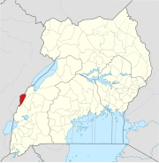
Mpondwe is a town in the Western Region of Uganda.

Amolatar Ugandan town

Amolatar is a town in Northern Uganda. It is the main municipal, administrative and commercial centre of Amolatar District. The district is named after the town.

Rwimi Place in Bunyangabu District

Rwimi is a town in Bunyangabu District in the Western Region of Uganda. With an estimated population of 16,200 in 2020 it is the largest urban center in the district, but the district headquarters are located elsewhere; in Kibiito.

Busolwe Place in Eastern Uganda, Uganda

Busolwe is a town in the Eastern Region of Uganda. It is one of the two municipalities in Butaleja District, the other being Butaleja.

Kaabong Ugandan town

Kaabong is a town in the Northern Region of Uganda. It is the chief municipal, administrative and commercial center of Kaabong District, and the district headquarters are located there.

Kyegegwa Place in Uganda

Kyegegwa is a town in the Western Region of Uganda. It is the main municipal, administrative, and commercial center of Kyegegwa District.

Ntoroko District District in Uganda

Ntoroko District is a district in the Western Region of Uganda. The district headquarters are in the Kibuuku town council. it is the second least populated district in Uganda.

Masulita Place in Central Region, Uganda

Masulita is a town in Wakiso District in the Central Region of Uganda. As of April 2021 Masulita is one of four town councils in the district.

References

  1. 1 2 3 Uganda Bureau of Statistics (14 June 2020). "The population development of Bundibugyo as well as related information and services" (Citypopulation.de Quoting Uganda Bureau of Statistics). Citypopulation.de. Retrieved 20 July 2021.
  2. Uganda Radio Network (24 November 2020). "NUP Denied Campaign Venue In Bundibugyo Town Council" (The Independent (Uganda) Quoting Uganda Radio Network). The Independent (Uganda) . Kampala, Uganda. Retrieved 20 July 2021.
  3. Google (20 July 2021). "Road Distance Between Bundibugyo, Uganda And Fort Portal, Uganda" (Map). Google Maps . Google. Retrieved 20 July 2021.
  4. Google (20 July 2021). "Road Distance Between Bundibugyo, Uganda And Kampala, Uganda" (Map). Google Maps . Google. Retrieved 20 July 2021.
  5. 1 2 Google (20 July 2021). "Location of Bundibugyo Municipal Council, Bundibugyo District, Western Region, Uganda" (Map). Google Maps . Google. Retrieved 20 July 2021.
  6. Topographic Map (20 July 2021). "Elevation of Bundibugyo Town Council, Uganda". Topographic-map.com. Retrieved 20 July 2021.
  7. Data Africa (2014). "Data Profile of Bundibugyo". Data Africa. Retrieved 20 July 2021.
  8. 1 2 Uganda Bureau of Statistics (2012). "Estimated Population of Bundibugyo In 2002, 2010 And 2011" (PDF). Uganda Bureau of Statistics . Kampala, Uganda. Archived from the original (Archived from the original on 7 July 2014) on 7 July 2014. Retrieved 20 July 2021.