
Buranda railway station is located on the Cleveland line in Queensland, Australia. It is one of two stations serving the Brisbane suburb of Woolloongabba, the other being Park Road.

Chermside is a suburb in the City of Brisbane, Queensland, Australia. In the 2016 census Chermside had a population of 9,315 people. The suburb is situated 9.8 kilometres (6.1 mi) by road north of the Brisbane CBD. It is home to a large Westfield shopping centre.

Bowen Hills is an inner north-eastern suburb in the City of Brisbane, Queensland, Australia. In the 2016 census Bowen Hills had a population of 3,226 people.

Coorparoo is a suburb in the City of Brisbane, Queensland, Australia. In the 2016 census, Coorparoo had a population of 16,282 people.

The South East Busway is a grade separated bus-only road running south from the Brisbane central business district to Eight Mile Plains in Queensland, Australia. The busway was completed to Woolloongabba in September 2000 and to Eight Mile Plains in April 2001. An extension of the busway to School Road at Rochedale was completed in 2014 with no additional busway stations. The maximum capacity of the busway is 18,000 commuters an hour during peak periods. The busway carries an estimated 70 million passengers annually.

Dutton Park is an inner southern suburb in the City of Brisbane, Queensland, Australia. In the 2016 census, Dutton Park had a population of 2,024 people.

Moorooka is a southern suburb in the City of Brisbane, Queensland, Australia. In the 2016 census, Moorooka had a population of 10,368 people.
The Eastern Busway is a bus-only road running from the University of Queensland's St Lucia campus to Langlands Park busway station in Queensland, Australia.

Pinkenba is a town and eastern coastal suburb within the City of Brisbane, Queensland, Australia. In the 2016 census, Pinkenba had a population of 368 people.
Lutwyche is a northern suburb in the City of Brisbane, Queensland, Australia. In the 2016 census, Lutwyche had a population of 3,454 people.

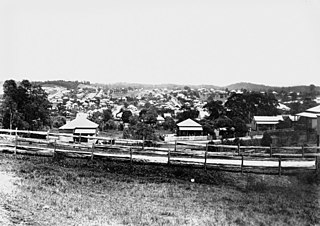
Woolloongabba is a suburb in the City of Brisbane, Queensland, Australia. In the 2016 census, Woolloongabba had a population of 5,631 people.

Camp Hill is an eastern suburb in the City of Brisbane, Queensland, Australia. In the 2016 census, Camp Hill had a population of 11,202 people.

Eight Mile Plains is an outer southern suburb in the City of Brisbane, Queensland, Australia. In the 2016 census, Eight Mile Plains had a population of 15,322 people.

Buranda Busway Station is located in Brisbane, Australia serving the suburb of Buranda. It opened on 30 April 2001 when the South East Busway was extended from Woolloongabba to Eight Mile Plains.

Brisbane City is the central suburb and central business district of Brisbane, the state capital of Queensland, Australia. It is colloquially referred to as the "Brisbane CBD" or "the city". It is located on a point on the northern bank of the Brisbane River, historically known as Meanjin, Mianjin or Meeanjin in the local Aboriginal Australian dialect. The triangular shaped area is bounded by the median of the Brisbane River to the east, south and west. The point, known at its tip as Gardens Point, slopes upward to the north-west where the city is bounded by parkland and the inner city suburb of Spring Hill to the north. The CBD is bounded to the north-east by the suburb of Fortitude Valley. To the west the CBD is bounded by Petrie Terrace, which in 2010 was reinstated as a suburb.

Yeronga is a southern riverside suburb in the City of Brisbane, Queensland, Australia. In the 2016 census, Yeronga had a population of 6,535 people.

Cannon Hill is a suburb in the City of Brisbane, Queensland, Australia. In the 2016 census Cannon Hill had a population of 5,533 people.

Ipswich Road is one Brisbane's main roads connecting Brisbane to the nearby city of Ipswich, via the Ipswich Motorway. Ipswich Road used to be part of the Cunningham Highway. Logan Road, Pacific Motorway, and Beaudesert Road are the other major roads in the south of Brisbane. The road was an important transport route in 19th century Brisbane.
Buranda State School is a heritage-listed state school at 24 Cowley Street, Woolloongabba, City of Brisbane, Queensland, Australia. It was designed by Department of Public Works (Queensland) and built from 1920 to 1928. It was added to the Queensland Heritage Register on 28 April 2017.

Roma Street is a major street in Brisbane, the capital of Queensland, Australia. It is named after Diamantina Bowen, the wife of the first Governor of Queensland, George Bowen.
