The Lake District, also known as the Lakes or Lakeland, is a mountainous region and national park in Cumbria, North West England. It is famous for its landscape, including its lakes, coast, and the Cumbrian mountains; and for its literary associations with Beatrix Potter, John Ruskin, and the Lake Poets.

Scafell Pike is a mountain in the Lake District region of Cumbria, England. It has an elevation of 978 metres (3,209 ft) above sea level, making it the highest and the most prominent mountain in England. The mountain is part of the Scafell massif, an inactive volcano, and is one of the Southern Fells.

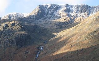
Scafell is a mountain in the Lake District region of Cumbria, England. It has a height of 964 metres, making it the second-highest mountain in England after its neighbour, Scafell Pike, from which it is separated by Mickledore col.

The River Esk, sometimes called the Cumbrian Esk, is a river in Cumbria, England. It flows for approximately 25 km from its source in the Scafells range of mountains to its estuary at Ravenglass. The valley it flows through is known as Eskdale. It is one of two Rivers Esk in Cumbria, and not to be confused with the Border Esk which flows into Cumbria from Scotland.
Nethermost Pike is a fell in Cumbria, England, and a part of the Lake District. At 891 metres (2,923 ft) it is the second highest Wainwright in the Helvellyn range, the highest of which is Helvellyn itself. It is located close to the southern end of the ridge, with Helvellyn to the north, and High Crag and Dollywaggon Pike to the south. Nethermost Pike, along with many of the Eastern Fells, lies between Thirlmere in the west and the Ullswater catchment in the east. The closest villages are Glenridding and Patterdale on the shores of Ullswater, over 8 kilometres (5 mi) away.

Malham Tarn is a glacial lake near the village of Malham in the Yorkshire Dales, England. The lake is one of only eight upland alkaline lakes in Europe. At an altitude of 377 metres (1,237 ft) above sea level it is the highest marl lake in the United Kingdom. Its geology, flora and fauna have led to it being listed under a number of conservation designations. The site is currently owned by the National Trust, who used to lease part of the site to the Field Studies Council but this closed as a field centre in 2022. The site was the inspiration for Charles Kingsley's 1863 novel The Water-Babies, A Fairy Tale for a Land Baby.

Pike o' Blisco, or Pike of Blisco, is a mountain in the Lake District in Cumbria, England. Located between the valleys of Great Langdale and Little Langdale, its relative isolation from neighbouring fells together with slopes falling away immediately from the summit in all directions mean it has excellent views: the view of the Langdale Pikes across Great Langdale is particularly arresting.

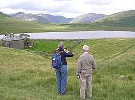
Devoke Water is a small lake in the south west of the Lake District in North West England. It is the largest tarn in the Lake District, a tarn being a specific type of glacial lake formed when a hollow is created on a mountain. The lake is 1.17 kilometres (0.73 mi) long, has an area of 0.34 square kilometres (0.13 sq mi) and lies at an altitude of 236 metres (774 ft) on Birker Fell. Its outflow, to the north west, is Linbeck Gill, which joins the River Esk before flowing into the Irish Sea at Ravenglass. The lake is in the unitary authority of Cumberland and the ceremonial county of Cumbria. Its south-western shore forms part of the south-western boundary of Eskdale parish, in which it is situated.

Boot is a small village in Eskdale on the western side of the English Lake District. It lies within the civil parish of Eskdale, the unitary authority of Cumberland, and the ceremonial county of Cumbria. The main part of the village lies beside the Whillan Beck, whilst its church, St Catherine's, lies 0.6 miles (0.97 km) to the south on the bank of the River Esk. The Whillan Beck flows into the Esk just downstream of the village.

Illgill Head is a fell in the English Lake District. It is known more commonly as the northern portion of the Wastwater Screes. The fell is 609 metres (1,998 ft) high and stands along the south-east shore of Wastwater, the deepest lake in England.

Seat Sandal is a fell in the English Lake District, situated four kilometres north of the village of Grasmere from where it is very well seen. Nevertheless, it tends to be overshadowed by its more illustrious neighbours in the Eastern Fells, Helvellyn and Fairfield.

Muncaster Fell is a fell at the far western edge of the Lake District National Park, in Cumbria, England. Muncaster Fell is a long, narrow ridge of land, approximately 1.2 km wide and 6 km long, lying between the River Mite to the north, and River Esk to the south. The fell rises from the coast near Ravenglass village to its highest point at Hooker Crag (231 m). The ridge then continues to the north-east, dropping gently to its furthest prominence at Silver Knott (174 m). The fell then falls away rapidly to the village of Eskdale Green at its north-eastern tip.
Birker Fell, also known as Birker Moor, is an upland wilderness area in the western portion of the Lake District National Park, in Cumbria, England. Rather than being formed of one single high peak, the fell is a broad, undulating area, approximately 6 km square, with numerous crags and prominences scattered across its area. The highest point of the fell is at Green Crag. The fell is bordered by the Duddon Valley to the south-east, Ulpha Fell to the south-west, Harter Fell to the north-east, and Eskdale to the north-west.

Slight Side is a fell in the English Lake District it stands 25 kilometres east southeast of the town of Whitehaven and reaches a height of 762 metres (2,499 ft). Slight Side lies at the south western edge of the Scafell Massif, a four-kilometre-long crescent of high ground which includes the highest ground in England. The fells names derives from the Old Norse language and means "The mountain shieling with the level pastures", it is a combination of the Norse words "sletta" and "saetr". With a shieling meaning a shepherds hut or a mountain pasture used in the summer.

Little Langdale is a valley in the Lake District, England, containing Little Langdale Tarn and a hamlet also called Little Langdale. A second tarn, Blea Tarn, is in a hanging valley between Little Langdale and the larger Great Langdale to the north. Little Langdale is flanked on the south and southwest by Wetherlam and Swirl How, and to the north and northwest by Lingmoor Fell and Pike of Blisco. The valley descends to join with Great Langdale above Elter Water.

Boat How or Eskdale Moor is a hill in the English Lake District, near Boot, in the Borough of Copeland, Cumbria. It lies south of Burnmoor Tarn, between the River Mite to the west and the Whillan Beck tributary of Eskdale to the east.

Great How or Great Howe is a hill of 522 metres (1,713 ft) in the west of the English Lake District, lying south of Scafell Pike and east of Burnmoor Tarn. It lies in the civil parish of Eskdale, the unitary authority area of Cumberland and the ceremonial county of Cumbria.
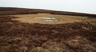
Priest's Tarn is an upland lake on Grassington Moor, in North Yorkshire, England. The water from Priest's Tarn was historically used for hydraulic mining purposes during the lead industry on Grassington Moor. The flow of water largely exits the hill to the south-east into Grimwith Reservoir, which in turn feeds into the River Wharfe. Walkers have observed that the tarn is looking like it is drying up.
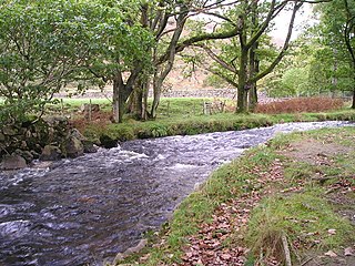
The Whillan Beck is a river in the west of the Lake District National Park in the English county of Cumbria. Administratively, the whole of the course of the Whillan Beck lies in the civil parish of Eskdale and the unitary authority of Cumberland.