The Municipality of Strathfield is a local government area in the inner west of Sydney, in the state of New South Wales, Australia.

Dulwich Hill is a suburb in the Inner West of Sydney, in the state of New South Wales, Australia. It is 7.5 kilometres south-west of the Sydney central business district, in the local government area of Inner West Council. Dulwich Hill stretches south to the shore of the Cooks River.
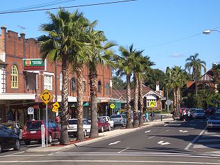
Croydon is a suburb in the Inner West of Sydney, in the state of New South Wales, Australia. It is located 9 kilometres (5.6 mi) west of the Sydney central business district. Croydon is split between the two local government areas of Municipality of Burwood and the Inner West Council.

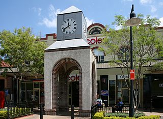
Burwood is a suburb in the Inner West of Sydney, in the state of New South Wales, Australia. It is 10 kilometres (6.2 mi) west of the Sydney central business district and is the administrative centre for the local government area of Municipality of Burwood.

Canada Bay is a suburb in the Inner West of Sydney, in the state of New South Wales, Australia. It is 11 kilometres (6.8 mi) west of the Sydney central business district, in the local government area of City of Canada Bay.

South Turramurra is a suburb on the Upper North Shore of Sydney in the state of New South Wales, Australia 18 kilometres (11 mi) north-west of the Sydney central business district, in the local government area of Ku-ring-gai Council. Turramurra and North Turramurra are separate suburbs.

Strathfield South is a suburb, in the Inner West of Sydney, Australia in the state of New South Wales, 13 kilometres west of the Sydney central business district, in the Strathfield local government area. The area was historically part of Druitt Town. Later it was part of Enfield, until Enfield Council was absorbed into Strathfield and Burwood councils, after which the part within Strathfield council was renamed Strathfield South.
Mortlake is a suburb in the Inner West of Sydney, in the state of New South Wales, Australia. It is 10 kilometres west of the Sydney central business district, in the local government area of the City of Canada Bay.

Greenacre is a suburb in Sydney, located 20 kilometres west of the Sydney central business district in the state of New South Wales, Australia. Most of Greenacre is in the local government area of the City of Canterbury-Bankstown, while a part in the east is in the Municipality of Strathfield.
Concord is a suburb in the inner West of Sydney, in the state of New South Wales, Australia. It is 10 kilometres (6.2 mi) west of the Sydney central business district, in the local government area of the City of Canada Bay. Concord West is a separate suburb, to the north-west.

Peakhurst Heights is a suburb in southern Sydney, in the state of New South Wales, Australia. Peakhurst Heights is located 22 kilometres south of the Sydney central business district and is part of the St George area. Peakhurst Heights is in the local government area of the Georges River Council.

Belfield is a suburb of Sydney, in the state of New South Wales, Australia. It is 13 kilometres southwest of the Sydney central business district, in the local government area of the City of Canterbury-Bankstown.

Belmore is a suburb of Sydney, in the state of New South Wales, Australia. Belmore is located 11 kilometres south-west of the Sydney central business district, in the local government area of the City of Canterbury-Bankstown.

Croydon Park is a suburb in the Inner West of Sydney, in the state of New South Wales, Australia. Croydon Park is 10 kilometres south-west of the Sydney central business district and is divided between the local government areas of the City of Canterbury-Bankstown, Municipality of Burwood and Inner West Council. Croydon is a separate suburb, to the north.

Breakfast Point is a suburb in the Inner West of Sydney, in the state of New South Wales, Australia. Breakfast Point is located 16 kilometres west of the Sydney central business district. It is in the local government area of the City of Canada Bay. People from Breakfast Point are colloquially called Breakfast Pointers.

Cabarita is a bayside suburb in the Inner West of Sydney, in the state of New South Wales, Australia. Cabarita is located 16 kilometres west of the Sydney central business district, in the local government area of the City of Canada Bay.

East Killara is a suburb on the Upper North Shore of Sydney in the state of New South Wales, Australia. East Killara is located 15 kilometres north of the Sydney Central Business District in the local government area of Ku-ring-gai Council. It is bordered by Garigal national park to the East and Eastern Arterial Rd/ Birdwood Ave to the west. Killara is a separate suburb to the south-west, which shares the postcode of 2071.

Enfield is a suburb in the Inner West of Sydney, in the state of New South Wales, Australia. It is 11 kilometres south-west of the Sydney central business district in the local government area of Municipality of Burwood.
Lane Cove West is a suburb on the Lower North Shore of Sydney, in the state of New South Wales, Australia. Lane Cove West is located 9 kilometres north-west of the Sydney central business district, in the local government area of the Municipality of Lane Cove. Lane Cove and Lane Cove North are separate suburbs.

Huntleys Cove is a suburb on the Lower North Shore of Sydney, in the state of New South Wales, Australia. Huntleys Cove is located 9 kilometres north-west of the Sydney central business district, in the local government area of the Municipality of Hunter's Hill. Huntleys Cove sits on the peninsula between Tarban Creek and the Parramatta River.