
The Muscogee, also known as the Muskogee, Muscogee Creek, Creek, Mvskokvlke, or the Muscogee Creek Confederacy in the Muscogee language, are a related group of indigenous peoples of the Southeastern Woodlands. Their original homelands are in what now comprises southern Tennessee, all of Alabama, western Georgia and part of northern Florida.
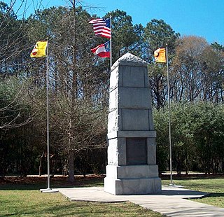
The Trail of Tears was a series of forced relocations of approximately 60,000 Native Americans in the United States between 1830 and 1850. Members of the Cherokee, Muscogee (Creek), Seminole, Chickasaw, and Choctaw nations were forcibly removed from their ancestral homelands in the Southeastern United States to areas to the west of the Mississippi River that had been designated as Indian Territory. The forced relocations were carried out by government authorities following the passage of the Indian Removal Act in 1830. The Cherokee removal in 1838 was brought on by the discovery of gold near Dahlonega, Georgia in 1828, resulting in the Georgia Gold Rush.

Troy is a city in Pike County, Alabama, United States. The city is the county seat of Pike County. It was formally incorporated on February 4, 1843.

Walnut Creek is a city in Contra Costa County, California, United States, located in the East Bay region of the San Francisco Bay Area, about 16 miles (26 km) east of the city of Oakland. With a total estimated population of 70,166, Walnut Creek serves as a hub for its neighboring cities because of its location at the junction of the highways from Sacramento and San Jose (I-680) and San Francisco/Oakland (SR-24) and its accessibility by BART. Its active downtown neighborhood features hundred-year-old buildings and extensive high-end retail establishments, restaurants and entertainment venues.

Shandaken is a town on the northern border of Ulster County, New York, United States, northwest of Kingston, New York. As of the 2010 census, the town had a total population of 3,085. The name is believed to be from an Esopus phrase for "land of rapid waters."
Dawson's Creek is an American teen drama television series about the lives of a close-knit group of friends beginning in high school and continuing into college that ran from 1998 to 2003. The series starred James Van Der Beek as Dawson Leery, Katie Holmes as his best friend and love interest Joey Potter, Joshua Jackson as their fellow best friend Pacey Witter, and Michelle Williams as Jen Lindley, a New York City transplant to the fictional town of Capeside, Massachusetts, where the series was set. The show was created by Kevin Williamson and debuted on The WB on January 20, 1998. It was produced by Columbia TriStar Television and was filmed in Wilmington, North Carolina.

The Chattahoochee River forms the southern half of the Alabama and Georgia border, as well as a portion of the Florida - Georgia border. It is a tributary of the Apalachicola River, a relatively short river formed by the confluence of the Chattahoochee and Flint rivers and emptying from Florida into Apalachicola Bay in the Gulf of Mexico. The Chattahoochee River is about 430 miles (690 km) long. The Chattahoochee, Flint, and Apalachicola rivers together make up the Apalachicola–Chattahoochee–Flint River Basin. The Chattahoochee makes up the largest part of the ACF's drainage basin.

The Tennessee River is the largest tributary of the Ohio River. It is approximately 652 miles (1,049 km) long and is located in the southeastern United States in the Tennessee Valley. The river was once popularly known as the Cherokee River, among other names, as many of the Cherokee had their territory along its banks, especially in eastern Tennessee and northern Alabama. Its current name is derived from the Cherokee village Tanasi.

A body of water or waterbody is any significant accumulation of water, generally on a planet's surface. The term most often refers to oceans, seas, and lakes, but it includes smaller pools of water such as ponds, wetlands, or more rarely, puddles. A body of water does not have to be still or contained; rivers, streams, canals, and other geographical features where water moves from one place to another are also considered bodies of water.

Halcott Mountain is one of the Catskill Mountains of the U.S. state of New York. It is mostly located in Greene County, with some of its lower slopes in Delaware and Ulster counties. Its exact summit elevation has not been officially determined, but the highest contour line on the mountain is 3,520 feet (1,070 m). It is one of the peaks on the divide between the Delaware and Hudson watersheds.
A stream is a body of water with surface water flowing within the bed and banks of a channel. The flow of a stream is controlled by three inputs - surface water, subsurface water and groundwater. The surface and subsurface water are highly variable between periods of rainfall. Groundwater, on the other hand, has a relatively constant input and is controlled more by long-term patterns of precipitation. The stream encompasses surface, subsurface and groundwater fluxes that respond to geological, geomorphological, hydrological and biotic controls.

Battle Creek is a city in the U.S. state of Michigan, in northwest Calhoun County, at the confluence of the Kalamazoo and Battle Creek rivers. It is the principal city of the Battle Creek, Michigan Metropolitan Statistical Area (MSA), which encompasses all of Calhoun County. As of the 2010 census, the city had a total population of 52,347, while the MSA's population was 136,146.

Onteora High School, located in Boiceville, New York, is part of the Onteora Central School District. The High School shares its building with the Onteora Middle School. However, the two schools remain administratively separate.

Schitt's Creek is a Canadian television sitcom created by Dan and Eugene Levy that aired on CBC Television from January 13, 2015 to April 7, 2020. It consists of 80 episodes spread over six seasons. Produced by Not a Real Company Productions, the series follows the trials and tribulations of the formerly wealthy Rose family when they are forced to relocate to Schitt's Creek, a small town they once purchased as a joke. Now living in a motel, Johnny Rose and Moira Rose —along with their adult children, David and Alexis —must adjust to life without money and with each other.

Broadstreet Hollow Creek or Broadstreet Hollow Brook is a river in New York. It begins in the town of Lexington in Greene County, and flows south, through the town of Shandaken in Ulster County then converges with the Esopus Creek.

