
Aurich is a district (Landkreis) in Lower Saxony, Germany. It is bounded by the North Sea, the districts of Wittmund and Leer, and the city of Emden.

The East Frisian Islands are a chain of islands in the North Sea, off the coast of East Frisia in Lower Saxony, Germany. The islands extend for some 90 kilometres (56 mi) from west to east between the mouths of the Ems and Jade / Weser rivers and lie about 3.5 to 10 km offshore. Between the islands and the mainland are extensive mudflats, known locally as Watten, which form part of the Wadden Sea. In front of the islands are Germany's territorial waters, which occupy a much larger area than the islands themselves. The islands, the surrounding mudflats and the territorial waters form a close ecological relationship. The island group makes up about 5% of the Lower Saxony Wadden Sea National Park.
Friesland is a district (Landkreis) in Lower Saxony, Germany. It is bounded by the districts of Wesermarsch, Ammerland, Leer and Wittmund, and by the North Sea. The city of Wilhelmshaven is enclosed by—but not part of—the district.
Leer is a district (Landkreis) in Lower Saxony, Germany. It is bounded by the city of Emden, the districts of Aurich, Wittmund, Friesland, Ammerland, Cloppenburg and Emsland, and by the Netherlands.

Wilhelmshaven is a coastal town in Lower Saxony, Germany. It is situated on the western side of the Jade Bight, a bay of the North Sea, and has a population of 76,089. Wilhelmshaven is the centre of the "JadeBay" business region and is Germany's main military port.
Wesermarsch is a Kreis (district) in the northwestern part of Lower Saxony, Germany. Neighboring are the districts of Cuxhaven and Osterholz, the city of Bremen in the state Free Hanseatic City of Bremen, the urban district of Delmenhorst, the district of Oldenburg and the urban district of Oldenburg, and the districts of Ammerland and Friesland.
Cuxhaven is a district (Landkreis) in Lower Saxony, Germany. It is bounded by the districts of Stade, Rotenburg, Osterholz and Wesermarsch, the city of Bremerhaven and the North Sea.
Osterholz is a district (Landkreis) in Lower Saxony, Germany. It is bounded by the districts of Wesermarsch, Cuxhaven, Rotenburg and Verden, and by the city of Bremen.

Nordenham is a town in the Wesermarsch district, in Lower Saxony, Germany. It is located at the mouth of the Weser river on the Butjadingen peninsula on the coast of the North Sea. The seaport city of Bremerhaven is located on the other side of the river. The Midgard-seaport in Nordenham is the largest private-owned harbor in Germany.

The Jade Bight is a bight or bay on the North Sea coast of Germany. It was formerly known simply as Jade or Jahde. Because of the very low input of freshwater, it is classified as a bay rather than an estuary.

Ganderkesee is a municipality in Oldenburg district, in Lower Saxony, Germany.

Elsfleth is a town in the district of Wesermarsch, Lower Saxony, Germany. It is situated at the confluence of the Hunte with the Weser, on the left bank of the Weser. It has a school of navigation, a harbour and docks.

Varel is a town in the district of Friesland, in Lower Saxony, Germany. It is situated near the Jade River and the Jade Bight, approximately 15 kilometres (9.3 mi) south of Wilhelmshaven and 30 kilometres (19 mi) north of Oldenburg. With a population of 23,984 (2020) it is the biggest town in the district of Friesland.

Sande is a municipality in the district of Friesland, Lower Saxony, Germany. It is situated near the Jade Bight, approximately 7 kilometres (4.3 mi) west of Wilhelmshaven, and 12 kilometres (7.5 mi) southeast of Jever.

Berne is a municipality in the district of Wesermarsch, in Lower Saxony, Germany. It is on the left bank of the Weser, approximately 20 km east of Oldenburg and 25 km northwest of Bremen.

Lemwerder is a municipality in the district of Wesermarsch, in Lower Saxony, Germany. It is on the left bank of the Weser, approximately 27 kilometres (17 mi) east of Oldenburg, and 17 kilometres (11 mi) northwest of the centre of Bremen.
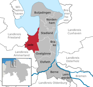
Jade is a municipality in the district of Wesermarsch, in Lower Saxony, Germany. It is situated on the river Jade, approx. 23 km (14 mi) north of Oldenburg, and 50 km (31 mi) northwest of Bremen.

Stadland is a municipality in the district of Wesermarsch, in Lower Saxony, Germany. It is situated on the left bank of the Weser, approx. 32 km northeast of Oldenburg, and 42 km northwest of Bremen. On the west side Stadland bordered to the Jade Bight. Its seat is in the village Rodenkirchen, which is also part of this municipality as the villages Schwei, Seefeld and Kleinensiel. There are also many little Bauernschaften (hamlets) in Stadland.
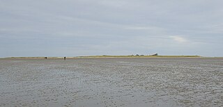
Mellum is an uninhabited island lying southeast of Wangerooge, off the coastal settlements of Horumersiel and Schillig.

The Weser Depression or Weser Lowlands is the region north of Porta Westfalica in Germany, where the River Weser no longer flows through a valley, but a broad plain consisting of meadows and river terraces.


