
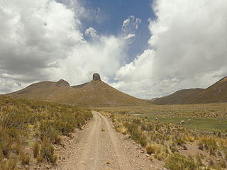
These lists cover volcanoes by type and by location.

Nevado Anallajsi is a stratovolcano in Bolivia. The date of its last eruption is unknown, but its youngest lava flows appear to have erupted from a vent on the north flank of the mountain. The main composition of the volcano is andesitic and dacitic. It overlies a plateau which is composed of ignimbrite. The volcano covers an area of 368.8 square kilometres (142.4 sq mi) and is 10.2 mya old based on its erosion state, while other estimates indicate an age of 2.6 mya.

Acotango is the central and highest of a group of stratovolcanoes straddling the border of Bolivia and Chile. It is 6,052 metres (19,856 ft) high. The group is known as Kimsa Chata and consists of three mountains: Acotango, Umurata north of it and Capurata south of it.

Payachata or Paya Chata is a north–south trending complex of potentially active volcanos on the border of Bolivia and Chile, directly north of Chungará Lake. The complex contains two peaks, Pomerape to the north and Parinacota to the south. On the Bolivian side the volcanoes are located in the Oruro Department, Sajama Province, Curahuara de Carangas Municipality, and on the Chilean side they lie in the Arica y Parinacota Region, Parinacota Province.
José Manuel Pando is a province in the La Paz Department in Bolivia. It was founded on April 22, 1986, during the presidency of Víctor Paz Estenssoro. The province was named after José Manuel Pando (1848–1917) who was the president of Bolivia from 1899 till 1904. Its capital is Santiago de Machaca.

The Cordillera Occidental or Western Cordillera of Bolivia is part of the Andes, a mountain range characterized by volcanic activity, making up the natural border with Chile and starting in the north with Juqhuri and ending in the south at the Licancabur volcano, which is on the southern limit of Bolivia with Chile. The border goes through the innominated point located at two-thirds of elevation of Licancabur's northeastern slope at the southwestermost point of Bolivia at 22° 49' 41" south and 67° 52' 35" west. The climate of the region is cold and inadequate for animal and plant life. Its main feature is its ground, in which are large quantities of metallic minerals including gold, silver, copper, and others.The range consists of three sections:

Descabezado Grande is a stratovolcano located in the Maule Region of central Chile. It is capped by a 1.4-kilometre-wide (0.9 mi) ice-filled caldera and named for its flat-topped form, as descabezado means "headless" in Spanish. A smaller crater about 500 metres (1,600 ft) wide is found in the northeast part of the caldera, and it has active fumaroles.

Callaqui is a stratovolcano located in the Bío Bío Region of Chile. It is a large ice-capped, basaltic andesite volcano which is elongated in the northeast-southwest direction, due to its construction along an 11 km (7 mi) long fissure. Numerous cinder cones and lava flows have erupted from vents along this linear fissure. Most of the activity at Callaqui has been fumarolic. Minor eruptions were reported 1751, 1864, and 1937, and the latest eruption was a small phreatic eruption in 1980.

In volcanology, a pyroclastic shield or ignimbrite shield is an uncommon type of shield volcano. Unlike most shield volcanoes, pyroclastic shields are formed mostly of pyroclastic and highly explosive eruptions rather than relatively fluid basaltic lava issuing from vents or fissures on the surface of the volcano. They typically display low-angle flank slopes and often have a central caldera caused by large eruptions. Lava is commonly extruded after explosive activity has ended. The paucity of associated Plinian fall deposits indicates that pyroclastic shields are characterized by low Plinian columns.

Zapaleri is a volcano whose summit is the tripoint of the borders of Argentina, Bolivia and Chile. A number of railways are in the area. It is part of Potosí Department (Bolivia), Jujuy Province (Argentina), and Antofagasta Region (Chile). The volcano formed on top of the 2.89 mya Tara Ignimbrite from the Guacha caldera and the basement beneath the volcano is formed from Cretaceous and Tertiary rocks affected by tectonic deformation. Volcanic rocks are andesite, basalt, dacite and rhyolite. Late Cretaceous rocks are also found in the area, as are Pleistocene shoshonite volcanic rocks.
Catacora is a location in the La Paz Department in Bolivia. It is the location of the Catacora Municipality, the second municipal section of the José Manuel Pando Province.

Kunturiri is a volcano in the Andes on the border of Bolivia and Chile which rises up to 5,762 metres (18,904 ft). On the Chilean side it is located in the Arica and Parinacota Region and on the Bolivian side in the Oruro Department, Sajama Province, Curahuara de Carangas Municipality, Sajama Canton as well as in the La Paz Department, Pacajes Province, Calacoto Municipality, Ulloma Canton.
Suni K'ira is a 5,899-metre-high (19,354 ft) shield volcano in Bolivia. It is located in the Potosí Department, Nor Lípez Province, Colcha "K" Municipality, and in the Sud Lípez Province, San Pablo de Lípez Municipality. It lies north of the Uturunku volcano.
Irruputuncu is a volcano in the commune of Pica, Tamarugal Province, Tarapacá Region, Chile, as well as San Pedro de Quemes Municipality, Nor Lípez Province, Potosí Department, Bolivia. The mountain's summit is 5,163 m (16,939 ft) high and has two summit craters—the southernmost 200 m (660 ft)-wide one has active fumaroles. The volcano also features lava flows, block and ash flows and several lava domes. The volcano is part of the Andean Central Volcanic Zone (CVZ).

Olca-Paruma is a volcanic complex in Chile. Lying on the border between Chile and Bolivia, it is formed by an east–west alignment of volcanoes. From west to east, these are Cerro Paruma, Volcan Paruma, Olca, and Mencheca or Michincha. Aside from the mines of Ujina, Rosario, and Quebrada Blanca, the area is sparsely populated.

Tata Sabaya is a 5,430-metre (17,810 ft) high volcano in Bolivia. It is part of the Central Volcanic Zone, one of several volcanic belts in the Andes which are separated by gaps without volcanic activity. This section of the Andes was volcanically active since the Jurassic, with an episode of strong ignimbritic volcanism occurring during the Miocene. Tata Sabaya lies in a thinly populated region north of the Salar de Coipasa salt pan.

Nevado Sajama is an extinct volcano and the highest peak in Bolivia. The mountain is located in Sajama Province, in Oruro Department. It is situated in Sajama National Park and is a composite volcano consisting of a stratovolcano on top of several lava domes. It is not clear when it erupted last but it may have been during the Pleistocene or Holocene.
Uturuncu is a dormant volcano in the Sur Lípez Province of Bolivia. It is 6,008 metres (19,711 ft) high, has two summit peaks, and consists of a complex of lava domes and lava flows with a total volume estimated to be 50–85 km3. It bears traces of a former glaciation, even though it does not currently carry glaciers. Volcanic activity took place during the Pleistocene epoch and the last eruption was 250,000 years ago; since then Uturuncu has not erupted but active fumaroles occur in the summit region, between the two summits.

