The Santa Monica Mountains is a coastal mountain range in Southern California, paralleling the Pacific Ocean. It is part of the Transverse Ranges. Because of its proximity to densely populated regions, it is one of the most visited natural areas in California. Santa Monica Mountains National Recreation Area is located in this mountain range.

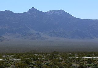
The Funeral Mountains are a short, arid mountain range in the United States along the California-Nevada border approximately 100 mi (160 km) west of Las Vegas. The mountains are considered a subrange of the Amargosa Range that form the eastern wall of Death Valley.

The Inyo Mountains are a short mountain range east of the Sierra Nevada mountains in eastern California in the United States. The range separates the Owens Valley to the west from Saline Valley to the east, extending for approximately 70 mi (130 km) SSE from the southern end of the White Mountains, from which they are separated by Westgard Pass, to east of Owens Lake.
Indio Hills Palms Park Property and the Coachella Valley Preserve, located in the Indio Hills, contain the 1,000 Palms Oasis and are a protected area in the Coachella Valley, located east of Palm Springs near Palm Desert, California. The Coachella Valley National Wildlife Refuge is contained within the Coachella Valley Preserve, and all are in the Colorado Desert section of the Sonoran Desert and adjacent to the Lower Colorado River Valley region.

The Cottonwood Mountains range is found in Death Valley National Park in Inyo County, California, U.S.

The Mayacamas Mountains are located in northwestern California in the United States. The mountain range is part of the Northern Inner Coast Ranges, of the California Coast Ranges System.

The San Emigdio Mountains are a part of the Transverse Ranges in Southern California, extending from Interstate 5 at Lebec and Gorman on the east to Highway 33–166 on the west. They link the Tehachapis and Temblor Range and form the southern wall of the San Joaquin Valley. The range is named after Emygdius, an early Christian martyr.
The Estrella River is a 28.5-mile-long (45.9 km) tributary river in eastern San Luis Obispo County, California. The river forms at the confluence of Cholame Creek, from the north, and San Juan Creek, from the south, near the town of Shandon. From there it flows west-northwest to its confluence with the Salinas River, of which it is a tributary, 8 miles north of Paso Robles. Cholame Creek has its headwaters on the southwest side of Middle Mountain and its tributary, Little Cholame Creek, begins on the northeast side. The creek drains the Cholame Valley, which is bordered by Diablo Range on the east and Cholame Hills, a northern extension of the Temblor Range, on the west. The average precipitation in the area ranges from 11 to 17 inches, increasing northward.

Panamint Springs is an unincorporated community in Inyo County, California. It lies at an elevation of 1926 feet.
Lennox-King Glacier is a large valley glacier, about 40 nautical miles (70 km) long, draining Bowden Névé and flowing northeast between the Holland Range and the Queen Alexandra Range of Antarctica to enter Richards Inlet, Ross Ice Shelf. It was named by the New Zealand Geological Survey Antarctic Expedition (1959–60) for Lieutenant Commander James Lennox-King, Royal New Zealand Navy, leader at Scott Base, 1960.

Browns Valley is an unincorporated community in Yuba County, California. It lies at an elevation of 269 feet. Browns Valley is located 12 miles (19 km) northeast of Marysville and is home to Collins Lake. The name was in honor of a settler who arrived in 1850 and discovered gold here.

The Tucalota Hills are a low mountain range of the Peninsular Ranges System, in Riverside County, California.

Big Valley is an unincorporated community in Calaveras County, California. It lies at an elevation of 2155 feet.

Happy Valley is an unincorporated community in Calaveras County, California. It lies at an elevation of 1509 feet.

Scenic Valley Ranchos is an unincorporated community in Calaveras County, California. It lies at an elevation of 384 feet.

Azucsagna is a former Tongva-Gabrieleño Californian Native American settlement in the San Gabriel Valley. The site is in Los Angeles County, California.

Donnellan Glacier is a steep valley glacier fed by highland ice adjacent to Opalchenie Peak and Fukushima Peak on Vinson Plateau, the summit plateau of Vinson Massif, in the Sentinel Range of the Ellsworth Mountains, Antarctica. The glacier flows west-southwestward from Opalchenie Peak along the northwest side of Mount Slaughter into Nimitz Glacier.
Temescal Mountains, formerly the Sierra Temescal, are one of the northernmost mountain ranges of the Peninsular Ranges in western Riverside County, in Southern California in the United States. They extend for approximately 25 mi (40 km) southeast of the Santa Ana River east of the Elsinore Fault Zone to the Temecula Basin and form the western edge of the Perris Block.


