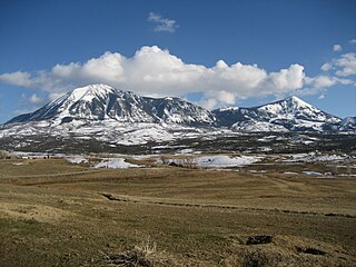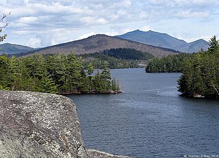
The Rocky Mountains, also known as the Rockies, are a major mountain range and the largest mountain system in North America. The Rocky Mountains stretch 3,000 miles in straight-line distance from the northernmost part of western Canada, to New Mexico in the southwestern United States. Depending on differing definitions between Canada and the U.S., its northern terminus is located either in northern British Columbia's Terminal Range south of the Liard River and east of the Trench, or in the northeastern foothills of the Brooks Range/British Mountains that face the Beaufort Sea coasts between the Canning River and the Firth River across the Alaska-Yukon border. Its southernmost point is near the Albuquerque area adjacent to the Rio Grande rift and north of the Sandia–Manzano Mountain Range. Being the easternmost portion of the North American Cordillera, the Rockies are distinct from the tectonically younger Cascade Range and Sierra Nevada, which both lie farther to its west.

The term "United States," when used in the geographical sense, refers to the contiguous United States, Alaska, Hawaii, the five insular territories of Puerto Rico, Northern Mariana Islands, U.S. Virgin Islands, Guam, American Samoa, and minor outlying possessions. The United States shares land borders with Canada and Mexico and maritime borders with Russia, Cuba, The Bahamas, and many other countries, mainly in the Caribbeanin addition to Canada and Mexico. The northern border of the United States with Canada is the world's longest bi-national land border.

The Appalachian Mountains, often called the Appalachians, are a mountain range in eastern to northeastern North America. The term "Appalachian" refers to several different regions associated with the mountain range, and its surrounding terrain. The general definition used is one followed by the United States Geological Survey and the Geological Survey of Canada to describe the respective countries' physiographic regions. The U.S. uses the term Appalachian Highlands and Canada uses the term Appalachian Uplands; the Appalachian Mountains are not synonymous with the Appalachian Plateau, which is one of the provinces of the Appalachian Highlands.

The Mountain Time Zone of North America keeps time by subtracting seven hours from Coordinated Universal Time (UTC) when standard time (UTC−07:00) is in effect, and by subtracting six hours during daylight saving time (UTC−06:00). The clock time in this zone is based on the mean solar time at the 105th meridian west of the Greenwich Observatory. In the United States, the exact specification for the location of time zones and the dividing lines between zones is set forth in the Code of Federal Regulations at 49 CFR 71.

The Pacific Time Zone (PT) is a time zone encompassing parts of western Canada, the western United States, and western Mexico. Places in this zone observe standard time by subtracting eight hours from Coordinated Universal Time (UTC−08:00). During daylight saving time, a time offset of UTC−07:00 is used.

A pyramidal peak, sometimes called a glacial horn in extreme cases, is an angular, sharply pointed mountain peak which results from the cirque erosion due to multiple glaciers diverging from a central point. Pyramidal peaks are often examples of nunataks.

Berrian Mountain is a mountain summit in the Front Range of the Rocky Mountains of North America. The 9,151-foot (2,789 m) peak is located 0.9 miles (1.5 km) north-northeast of the community of Aspen Park in Jefferson County, Colorado, United States.

Aspen Mountain is a mountain summit in the Elk Mountains range of the Rocky Mountains of North America. The 11,212-foot (3,417 m) peak is located in White River National Forest, 1.4 miles (2.2 km) south-southeast of downtown Aspen in Pitkin County, Colorado, United States. The north face of the mountain is the location of the Aspen Mountain ski area, one of four adjacent ski areas operated collectively as Aspen/Snowmass.

Red Mountain is a set of three peaks in the San Juan Mountains of western Colorado in the United States, about five miles (8.0 km) south of Ouray. The mountains get their name from the reddish iron ore rocks that cover the surface. Several other peaks in the San Juan Mountains likewise have prominent reddish coloration from iron ore and are also called "Red Mountain".

Mount Lamborn is a mountain summit in the West Elk Mountains range of the Rocky Mountains of North America. The 11,402-foot (3,475 m) peak is located in Gunnison National Forest, 5.9 miles (9.5 km) southeast by south of the Town of Paonia in Delta County, Colorado, United States. The summit of Mount Lamborn is the highest point in Delta County. Together with nearby Landsend Peak to the southwest, it lies at the western edge of the West Elks, rising dramatically nearly 6,000 ft above the valley of the North Fork Gunnison River to the west.

The Great Craggy Mountains, commonly called the Craggies, are a mountain range in western North Carolina, United States. They are a subrange of the Blue Ridge Mountains and encompass an area of approx. 194 sq mi (503 km²). They are situated in Buncombe County, North Carolina, 14 miles northeast of Asheville. The Black Mountains lie to the northeast, across the upper Cane River valley.

Hough Peak is a mountain located in Essex County, New York. The mountain, part of the Dix Range, is named after Franklin B. Hough (1822–1885), the first chief of the United States Division of Forestry, and sometimes called the "father of American forestry". Hough Peak is flanked to the north by Dix Mountain, and to the south by South Dix.

Mount Meeker is a high mountain summit of the Twin Peaks Massif in the northern Front Range of the Rocky Mountains of North America. The 13,916-foot (4,242 m) thirteener is located in the Rocky Mountain National Park Wilderness, 4.8 miles (7.7 km) west by north of the community of Allenspark in Boulder County, Colorado, United States.

The Black Hills is an isolated mountain range rising from the Great Plains of North America in western South Dakota and extending into Wyoming, United States. Black Elk Peak, which rises to 7,242 feet (2,207 m), is the range's highest summit. The name of the range in Lakota is Pahá Sápa. It encompasses the Black Hills National Forest. It formed as a result of an upwarping of ancient rock, after which the removal of the higher portions of the mountain mass by stream erosion produced the present-day topography. The hills are so called because of their dark appearance from a distance, as they are covered in evergreen trees.

The Sunset Mountains in Coconino County, Arizona, are two small mesas called East Sunset Mountain and West Sunset Mountain, standing southeast of Winslow and surrounding a stretch of State Route 87. They are unrelated to Sunset Mountain near Scottsdale, far south.

Pikes Peak is the highest summit of the southern Front Range of the Rocky Mountains in North America. The ultra-prominent 14,115-foot (4,302.31 m) fourteener is located in Pike National Forest, 12 miles (19 km) west of downtown Colorado Springs, Colorado. The town of Manitou Springs lies at its base.

The Mountain states form one of the nine geographic divisions of the United States that are officially recognized by the United States Census Bureau. It is a subregion of the Western United States.

Mount Herard is a high and prominent mountain summit in the Sangre de Cristo Range of the Rocky Mountains of North America. The 13,345-foot (4,068 m) thirteener is located in the Sangre de Cristo Wilderness of Great Sand Dunes National Preserve, 15.0 miles (24.1 km) southeast of the Town of Crestone in Saguache County, Colorado, United States.

There is another Dewey Mountain in Chittenden County, Vermont

Mount Pisgah is a 2,090-foot-tall (640 m) mountain in Essex County on the northern edge of the village of Saranac Lake. The mountain is privately owned. There is a small, dispersed housing development on the south side, communications towers on the summit, and a village ski area on the north side.


