The Continental Divide of the Americas is the principal, and largely mountainous, hydrological divide of the Americas. The Continental Divide extends from the Bering Strait to the Strait of Magellan, and separates the watersheds that drain into the Pacific Ocean from those river systems that drain into the Atlantic and Arctic Ocean, including those that drain into the Gulf of Mexico, the Caribbean Sea, and Hudson Bay.

The Continental Divide National Scenic Trail is a United States National Scenic Trail with a length measured by the Continental Divide Trail Coalition of 3,028 miles (4,873 km) between the U.S. border with Chihuahua, Mexico and the border with Alberta, Canada. Frequent route changes and a large number of alternate routes result in an actual hiking distance of 2,700 miles (4,300 km) to 3,150 miles (5,070 km). The CDT follows the Continental Divide of the Americas along the Rocky Mountains and traverses five U.S. states — Montana, Idaho, Wyoming, Colorado, and New Mexico. In Montana near the Canadian border the trail crosses Triple Divide Pass.

The Sweetwater River is a 238-mile (383 km) long tributary of the North Platte River, in the U.S. state of Wyoming. As a part of the Mississippi River system, its waters eventually reach the Gulf of Mexico.

Tehachapi Pass is a mountain pass crossing the Tehachapi Mountains in Kern County, California. Traditionally, the pass marks the northeast end of the Tehachapis and the south end of the Sierra Nevada range.

Fremont Pass is a 11,318-foot (3,450 m) mountain pass in central Colorado, in the Rocky Mountains of the western United States.

Kicking Horse Pass is a high mountain pass across the Continental Divide of the Americas of the Canadian Rockies on the Alberta–British Columbia border, and lying within Yoho and Banff national parks. Divide Creek forks onto both sides of the Continental Divide.

The Yellowhead Pass is a mountain pass across the Continental Divide of the Americas in the Canadian Rockies. It is located on the provincial boundary between the Canadian provinces of Alberta and British Columbia, and lies within Jasper National Park and Mount Robson Provincial Park.

The Great Divide Basin or Great Divide Closed Basin is an area of land in the Red Desert of Wyoming where none of the water falling as rain to the ground drains into any ocean, directly or indirectly. It is thus an endorheic basin, one of several in the United States that adjoin the Continental Divide. To the south and west of the basin is the Green River watershed, draining to the Gulf of California/Pacific Ocean; to the north and east is the North Platte watershed, draining to the Gulf of Mexico/Atlantic Ocean. The basin is very roughly rectangular in shape; the northwest corner is at Oregon Buttes near South Pass, about 40 miles (64 km) southwest of Lander, and the southeast corner is in the Sierra Madre Range near Bridger Pass, about 20 miles (32 km) southwest of Rawlins.

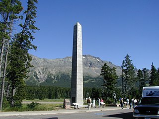
Marias Pass is a mountain pass in the Rocky Mountains in the western US state of Montana. Lying on the southern border of Glacier National Park, it is traversed by US Highway 2 and by the BNSF Hi-Line Subdivision. The pass is the lowest crossing of the Continental Divide between Canada and central New Mexico , and is the northernmost pass in the US open to automobile traffic year-round.
Rogers Pass is a mountain pass that rises 5,610 feet (1,710 m) above sea level and is located on the Continental Divide in the U.S. state of Montana. The pass is adjacent to Helena National Forest and is traversed by Montana Highway 200, providing the shortest route between the cities of Great Falls and Missoula, Montana.

Isa Lake is located in Yellowstone National Park, in the U.S. state of Wyoming. The lake straddles the continental divide at Craig Pass. Indigenous peoples have lived in the Yellowstone region for at least 11,000 years. In the 1800s, at the time of the first European exploration of the area, the region was home to several Indigenous Nations including the Nimíipuu, Absaroke, and Shoshone Nations. Hiram M. Chittenden became the first known European to sight the lake in 1891, while searching for the best routes connecting Old Faithful and the West Thumb Geyser Basin. Chittenden named the lake after Miss Isabel Jelke, from Cincinnati, though it is not clear why.

Marshall Pass, elevation 10,842 ft (3,305 m), is a mountain pass in the Rocky Mountains of central-southern Colorado, US. It lies in northern Saguache County on the Continental Divide between the Sawatch Range to the north and the Cochetopa Hills to the south. The pass is part of a backcountry alternative to U.S. Highway 50 between Salida and Gunnison.

The Puerco River or Rio Puerco is a tributary of the Little Colorado River in northwestern New Mexico and northeastern Arizona. It flows through arid terrain, including the Painted Desert.

Bridger Pass is a mountain pass in Carbon County, Wyoming on the Continental Divide of the Americas near the south Great Divide Basin bifurcation point, i.e., the point at which the divide appears to split and envelop the basin.
The Great Divide Mountain Bike Route (GDMBR) is a 3,083.8 mi (4,962.9 km), off-road bicycle touring route between Jasper, Alberta, Canada and Antelope Wells, New Mexico, USA. Completed in 1997, the GDMBR was developed by Adventure Cycling Association, who continue to maintain highly detailed route maps and a guidebook.
The Pyramid Mountains are a 30 mi (48 km) long, mountain range in central-east Hidalgo County, New Mexico. The city of Lordsburg and Interstate 10 lie at its northern border.

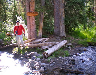
Parting of the Waters is an unusual hydrologic site at Two Ocean Pass on the Great Divide, within the Teton Wilderness area of Wyoming's Bridger-Teton National Forest. Two Ocean Pass separates the headwaters of Pacific Creek, which flows west to the Pacific Ocean, and Atlantic Creek, which flows east to the Atlantic Ocean. At Parting of the Waters, at 44°02.571′N110°10.524′W, North Two Ocean Creek flows down from its drainage on the side of Two Ocean Plateau, and divides its waters roughly equally between its two distributaries, Pacific Creek and Atlantic Creek. From this split, Two Ocean Creek waters flow either 3,488 miles (5,613 km) to the Gulf of Mexico via Atlantic Creek and the Yellowstone, Missouri and Mississippi Rivers, or 1,353 miles (2,177 km) to the Pacific via Pacific Creek and the Snake and Columbia Rivers. In the marshy area of Two Ocean Pass adjacent to Parting of the Waters, water actually covers the Continental Divide such that a fish could swim from the Pacific Ocean to the Atlantic Ocean drainages. In fact, it is thought that this was the pass that provided the route for Yellowstone cutthroat trout to migrate from the Snake River (Pacific) to Yellowstone River (Atlantic) drainages.

La Veta Pass is the name associated with two nearby mountain passes in the Sangre de Cristo Mountains of south central Colorado in the United States, both lying on the boundary between Costilla and Huerfano counties.

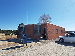
Continental Divide is an unincorporated community in McKinley County, New Mexico, United States.


