Sumner is a coastal seaside suburb of Christchurch, New Zealand and was surveyed and named in 1849 in honour of John Bird Sumner, the then newly appointed Archbishop of Canterbury and president of the Canterbury Association. Originally a separate borough, it was amalgamated with the city of Christchurch as communications improved and the economies of scale made small town boroughs uneconomic to operate.

Lyttelton is a port town on the north shore of Lyttelton Harbour / Whakaraupō, at the northwestern end of Banks Peninsula and close to Christchurch, on the eastern coast of the South Island of New Zealand.

The Bridle Path is a steep shared-use track that traverses the northern rim of the Lyttelton volcano connecting the port of Lyttelton with the city of Christchurch in the South Island of New Zealand. It is a popular walking and mountain biking route. The track ascends from the port itself to a height of 333 metres (1,093 ft) before descending again via Heathcote Valley to Christchurch. At the summit, next to the Summit Road, is a stone shelter with covered seats that is a 1940 New Zealand centennial memorial to the Pioneer Women of Canterbury. There are also seven commemorative stone seats placed along the Bridle Path; most of these were built for the 1950 Canterbury centenary celebrations.
Charlotte Jane was one of the First Four Ships in 1850 to carry emigrants from England to the new colony of Canterbury in New Zealand.

The Canterbury Association was formed in 1848 in England by members of parliament, peers, and Anglican church leaders, to establish a colony in New Zealand. The settlement was to be called Canterbury, with its capital to be known as Christchurch. Organised emigration started in 1850 and the colony was established in the South Island, with the First Four Ships bringing out settlers steeped in the region's history. The Association was not a financial success for the founding members and the organisation was wound up in 1855.

Isaac Luck was a New Zealand architect. A professional builder, he arrived in Lyttelton on the Steadfast in 1851. He was the third chairman of the Christchurch Town Council. He was the brother-in-law of and in partnership with Benjamin Mountfort, and was the less well-known architectural partner for the design of the Canterbury Provincial Council Buildings.

Mount Cavendish is located in the Port Hills, with views over Christchurch, New Zealand and Lyttelton. It is part of the crater wall of the extinct volcano that formed Lyttelton Harbour. The Mount Cavendish Reserve displays some of the best examples of lava flow to be seen on the Port Hills.

John Robert Godley was an Anglo-Irish statesman and bureaucrat. Godley is considered to be the founder of Canterbury, New Zealand, although he lived there for only two years.

Lyttelton Harbour / Whakaraupō is a major inlet on the northwest side of Banks Peninsula, on the coast of Canterbury, New Zealand; the other major inlet is Akaroa Harbour, which enters from the southern side of the peninsula. Whakaraupō enters from the northern coast of the peninsula, heading in a predominantly westerly direction for approximately 15 km (9.3 mi) from its mouth to the aptly-named Head of the Bay near Teddington. The harbour sits in an eroded caldera of the ancient Banks Peninsula Volcano, the steep sides of which form the Port Hills on its northern shore.

The First Four Ships refers to the four sailing vessels chartered by the Canterbury Association which left Plymouth, England, in September 1850 to transport the first English settlers to new homes in Canterbury, New Zealand. The colonists or settlers who arrived on the first four ships are known as the Canterbury Pilgrims.
James Townsend was an English wine merchant, who in later life was a pioneer settler in New Zealand's South Island. He was also an amateur cricketer.

Joseph Brittan was a New Zealand surgeon, newspaper editor, and provincial councillor, was one of the dominant figures in early Christchurch. Born into a middle-class family in southern England, he followed his younger brother Guise Brittan to Christchurch, where he and his wife arrived in February 1852 with four children. Joseph Brittan soon got involved in the usual activities of early settlers and gained prominence in doing so. He had bought 100 acres on 10 July 1851 and took up 50 of this to the east of Christchurch that he converted to farmland. There, he built the family residence, and the suburb of Linwood was subsequently named after Brittan's farm and homestead of Linwood House.

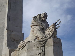
Frederick George Gurnsey was a New Zealand carver and art teacher. He was born in Newport, Monmouthshire, Wales on 18 January 1868. He did the carvings for the Bridge of Remembrance in Christchurch. The carvings in the sanctuary of the Nurses' Memorial Chapel at Christchurch Hospital are by Frederick Gurnsey and Jack Vivian. His carved mural in the Canterbury Pioneer Women's Memorial is not regarded as successful.

Jane Deans was a New Zealand pioneer and community leader. She came to Christchurch in 1853 onto her husband's farm that he had established ten years earlier. Her husband died in the following year, and Deans became a community leader. The Christchurch suburb of Riccarton derives its name from the farm, and the historic buildings and the adjacent forest are popular places to visit.

Charles Obins Torlesse was a prominent surveyor for the Canterbury Association in Canterbury, New Zealand.

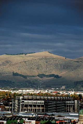
Tauhinukorokio / Mount Pleasant, also known just as either Mount Pleasant or Tauhinukorokio individually, is the highest elevation in the eastern Port Hills in Christchurch, New Zealand. It once held a Māori pā, but there was little left of it when European settlers first arrived in the 1840s. The hill was first used as a sheep run, and became the base trig station for the survey of Canterbury. It was also used as a signal station to make residents aware of ships coming into Lyttelton Harbour / Whakaraupō. During World War II, an extensive heavy anti-aircraft artillery (HAA) battery was built near the summit, and the foundations of those buildings still exist.
Captain Charles Simeon was one of the members of the Canterbury Association who emigrated to Canterbury in New Zealand in 1851. The family spent four years in the colony and during this time, he held various important posts and positions. He returned to England in 1855. He was devoted to the Anglican church and three of his sons became priests, while two of his daughters married priests.

Henry Barnes Gresson was a New Zealand judge.

Awaroa / Godley Head, called Cachalot Head by early French explorers, is a prominent headland in Christchurch, New Zealand, located at the entrance to Lyttelton Harbour / Whakaraupō. The headland is named for John Robert Godley.

Heathcote George Helmore was a notable New Zealand architect.


