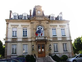
Arpajon is a commune in the Essonne department in the Île-de-France region of northern France.
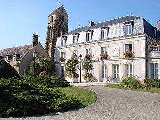
Saint-Germain-lès-Arpajon is a commune in the Essonne department. It is a suburb of Paris located 30 km (19 mi) south of Paris via the N20, and 20 km (12 mi) north of Étampes.

The arrondissement of Étampes is an arrondissement of France in the Essonne department in the Île-de-France region. Since the January 2017 reorganization of the arrondissements of Essonne, it has 76 communes.

The arrondissement of Palaiseau is an arrondissement of France in the Essonne department in the Île-de-France region. Since the January 2017 reorganization of the arrondissements of Essonne, it has 68 communes.
The arrondissement of Pithiviers is an arrondissement of France in the Loiret department in the Centre-Val de Loire region. It has 79 communes.
The following is a list of the 21 cantons of the Essonne department, in France, following the French canton reorganisation which came into effect in March 2015:

The canton of Fontainebleau is a French administrative division, located in the arrondissement of Fontainebleau, in the Seine-et-Marne département.

Bouray-sur-Juine is a commune in the Essonne department in Île-de-France in northern France.

The Juine is a French river, 53 kilometres (33 mi) long. It is a left tributary of the river Essonne.
The canton of Brétigny-sur-Orge is an administrative division of the Essonne department, Île-de-France region, northern France. Its borders were modified at the French canton reorganisation which came into effect in March 2015. Its seat is in Brétigny-sur-Orge.
The canton of Draveil is an administrative division of the Essonne department, Île-de-France region, northern France. Its borders were modified at the French canton reorganisation which came into effect in March 2015. Its seat is in Draveil.
The canton of Épinay-sous-Sénart is an administrative division of the Essonne department, Île-de-France region, northern France. Its borders were modified at the French canton reorganisation which came into effect in March 2015. Its seat is in Épinay-sous-Sénart.
The canton of Étampes is an administrative division of the Essonne department, Île-de-France region, northern France. Its borders were modified at the French canton reorganisation which came into effect in March 2015. Its seat is in Étampes.
The canton of Gif-sur-Yvette is an administrative division of the Essonne department, Île-de-France region, northern France. Its borders were modified at the French canton reorganisation which came into effect in March 2015. Its seat is in Gif-sur-Yvette.
The canton of Mennecy is an administrative division of the Essonne department, Île-de-France region, northern France. Its borders were modified at the French canton reorganisation which came into effect in March 2015. Its seat is in Mennecy.
The canton of Les Ulis is an administrative division of the Essonne department, Île-de-France region, northern France. Its borders were modified at the French canton reorganisation which came into effect in March 2015. Its seat is in Les Ulis.
The canton of Vigneux-sur-Seine is an administrative division of the Essonne department, Île-de-France region, northern France. Its borders were modified at the French canton reorganisation which came into effect in March 2015. Its seat is in Vigneux-sur-Seine.
The canton of Malesherbes is an administrative division of the Loiret department, central France. Its borders were modified at the French canton reorganisation which came into effect in March 2015. Its seat is in Le Malesherbois.
The canton of Pithiviers is an administrative division of the Loiret department, central France. Its borders were modified at the French canton reorganisation which came into effect in March 2015. Its seat is in Pithiviers.
Communauté d'agglomération Cœur d'Essonne is the communauté d'agglomération, an intercommunal structure, centred on the city of Sainte-Geneviève-des-Bois, a southern suburb of Paris. It is located in the Essonne department, in the Île-de-France region, northern France. It was created in January 2016. Its population was 195,960 in 2014.

