Villiers-sur-Orge is a commune in the arrondissement of Palaiseau, in the Essonne department, in the Île-de-France region.
Saint Genevieve or Sainte-Geneviève may refer to:

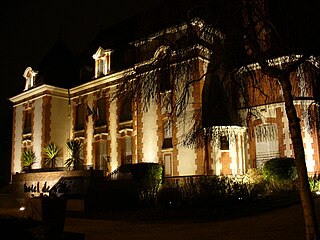
Sainte-Geneviève-des-Bois is a commune in the southern suburbs of Paris, France. It is located 23.5 km from the center of Paris, in the arrondissement of Palaiseau, in the Essonne department, in the Île-de-France region.
The canton of Lorris is a canton of the Loiret département, in the Centre-Val de Loire région of France. 37 of its 38 communes are part of the arrondissement of Montargis.

The arrondissement of Évry is an arrondissement of France in the Essonne department in the Île-de-France region. It has 52 communes.

The arrondissement of Palaiseau is an arrondissement of France in the Essonne department in the Île-de-France region. Since the January 2017 reorganization of the arrondissements of Essonne, it has 68 communes.
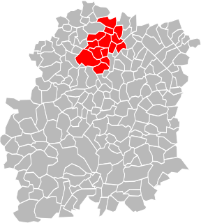
The following is a list of the 21 cantons of the Essonne department, in France, following the French canton reorganisation which came into effect in March 2015:
Sainte-Geneviève-des-Bois Russian Cemetery is part of the Cimetière de Liers and is called the Russian Orthodox cemetery, in Sainte-Geneviève-des-Bois.
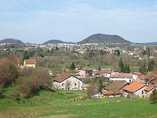
The Canton of Bruyères is a largely rural French administrative and electoral grouping of communes in the Vosges département of eastern France and in the region of Grand Est. The canton has its administrative centre at Bruyères.
The Communauté d'agglomération Paris-Saclay(or CAPS) is an administrative entity in the Essonne département, near Paris. Administrative center: Orsay. It was formed on 1 January 2016 by the merger of the former Communauté d'agglomération du Plateau de Saclay and the Communauté d'agglomération Europ'Essonne.
The canton of Arpajon is an administrative division of the Essonne department, Île-de-France region, northern France. Its borders were modified at the French canton reorganisation which came into effect in March 2015. Its seat is in Arpajon.
The canton of Athis-Mons is an administrative division of the Essonne department, Île-de-France region, northern France. Its borders were modified at the French canton reorganisation which came into effect in March 2015. Its seat is in Athis-Mons.
The canton of Brétigny-sur-Orge is an administrative division of the Essonne department, Île-de-France region, northern France. Its borders were modified at the French canton reorganisation which came into effect in March 2015. Its seat is in Brétigny-sur-Orge.
The canton of Étampes is an administrative division of the Essonne department, Île-de-France region, northern France. Its borders were modified at the French canton reorganisation which came into effect in March 2015. Its seat is in Étampes.
The canton of Longjumeau is an administrative division of the Essonne department, Île-de-France region, northern France. Its borders were modified at the French canton reorganisation which came into effect in March 2015. Its seat is in Longjumeau.
The canton of Savigny-sur-Orge is an administrative division of the Essonne department, Île-de-France region, northern France. Its borders were modified at the French canton reorganisation which came into effect in March 2015. Its seat is in Savigny-sur-Orge.
The canton of Malesherbes is an administrative division of the Loiret department, central France. Its borders were modified at the French canton reorganisation which came into effect in March 2015. Its seat is in Le Malesherbois.
The canton of Ligny-en-Barrois is an administrative division of the Meuse department, northeastern France. Its borders were modified at the French canton reorganisation which came into effect in March 2015. Its seat is in Ligny-en-Barrois.
Communauté d'agglomération Cœur d'Essonne is the communauté d'agglomération, an intercommunal structure, centred on the city of Sainte-Geneviève-des-Bois, a southern suburb of Paris. It is located in the Essonne department, in the Île-de-France region, northern France. It was created in January 2016. Its population was 195,960 in 2014.

