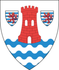
Canton of Esch-sur-Alzette

Last updated
Canton of Esch-sur-Alzette
Kanton Esch-Uelzecht (Luxembourgish)
Canton d'Esch-sur-Alzette (French)
Kanton Esch an der Alzette (German)
Coat of arms esch alzette luxbrg.png
Canton Esch-sur-Alzette in Luxembourg.svg
Coordinates: 49°30′N6°0′E / 49.500°N 6.000°E / 49.500; 6.000
Country Luxembourg
Legislative constituency Sud
LAU 1 LU00002
Communes
(cities in bold)
Bettembourg
Differdange
Dudelange
Esch-sur-Alzette
Frisange
Kayl
Leudelange
Mondercange
Pétange
Reckange-sur-Mess
Roeser
Rumelange
Sanem
Schifflange
Area
  Total242.8 km2 (93.7 sq mi)
  Rank 4th of 12
Highest elevation435 m (1,427 ft)
Lowest elevation224 m (735 ft)
Population
 (2024)
  Total192,739
  Rank 2nd of 12
  Density790/km2 (2,100/sq mi)
   Rank 2nd of 12

Esch-sur-Alzette (Luxembourgish : Esch-Uelzecht) is a canton in southwestern Luxembourg. It is both the second most populous and second most densely populated canton after the canton of Luxembourg. It borders Belgium & France.

Contents

Administrative divisions

Esch-sur-Alzette Canton consists of the following fourteen communes:

History

Like the other cantons of Luxembourg, the canton of Esch dates back to 31 August 1795. However, it was created under the name of the canton of Soleuvre. This term was of short duration since, already on 22 October 1796, a new decree renamed it the canton of Bascharage. Bascharage canton was less spread-out than the current canton of Esch since Leudelange, Pontpierre, Bettembourg and Dudelange belonged to the canton of Hesperange, created to the south of the capital. Bascharage canton, on the other hand, included Marner, which is now in Capellen canton. Subsequently, there was a new disruption of the cantonal borders, which were at the same time administrative and judicial divisions, after a consular decree of 6 March 1802. The number of cantons in the Forêts department was reduced from 37 to 27 and, in the place of Bascharage canton, a canton of Bettembourg was created. However, this did not have the same borders as its predecessor, as it lost its western part, which went to the neighbouring canton of Messancy. The boundary between the cantons of Bettembourg and Messancy passes between Differdange (in the canton of Messancy), and Belvaux (in the canton of Bettembourg). Twelve years later came the end of Napoleon's Empire, the end of the Forêts department, and Luxembourg's de facto incorporation into the Kingdom of the Netherlands. The Dutch administration maintained the French administrative divisions, except for renaming arrondissements to districts. [1]

After the Belgian Revolution of 1830, this system ended and for nine years, the administration of the Grand-Duchy — before its third partition — was carried out by Belgium, except for the city and federal fortress of Luxembourg, with its Prussian garrison. Under the French and Dutch administration, there had been a district of Luxembourg, whose commissioner naturally resided in Luxembourg City. In order to administer this district, apart from Luxembourg City itself, the seat of the commissioner, an agent of the Belgian government, had been transferred to Bettembourg. This village of 740 habitants was now the administrative centre of the district. The notary Philippe Hanno, a Luxembourg native, was named district commissioner with residence in Bettembourg. In the night of 15 February 1834, the Prussian general du Moulin, commandant of the Fortress of Luxembourg, had Hanno captured in Bettembourg and imprisoned in Luxembourg. It required the intervention of France and the United Kingdom before Hanno was released. [1]

The Treaty of London of 1839 divided Luxembourg, and in doing so, also partitioned the border cantons, from Troisvierges to Pétange.

The neighbour of the canton of Esch was that of Messancy, whose territory mostly passed to Belgium. The rest, that is the communes of Pétange and Differdange, was added to the canton of Bettembourg. At the same time, however, Bettembourg canton lost the commune of Dippach to the canton of Capellen, and the commune of Weiler-la-Tour to Luxembourg canton. With 13,116 inhabitants, the canton of Bettembourg was second to that of Luxembourg, with 27,891 inhabitants. Bettembourg was an agricultural canton. Minette ore was still unknown. Alluvial ore was scraped and washed in Bascharage, Pétange, Differdange, Esch, Kayl and Bettembourg. In terms of factories, there was only the blast furnace of Lasauvage. There were no cities. Esch, which would later become a city, had at this time only 1,400 inhabitants. In Esch, there were two tanneries. [1]

After an administrative reorganisation, necessitated by the partition, a decree of 12 October 1842 transferred the justice of the peace, and therefore the administrative centre of the canton, from Bettembourg to Esch. The reason was that, due to the additions to the west and the territorial losses in the east mentioned above, the canton's centre had moved to the west, and now, more than ever, Bettembourg was on the periphery. [1]

However, the question of its administrative centre came up again when, in 1849, the Chamber of Deputies, considered a bill to re-establish the justice of the peace in Bettembourg, and therefore the canton's centre. The originator of this bill was the notary Graas, from Bettembourg. Four communes of the canton supported it, while seven opposed it. The government was also against it, and the bill failed. [1]

In 1860, the mayors of Clemency, Dippach, Bascharage, Pétange, Sanem and Differdange addressed a petition to the Assembly of Estates, demanding that due to their great distance from the canton's centre Esch, they should be carved off and organised into their own new canton of Bascharage. The petition was not taken into consideration by the Assembly. [1]

Since then, the canton of Esch has seen several internal changes.

Since 1847, the inhabitants of Leudelange had not ceased to demand their separation from the commune of Reckange, and to be organised into a distinct commune. As justification they invoked Reckange's distance of more than 6 km, the fact that Leudelange was already a parish and that, until 1821, there had been a commune of Leudelange. At the session of the Estates of 15 February 1856, this was approved by 33 votes to 3. Then, in 1862, in a petition to the Estates, the commune of Leudelange demanded to be detached from the canton of Esch to be added to that of Luxembourg.   [1]

Population

[2]

See also

Related Research Articles

<span class="mw-page-title-main">Luxembourg District</span>

The District of Luxembourg was one of three districts of the Grand Duchy of Luxembourg. It contained four cantons, divided into 44 communes:

  1. Capellen
  2. Esch-sur-Alzette
  3. Luxembourg
  4. Mersch

The 12 cantons of the Grand Duchy of Luxembourg are subdivisions at the first level of local administrative unit (LAU-1) in the European Union's Nomenclature of Territorial Units for Statistics for Eurostat purposes. They were subdivisions of the three districts of Luxembourg until 2015, when the district level of government was abolished. The cantons are in turn subdivided into 100 communes.

<span class="mw-page-title-main">Leudelange</span> Commune in Esch-sur-Alzette, Luxembourg

Leudelange is a commune and town in south-western Luxembourg. It is situated in the canton of Esch-sur-Alzette.

<span class="mw-page-title-main">Communes of Luxembourg</span> Aspect of Luxembourgish geography

Luxembourg's 100 communes conform to LAU Level 2 and are the country's lowest administrative divisions.

<span class="mw-page-title-main">Dippach</span> Commune in Capellen, Luxembourg

Dippach is a commune and small town in south-western Luxembourg. It is part of the canton of Capellen, which is part of the district of Luxembourg. The commune's administrative centre is Schouweiler. The River Mess, a tributary of the Alzette, rises here.

<span class="mw-page-title-main">Pétange</span> Commune in Esch-sur-Alzette, Luxembourg

Pétange is a commune and town in south-western Luxembourg. It is part of the canton of Esch-sur-Alzette and is the fifth-most populous commune in Luxembourg, as well as the most populous without town status. Pétange lies at the borders with both Belgium and France.

<span class="mw-page-title-main">Reckange-sur-Mess</span> Commune in Esch-sur-Alzette, Luxembourg

Reckange-sur-Mess is a commune and small town in south-western Luxembourg. It is part of the canton of Esch-sur-Alzette.

<span class="mw-page-title-main">Société Nationale des Chemins de Fer Luxembourgeois</span> State-owned railway company of Luxembourg

The Société Nationale des Chemins de Fer Luxembourgeois is the national railway company of Luxembourg. In 2023, it carried approximately 28.7 million passengers. As of 2023, the company employs around 5,000 people, making CFL the country's largest corporate employer.

<span class="mw-page-title-main">Guttland</span> A region of Luxembourg

The Guttland is a region covering the southern and central parts of the Grand Duchy of Luxembourg. The Guttland covers 68% of the territory of Luxembourg; to the north of Gutland lies the Éislek, which covers the remaining 32% of the Grand Duchy. To the east, the Luxembourgish Guttland adjoins the Bitburger Gutland of Germany.

<span class="mw-page-title-main">Nordstad</span>

Nordstad is a development area in north-central Luxembourg, and a colloquial term to refer to the combined urban areas in the region. The name is Luxembourgish for 'northern city', but it remains the title, both formal and informal, of the region in any language.

The Red Lands form a geographic region in southern and south-western Luxembourg. They are so called for their red iron-laden earth. The Red Lands roughly correspond with the southern part of the canton of Esch-sur-Alzette, along the border with France. Geologically, the Red Lands are sedimentary, mostly sandstones and conglomerates, formed in the Middle Jurassic epoch.

<span class="mw-page-title-main">Rodange railway station</span>

Rodange railway station is a railway station serving Rodange, in the commune of Pétange, in south-western Luxembourg. It is operated by Chemins de Fer Luxembourgeois, the state-owned railway company.

<span class="mw-page-title-main">CFL Line 70</span>

Line 70 is a railway line connecting Luxembourg City to the south-west of Luxembourg, and on to Belgium and France. The terminus at the north-eastern end is Luxembourg railway station, whilst the terminals at the south are the French town of Longuyon and the Belgian town of Athus. It is designated, and predominantly operated, by Chemins de Fer Luxembourgeois During the 2010 decade, the former line 80 have been merged with this line in order to give the newly created line between Thionville and Longwy via Esch-sur-Alzette.

Line 60 is a railway line connecting Luxembourg City to the Red Lands of the south of Luxembourg, and on to France. The terminus at the northern end is Luxembourg railway station, whilst the terminals at the south are Rumelange, Pétange, and the French towns of Volmerange-les-Mines and Audun-le-Tiche. It is designated, and predominantly operated, by Chemins de Fer Luxembourgeois.

<span class="mw-page-title-main">A13 motorway (Luxembourg)</span> Highway in Luxembourg

The Autoroute 13, abbreviated to A13, is a motorway in southern Luxembourg. It is 42.310 kilometres (26.290 mi) long and connects Pétange to Schengen, via all the largest towns in the Red Lands. At Schengen, it reaches the German border, whereupon it meets the A8, which crosses southern Germany.

<span class="mw-page-title-main">Käerjeng</span> Commune in Capellen, Luxembourg

Käerjeng is a commune in southwestern Luxembourg, in the canton of Capellen. It lies on the border with Belgium. It has an area of 33.67 km2.

<span class="mw-page-title-main">France–Luxembourg border</span> International border between France and Luxembourg

The France–Luxembourg border stretches 73 kilometers in length, to the northeast of France and to the south of Luxembourg.

References

  1. 1 2 3 4 5 6 7 Calmes, Albert (28 April 1962). "Le canton d'Esch". Luxemburger Wort (in French). p. 17. Retrieved 14 February 2024.
  2. "Population par canton et commune". statistiques.public.lu. Retrieved 11 January 2022.