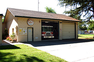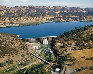
Esparto is a census-designated place (CDP) in Yolo County, California, United States. It is part of the Sacramento–Arden-Arcade–Roseville Metropolitan Statistical Area. The population was 3,108 at the 2010 census.

Wine Country is a region of California, in the northern San Francisco Bay Area, known worldwide as a premier wine-growing region. The region is famed for its wineries, its cuisine, Michelin star restaurants, boutique hotels, luxury resorts, historic architecture, and culture. Viticulture and wine-making have been practiced in the region since the Spanish missionaries from Mission San Francisco Solano established the first vineyards in 1812.

The Diablo Range is a mountain range in the California Coast Ranges subdivision of the Pacific Coast Ranges in northern California, United States. It stretches from the eastern San Francisco Bay Area at its northern end to the Salinas Valley area at its southern end.

Cache Creek is an 87-mile-long (140 km) stream in Lake, Colusa and Yolo counties, California.
Capay is an unincorporated community in Yolo County, California. It is located on Cache Creek 2 miles (3.2 km) west-northwest of Esparto, in the Capay Valley, in the northwestern part of the county. Capay's ZIP Code is 95607 and its area code 530. It lies at an elevation of 210 feet.
Rumsey is an unincorporated community and census-designated place (CDP) in Yolo County, California. It is located 18 miles (29 km) northwest of Esparto, in the Capay Valley, in the northwestern part of the county. Rumsey's ZIP Code is 95679 and its area code 530. It lies at an elevation of 420 feet.
Brooks is an unincorporated community and census-designated place (CDP) in Yolo County, California, located in the Capay Valley in the northwest of the county. Brooks' ZIP Code is 95606 and its area code 530. The Yocha Dehe Wintun Nation is headquartered in Brooks. The town is home to a large casino Cache Creek Casino Resort. It lies at an elevation of 341 feet.
The Vaca Valley and Clear Lake Railroad was a standard gauge railroad that operated at Vacaville, California in the late 19th century. The Vaca Valley Railroad was incorporated on April 12, 1869 to run a branch from the mainline of the California Pacific Railroad at Elmira to Rumsey.

Capay Valley is a mostly rural valley northwest of Sacramento in Yolo County, California, United States. It lies east of Blue Ridge and west of the Capay Hills.

The Capay Valley AVA is an American Viticultural Area located in the Capay Valley, in northwest Yolo County, California.
Cottonwood is a former settlement in Yolo County, California. It was located 2 miles (3.2 km) south of Madison, at an elevation of 164 feet. It still appears on maps as of 1917.
The Sweitzer Hills are a low and short mountain range within the Capay Valley, in northern Yolo County, California.
Capay is an unincorporated community in Glenn County, California. It is located 7 miles (11 km) east-northeast of Orland, at an elevation of 187 feet.
Rancho Cañada de Capay was a 40,079-acre (162.19 km2) Mexican land grant in present-day Yolo County, California given in 1846 by Governor Pío Pico to the three brothers Santiago, Nemicio, and Francisco Berreyesa. "Cañada de Capay" means "valley of the Capay" in Spanish. "Capay" comes from the Southern Wintun Indian word for "stream". The rancho occupied the Capay Valley on both sides of Cache Creek.

Sacramento River National Wildlife Refuge is located along the Sacramento River in the Sacramento Valley of California. Landscape is very flat, bordered by the Sierra and Coast ranges, with intensive agriculture. This riparian community is one of the most important wildlife habitats in California and North America.
Rancho Capay was a 44,388-acre (179.63 km2) Mexican land grant in present-day Tehama County and Glenn County, California given in 1844 by Governor Manuel Micheltorena to Maria Josefa Soto. The name comes from the Wintun word meaning stream, and refers to Stony Creek. The grant extended two leagues in width and five leagues along the west side of the Sacramento River from Thomes Creek and Rancho Saucos on the north to Stony Creek on the south, and encompassed present day Hamilton City and Monroeville.

Stony Creek is a 73.5-mile (118.3 km)-long tributary of the Sacramento River in Northern California. It drains a watershed of more than 700 square miles (1,800 km2) on the west side of the Sacramento Valley in Glenn, Colusa, Lake and Tehama Counties.
The 1892 Vacaville–Winters earthquakes occurred in northern California as a large doublet on April 19 and April 21. Measured on a seismic scale that is based on an isoseismal map or the event's felt area, the 6.4 and 6.2 Mla events were assigned a maximum Mercalli intensity of IX (Violent), and affected the North Bay and Central Valley areas. The total damage was estimated to be between $225,000 and 250,000 and one person was killed. No evidence of fault movement on the surface of the ground was observed as a result of either of the strong shocks. Both occurred in the domain of the San Andreas strike-slip system of faults, but their focal mechanism is uncertain.


