Related Research Articles
The Queen Elizabeth Range is a rugged mountain range of the Transantarctic Mountains System, located in the Ross Dependency region of Antarctica.

The Byrd Glacier is a major glacier in Antarctica, about 136 km (85 mi) long and 24 km (15 mi) wide. It drains an extensive area of the Antarctic plateau, and flows eastward to discharge into the Ross Ice Shelf.
The Churchill Mountains are a mountain range group of the Transantarctic Mountains System, located in the Ross Dependency region of Antarctica. They border on the western side of the Ross Ice Shelf, between Byrd Glacier and Nimrod Glacier.
The Cook Mountains is a group of mountains bounded by the Mulock and Darwin glaciers in Antarctica.

The Darwin Glacier is a large glacier in Antarctica. It flows from the polar plateau eastward between the Darwin Mountains and the Cook Mountains to the Ross Ice Shelf. The Darwin and its major tributary the Hatherton are often treated as one system, the Darwin–Hatherton.

Cape Evans is a rocky cape on the west side of Ross Island, Antarctica, forming the north side of the entrance to Erebus Bay.
Surveyors Range is a 30 miles (48 km) long mountain range in the Churchill Mountains of Antarctica.
The Mulock Glacier is a large, heavily crevassed glacier which flows into the Ross Ice Shelf 40 kilometers south of the Skelton Glacier in the Ross Dependency, Antarctica.
Båkenesdokka Valley is an ice-filled valley at the east side of Roberts Knoll, draining north to Jelbart Ice Shelf in Queen Maud Land. It was mapped by Norwegian cartographers from surveys and from air photos by the Norwegian-British-Swedish Antarctic Expedition (1949–52) and named "Båkenesdokka".
Barne Inlet is a reentrant on the west side of the Ross Ice Shelf, on the coast of Antarctica. It lies between Cape Kerr and Cape Selborne. It is about 17 nautical miles (30 km) wide, and is occupied by the lower part of Byrd Glacier.
The Nash Range is a mainly ice-covered coastal range in the Churchill Mountains of Antarctica.

Nicholson Peninsula is a broad ice-covered peninsula about 15 nautical miles (28 km) long, between Couzens Bay and Matterson Inlet on the Shackleton Coast on the west side of the Ross Ice Shelf, Antarctica.
The Darley Hills are a range of high, ice-covered coastal hills in the Churchill Mountains, Antarctica.

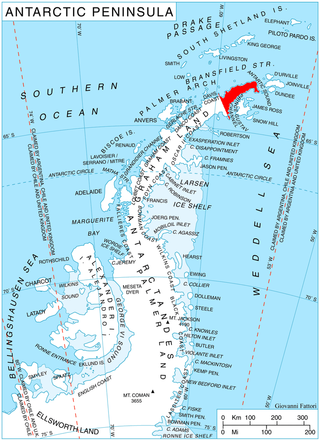
Cape Dubouzet is a cape that marks the northeastern extremity of Trinity Peninsula and the Antarctic Peninsula. It is situated 7.7 miles (12 km) north by west of Sheppard Point, 1.15 miles (2 km) northeast of Vishegrad Knoll, 9 miles (14 km) east-southeast of Prime Head, 6.7 miles (11 km) east-southeast of Siffrey Point, and 11.3 miles (18 km) west-southwest of Archibald Point, Bransfield Island.
Fricker Glacier is a glacier, 10 nautical miles (19 km) long, which lies close north of Tindal Bluff and Monnier Point and flows in a northeasterly direction into the southwest side of Mill Inlet, on the east coast of Graham Land, Antarctica. It was charted by the Falkland Islands Dependencies Survey (FIDS) and photographed from the air by the Ronne Antarctic Research Expedition in 1947, and was named by the FIDS for Karl Fricker, a German Antarctic historian.

McCarroll Peak is a rock peak, 1,105 metres (3,625 ft) high, standing at the south side of Richthofen Pass on the east coast of Graham Land, Antarctica. The peak was probably first seen by the Swedish Antarctic Expedition under Otto Nordenskjöld, 1901–04. The name "Cape McCarroll" for H.G. McCarroll of Detroit, Michigan, was given to the south side of Nordenskjöld's "Richthofen Valley" by Sir Hubert Wilkins on his flight of December 20, 1928. The name has been modified and applied to the peak here described in order to maintain the intended relationship between the McCarroll and Richthofen features.
The Steeple is a rocky ridge, about 500 m, forming the northwest arm of horseshoe-shaped Mount Carroll. It rises on the east side of Depot Glacier, 1.5 nautical miles (2.8 km) south of the head of Hope Bay, at the northeast end of Antarctic Peninsula. Discovered by the Swedish Antarctic Expedition, 1901–04, under Otto Nordenskjöld. The descriptive name was applied by the Falkland Islands Dependencies Survey (FIDS), 1945.
Cape Keltie is an ice-covered cape on the Clarie Coast of Antarctica, 11 nautical miles (20 km) west of Cape Cesney. It was discovered from the Aurora by the Australasian Antarctic Expedition (1911–14) under Douglas Mawson, and roughly charted at a distance of about 10 nautical miles (19 km) as lying in 66°5′S 133°0′E. It was named by Mawson for Sir John Scott Keltie, Secretary of the Royal Geographical Society, 1892–1915. The identification of this feature is based upon the G.D. Blodgett map of 1955, compiled from aerial photos taken by U.S. Navy Operation Highjump (1946–47).
Kerr Inlet is an ice-filled inlet, 1 nautical mile (2 km) wide, located at the west side of Cape Kerr in the northern part of Barne Inlet, Antarctica. It was named by the Advisory Committee on Antarctic Names in association with Cape Kerr.
Mount Carroll is a horseshoe-shaped mountain rising to 650 metres (2,130 ft), south of Hope Bay on the Trinity Peninsula. It was discovered and mapped by the Swedish Antarctic Expedition under Otto Nordenskiöld (1901–04) and surveyed by the Falklands Islands Dependencies Survey (1945–47), and named in error Mount Carrel after Tom Carroll, Newfoundland boatswain of the ship Eagle, which participated in establishing the Falklands Islands Dependencies Survey (FIDS) Hope Bay base in February 1945. The spelling has been amended to correct the original error.
References
- ↑ "Cape Kerr". Geographic Names Information System . United States Geological Survey, United States Department of the Interior . Retrieved 2013-04-29.
![]() This article incorporates public domain material from "Cape Kerr". Geographic Names Information System . United States Geological Survey.
This article incorporates public domain material from "Cape Kerr". Geographic Names Information System . United States Geological Survey.