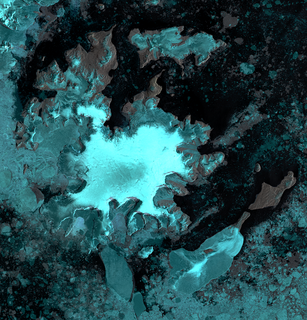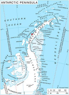
Ineson Glacier is a glacier flowing northwest into Gin Cove, James Ross Island, Antarctica. Following geological work by the British Antarctic Survey (BAS), 1981–83, it was named by the UK Antarctic Place-Names Committee after Jonathan R. Ineson, a BAS geologist in the area.
Irving Island is a small island at the northeastern end of the Barcroft Islands, in the Biscoe Islands, Antarctica. It was mapped from air photos taken by the Falkland Islands and Dependencies Aerial Survey Expedition (1956–57), and was named by the UK Antarctic Place-Names Committee for Laurence Irving, an American physiologist who has specialized in the effects of a polar environment.

Lawrie Glacier is a glacier flowing between Mount Genecand and Mezzo Buttress, and entering the head of Barilari Bay between Cherkovna Point and Prestoy Point on the west coast of Graham Land, Antarctica. It was charted by the British Graham Land Expedition under Rymill, 1934–37, and was named by the UK Antarctic Place-Names Committee in 1959 for Robert Lawrie, an English alpine and polar equipment specialist.
Benedict Point is a headland about 5 nautical miles (9 km) south of Cape Leblond on the east side of Lavoisier Island, Biscoe Islands. It was mapped from air photos taken by the Falkland Islands and Dependencies Aerial Survey Expedition (1956–57), and named by the UK Antarctic Place-Names Committee for Francis G. Benedict, an American physiologist who, with W.O. Atwater, perfected the technique for calorimetric measurement of metabolism.
Blue Whale Harbour is a small, sheltered anchorage entered 1 nautical mile (2 km) west-southwest of Cape Constance, along the north coast of South Georgia Island. It was charted in 1930 by Discovery Investigations personnel. It is named for the blue whale, a commercially important species which was once widely distributed in polar and subpolar waters; numbers are now very small.

Borradaile Island is one of the Balleny Islands. It was the site of the first landing south of the Antarctic Circle, and features the "remarkable pinnacle" called Beale Pinnacle, near Cape Beale on its south-eastern coast, and Cape Scoresby on its north-western coast.

Crystal Sound is a sound in Antarctica between the southern part of the Biscoe Islands and the coast of Graham Land, with northern limit Cape Evensen to Cape Leblond and southern limit Holdfast Point, Roux Island, Liard Island and the Sillard Islands. It was so named by the UK Antarctic Place-Names Committee in 1960 because many features in the sound are named for men who have undertaken research on the structure of ice crystals. To the north of Crystal Sound, many geographical features are named after physiologists.
The Fringe Rocks are a group of rocks forming the western limit of the Saffery Islands, off the west coast of Graham Land, Antarctica. They were charted by the British Graham Land Expedition under John Rymill, 1934–37, and were so named by the UK Antarctic Place-Names Committee in 1959 because of their position on the fringe of the ships' passage between the Saffery Islands and the Trump Islands.
Cape Faraday is a cape which forms the northern tip of Powell Island in the South Orkney Islands. It was discovered by Captain George Powell and Captain Nathaniel Palmer on the occasion of their joint cruise in December 1821. The name first appears on Powell's chart published in 1822.
Monflier Point is a point which marks the southwest end of Rabot Island in the Biscoe Islands of Antarctica. It was first charted and named by the Fourth French Antarctic Expedition, 1908–10, under Jean-Baptiste Charcot.
The Foote Islands are a small group of snow-capped islands and several rocks, lying 12 nautical miles (22 km) southeast of Cape Leblond, Lavoisier Island, in Crystal Sound. They were mapped from air photos obtained by the Ronne Antarctic Research Expedition (1947–48) and surveys by the Falkland Islands Dependencies Survey (FIDS) (1958–59). They were named by the UK Antarctic Place-Names Committee for Brian L.H. Foote, a FIDS radio mechanic at Arthur Harbour (1957) and a surveyor at Detaille Island (1958), who made surveys of the Crystal Sound area.
Mount Harkness is a mountain, 1,900 metres (6,200 ft) high, standing 1.5 nautical miles (3 km) south of the Organ Pipe Peaks and forming part of the east wall of Scott Glacier, in the Queen Maud Mountains of Antarctica. It was discovered in December 1934 by the Byrd Antarctic Expedition geological party under Quin Blackburn, and named at that time by Rear Admiral Richard E. Byrd for Bruce Harkness, a friend of Richard S. Russell, Jr., a member of that party.

Lofgren Peninsula is an ice-covered peninsula about 22 nautical miles (40 km) long, projecting between Cadwalader Inlet and Morgan Inlet on the northeast side of Thurston Island, Antarctica. The northern extremity of the peninsula is Cape Menzel, a bold rock cape. These features were discovered in helicopter flights from the USS Burton Island and the USS Glacier of the U.S. Navy Bellingshausen Sea Expedition in February 1960, and was named by the Advisory Committee on Antarctic Names. The peninsula was named for Charles E. Lofgren, personnel officer with the Byrd Antarctic Expedition, 1928–30. The cape was named for Reinhard W. Menzel, a geomagnetist-seismologist with the Eights Station winter party, 1965.

Livonia Rock is a rock lying 0.5 nautical miles (1 km) south of Cape Melville, the eastern extremity of King George Island, in the South Shetland Islands, Antarctica. It was named by the UK Antarctic Place-Names Committee in 1960 for the sealing vessel Livonia from London, which visited the South Shetland Islands in 1821–22.
Cape Little is a cape at the eastern extremity of the peninsula between Wright Inlet and Keller Inlet, on the east coast of Palmer Land, Antarctica. It was probably seen from the air by members of the United States Antarctic Service who photographed Wright Inlet in December 1940. The cape was photographed from the air during 1947 by the Ronne Antarctic Research Expedition (RARE) under Finn Ronne, who in conjunction with the Falkland Islands Dependencies Survey charted it from the ground. It was named by Ronne for Delbert M. Little, Assistant Chief for Operations, U.S. Weather Bureau, who arranged the program for sending weather reports from the RARE.

Hoek Glacier is a glacier flowing into Dimitrov Cove northeast of Veshka Point on the northwest coast of Velingrad Peninsula on Graham Coast in Graham Land, Antarctica, southward of the Llanquihue Islands. It was charted by the British Graham Land Expedition under John Rymill, 1934–37, and was named by the UK Antarctic Place-Names Committee in 1959 for Henry W. Hoek (1878–1951), a pioneer Swiss ski-mountaineer and author of one of the earliest skiing manuals.
Cape Herdman is a broad ice-covered cape forming the southern entrance point to Violante Inlet, on the Black Coast of Palmer Land, Antarctica. The cape was photographed from the air in 1940 by the United States Antarctic Service; it was rephotographed from the air in 1947 by the Ronne Antarctic Research Expedition and, in conjunction with the Falkland Islands Dependencies Survey surveyed from the ground. It was named by the UK Antarctic Place-Names Committee after Henry F.P. Herdman (1901–67), a British oceanographer who was a member of the scientific staff of the Discovery Investigations, 1924–49, and was later with the National Institute of Oceanography, 1949–67.
McClary Glacier is a glacier 10 nautical miles (19 km) long and 2 nautical miles (4 km) wide on the west coast of Graham Land, Antarctica. It flows southwest along the north side of Butson Ridge into Marguerite Bay between Cape Calmette and the Debenham Islands. The glacier was first roughly surveyed by the British Graham Land Expedition, 1936–37, and resurveyed by the Falkland Islands Dependencies Survey, 1946–50. It was named by the UK Antarctic Place-Names Committee for George B. McClary, father of Nelson McClary, mate on the Port of Beaumont during the Ronne Antarctic Research Expedition, 1947–48.
Mackworth Rock is an insular rock in Pendleton Strait, Antarctica, about 2 nautical miles (4 km) north of Cape Leblond, Lavoisier Island. It was mapped from air photos taken by the Falkland Islands and Dependencies Aerial Survey Expedition (1956–57), and was named by the UK Antarctic Place-Names Committee for Norman H. Mackworth, a British experimental psychologist who in 1953 first demonstrated beyond doubt that people acclimatize to cold.

Sölch Glacier is a glacier on the Pernik Peninsula of the Loubet Coast in Graham Land, flowing west to Salmon Cove just north of Kanchov Peak on the east side of Lallemand Fjord. It was mapped from air photos taken by the Falkland Islands and Dependencies Aerial Survey Expedition, 1956–57, and named by United Kingdom Antarctic Place-Names Committee for Johann Sölch (1883–1951), an Austrian glacial geologist and glaciologist.


